Achilleus 3D - Tactical Map
Rating
0
Reviews
0
App details
About Achilleus 3D - Tactical Map
[DESCRIPTION]
- Achilleus 3D is a Tactical Map and Navigation tool, designed to maximize situational awareness and operational readiness.
- Simple, intuitive interface that can be operated easily with one hand.
*** Achilleus 3D is under active development and will have new features and improvements in the future. ***
Plan and organize your mission!
[MAPPING]
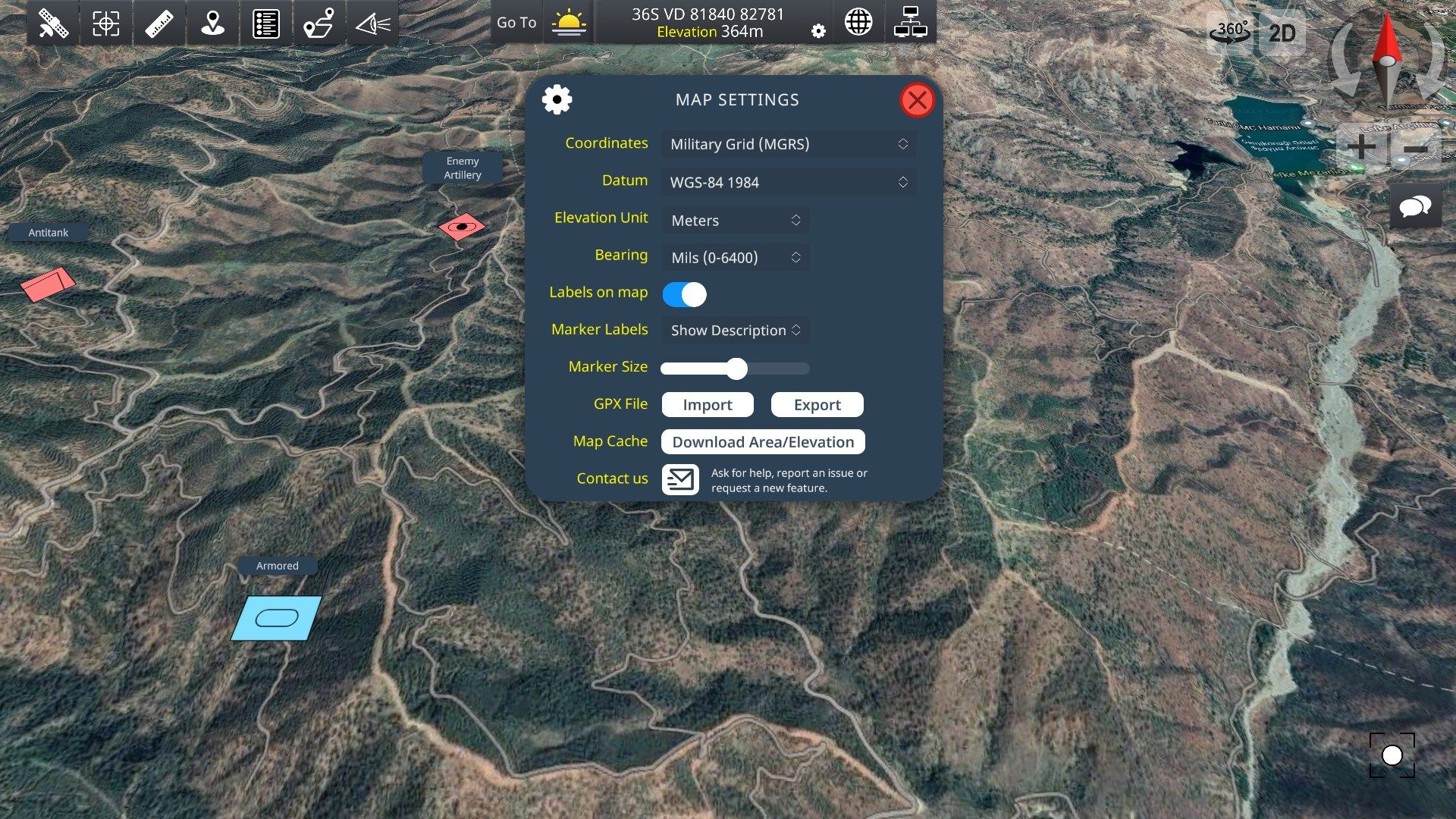
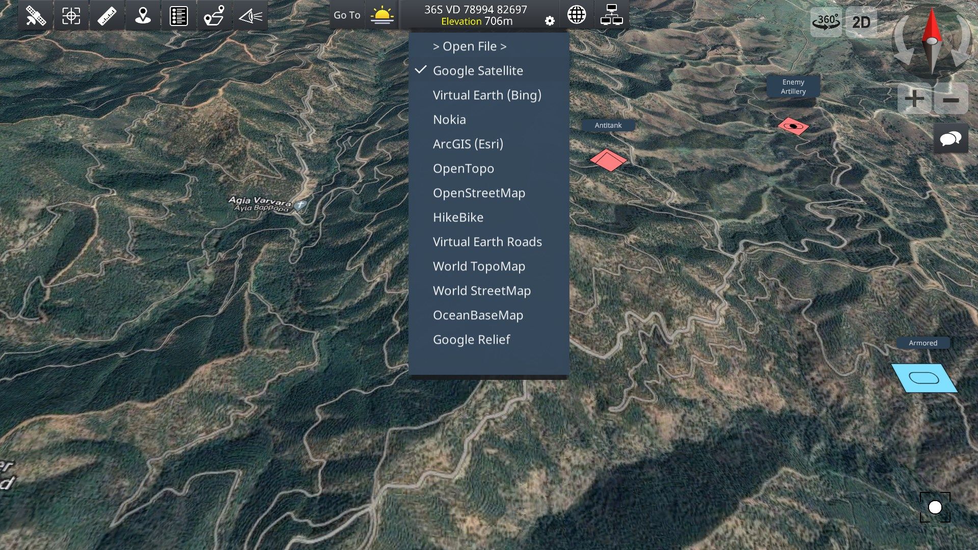
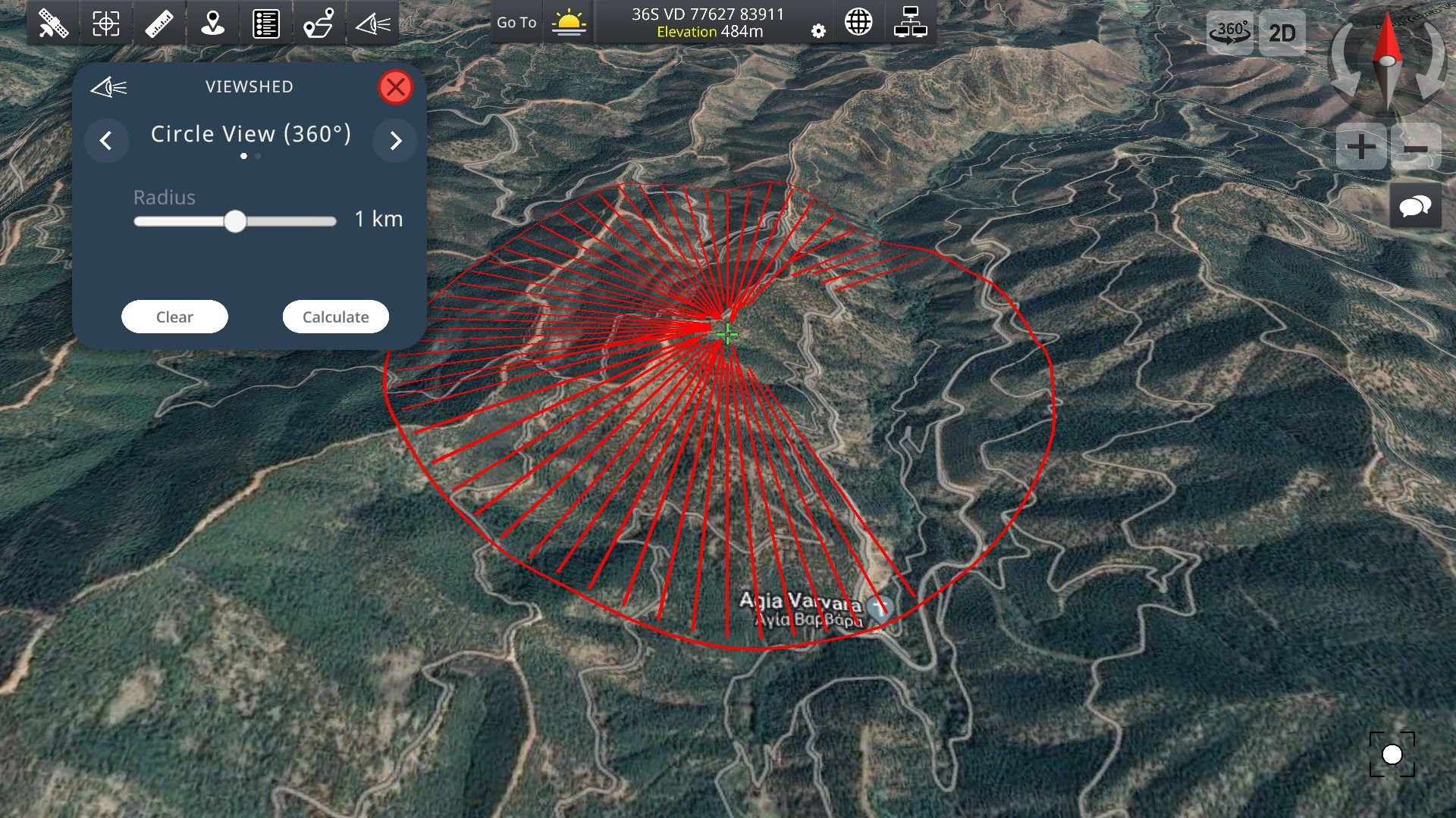
- 2D maps and 3D maps with elevation.
- Online and Offline Maps (Virtual Earth, Google Satellite, OpenTopo, OpenStreetMap, ArcGIS Satellite, Nokia).
- Tool for cache map and elevation data for offline use.
- Automatically cache Map and Elevation data and can be used when you are offline.
- Military Grid Reference System (MGRS) & United States National Grid (USNG).
- Supports various map DATUM formats.
- Latitude/Longitude degrees.
- Universal Transverse Mercator (UTM).
- Create and navigate to waypoints.
- Use the crosshair to position new waypoints.
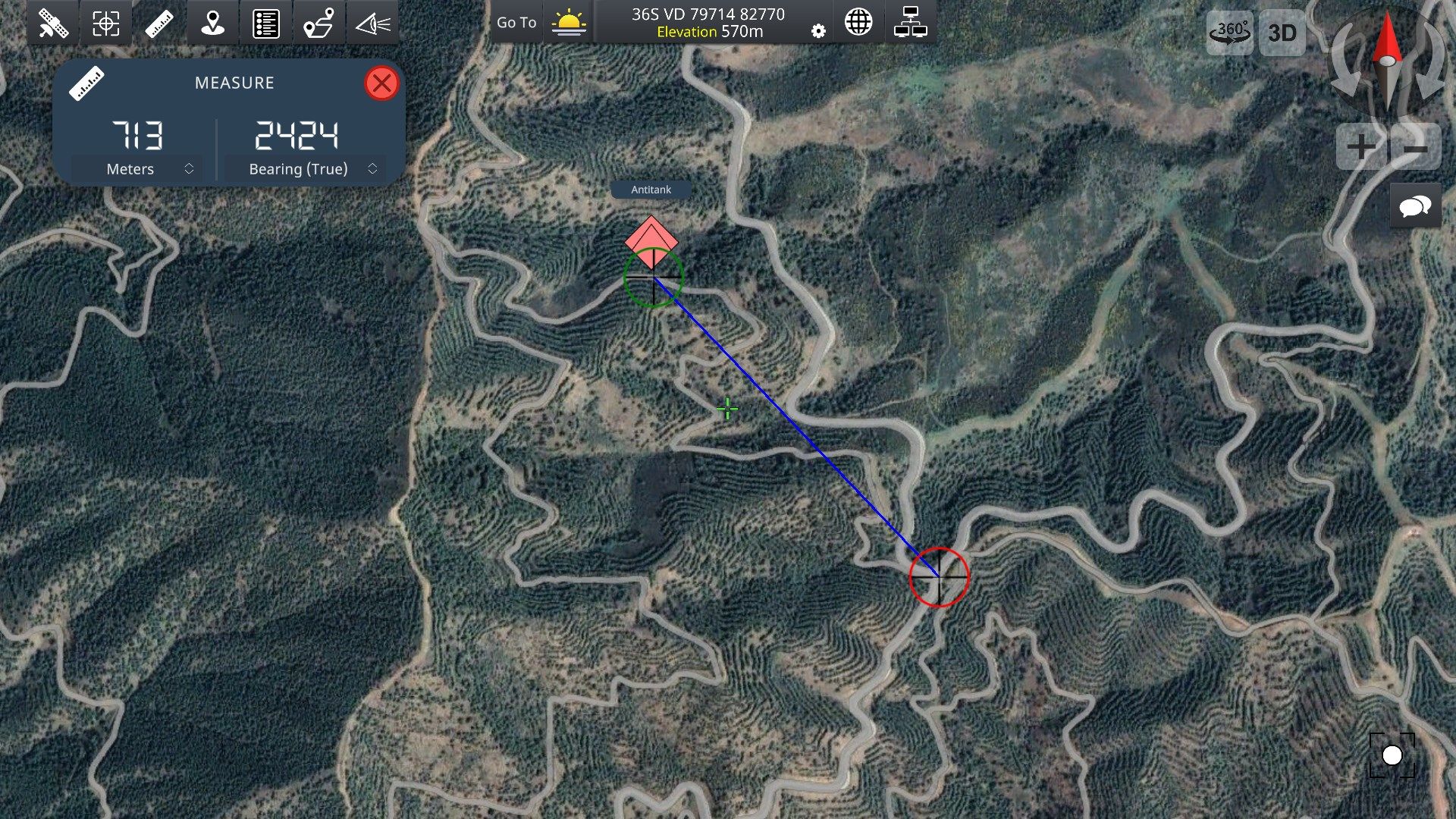
- Measure distances.
- Measure bearings (mils, degrees).
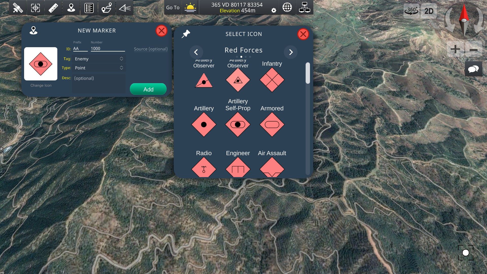
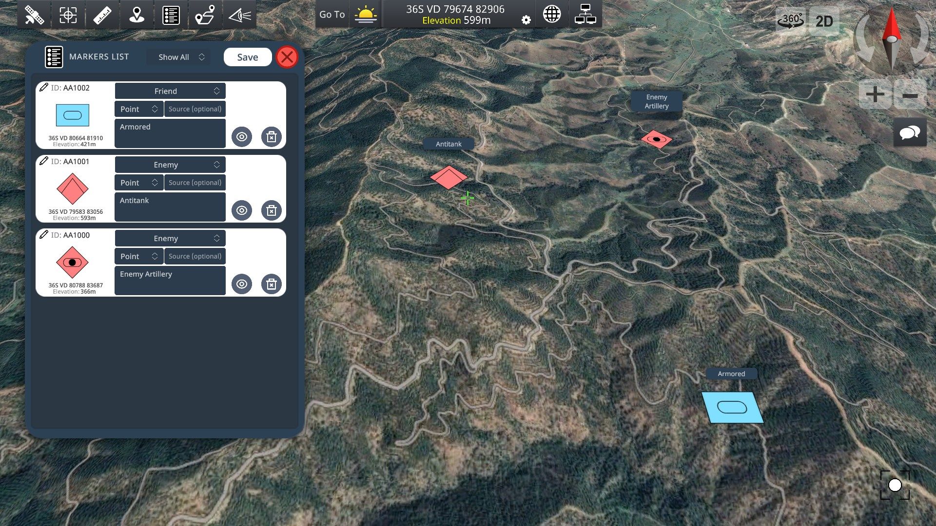
- Markers Management tool (Add ID, description, tags etc…).
[GPS NAVIGATION]
- 2D and 3D Navigation. Draw your route to destination.
- Use compass to rotate map, while you travel.
- Get speed, total distance and time to destination.
- GPS current location and altitude in real time.
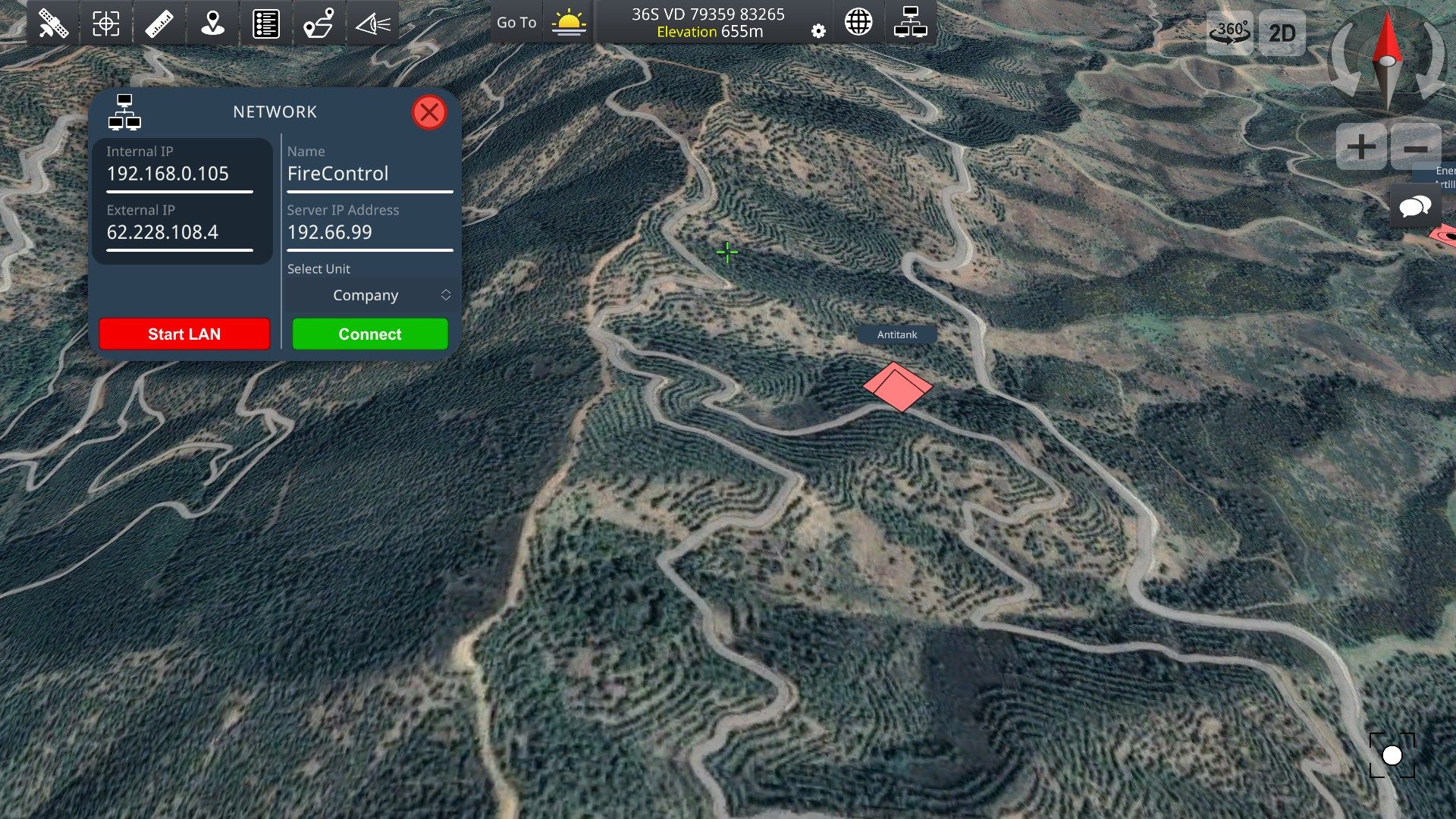
[NETWORK]
With the new Network feature, users can share their map status and chat at the same time over a TCP/IP network. No external server needed! You can use your device as a Server OR connect to a network as a client.
Military leaders must be able to command and control the many activities of their forces to accomplish their missions.
- LIVE Monitoring Map of users activity over the network.
- SHARE your map markers with other users.
- CHAT with other users over the network.
- No server needed! Achilleus 3D network is working through TCP/IP. No external server needed! Use your device as a Server OR connect to a network as a client.
- Due to cellular providers restriction, you cannot host a local area network from your device while you are connected to a cellular connection. Please use a local network wifi or connect to another server.
[MILITARY SYMBOLOGY]
- Includes basic Joint Military Symbology (MIL-STD-2525D).
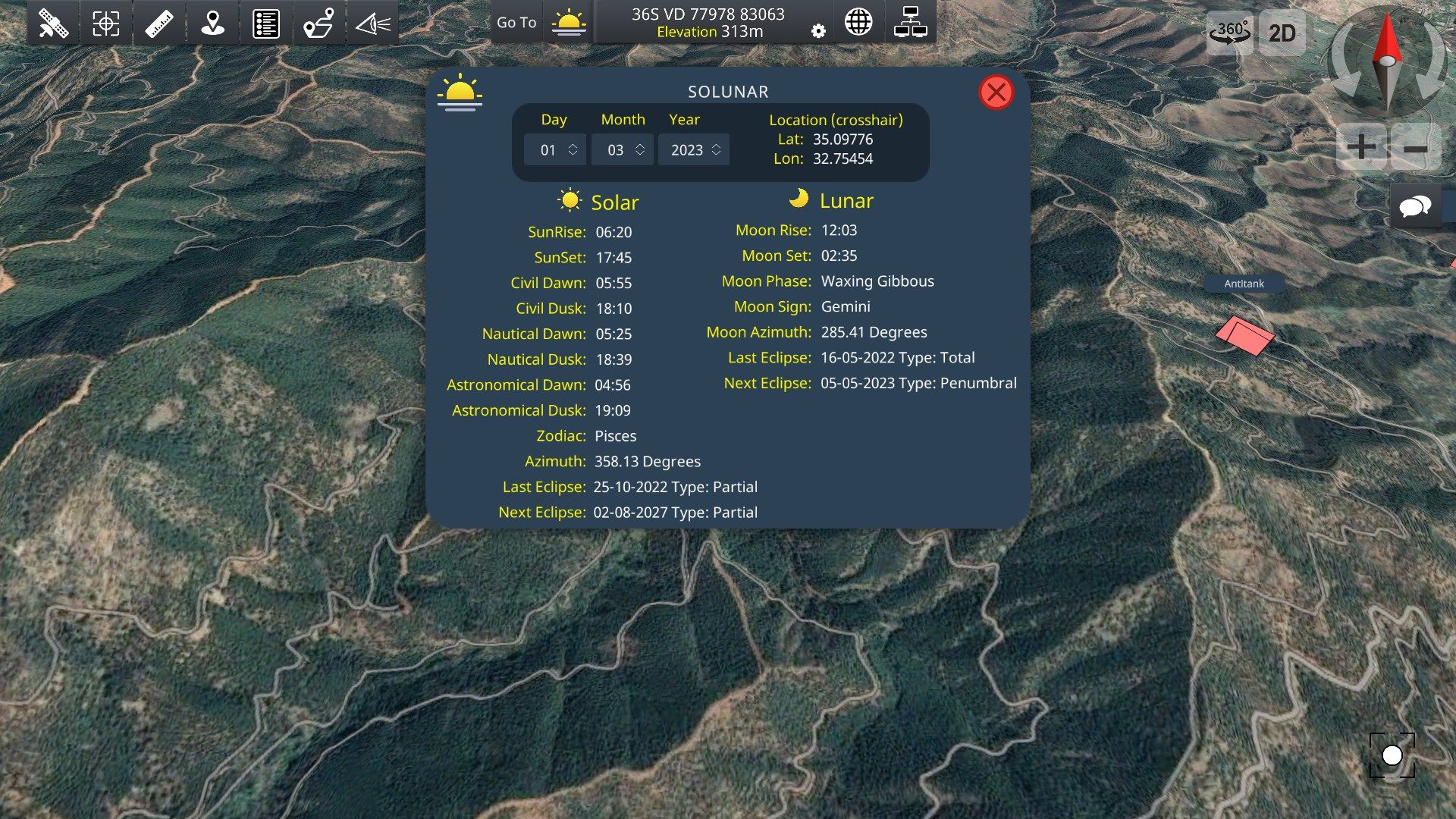
[SOLAR & LUNAR INFORMATION]
- Wide array of location based Solar/Lunar information such as Rise/Set times, phase info and more (works offline).
NOTE: Using GPS will shorten battery life.