

Description
Keep track of current and historic earthquakes on planet earth.
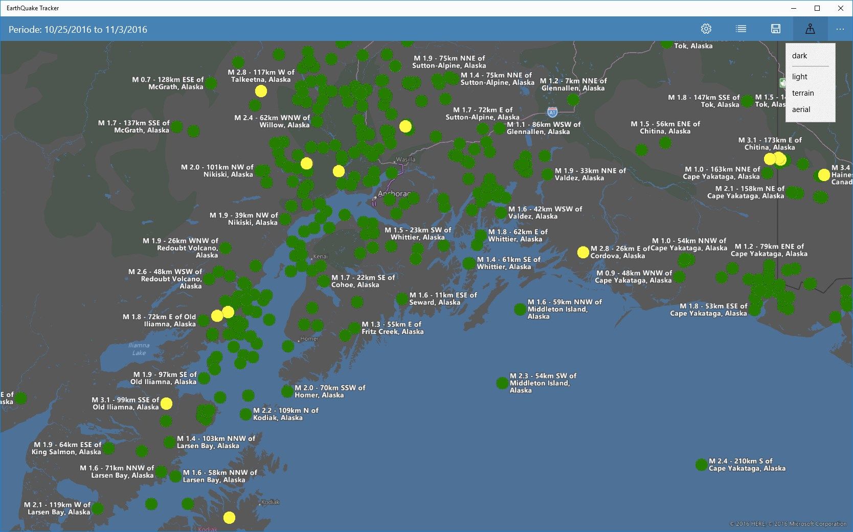
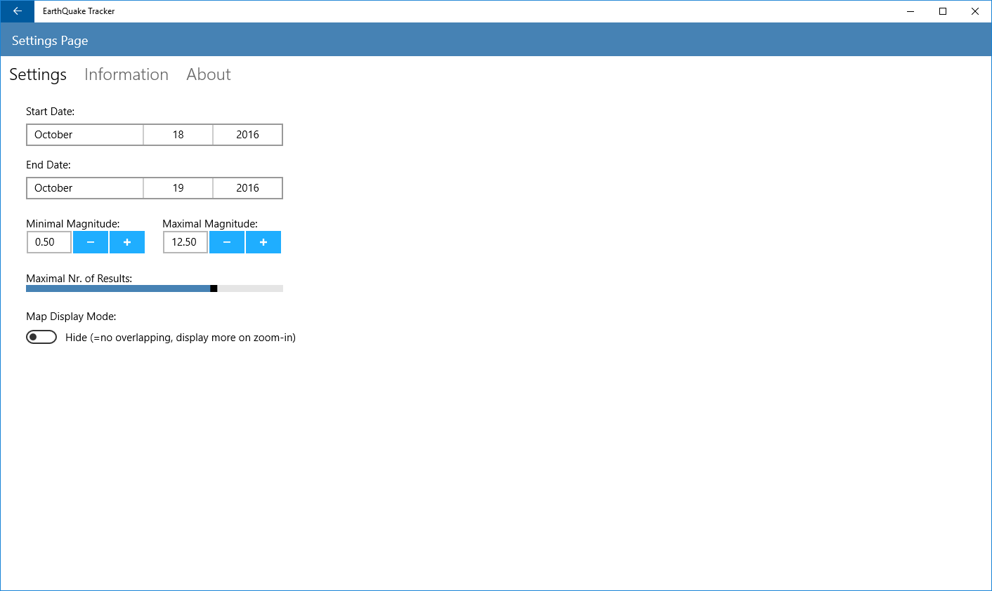
After the startup of this app, the earthquakes for the last 48 hours are displayed on the map. You can choose to show the earthquakes for a different time frame by going to the settings page.
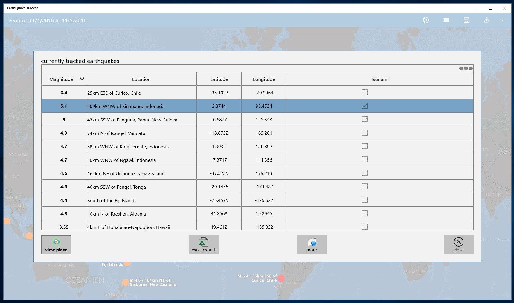
In settings, you can also filter the displayed earthqakes by their magnitudes. You can select a range via min and max magnitude.
You can also swap the map display mode:
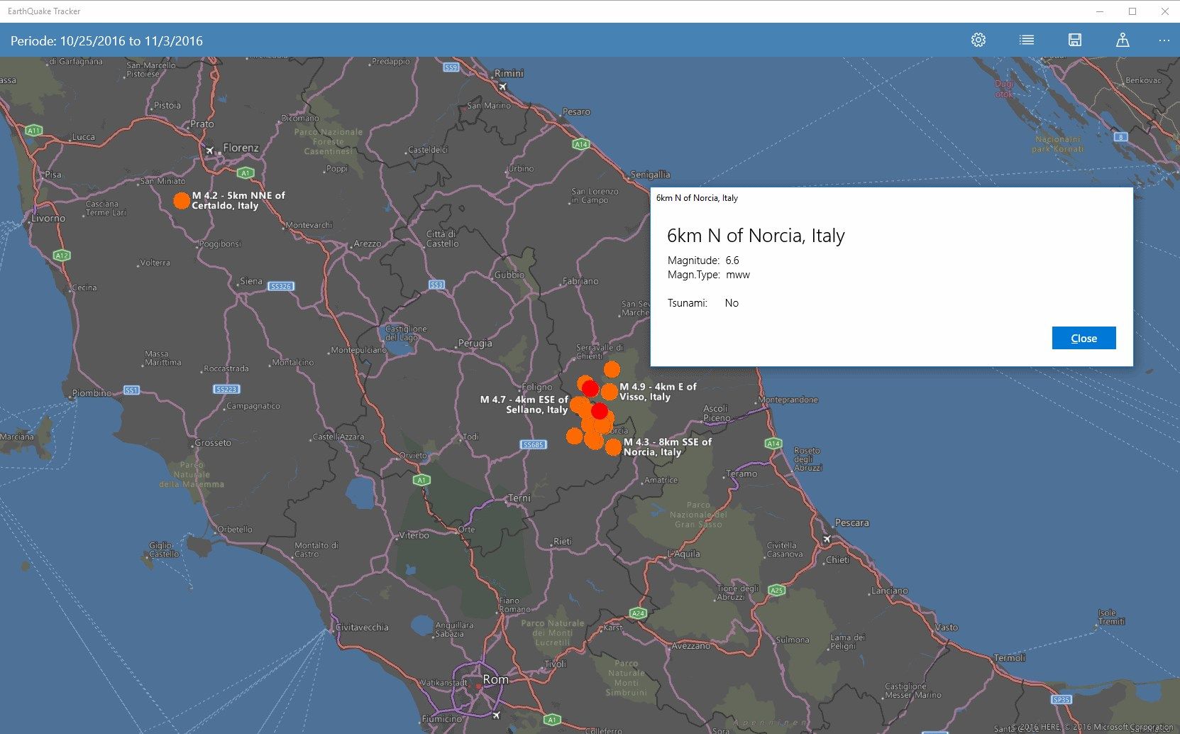
Either all eartquakes will be drawn simultaneously on the map (=always visible). This can lead to overlapping results. This is the default behaviour. Or you turn this behaviour off. Then overlapping results will be hidden. The more you zoom in the map, the more earthquakes will pop up on the map.
Running an a desktop PC you can zoom in/out with the mouse wheel. On mobile phone or tablet, you can use your fingers on the map to zoom in/out.
Source: USGS, the US Geological Survey
-
earthquakes map
-
actual earthquakes
-
historic earthquakes
-
save screenshots
-
excel data export