

FieldMAP
Description
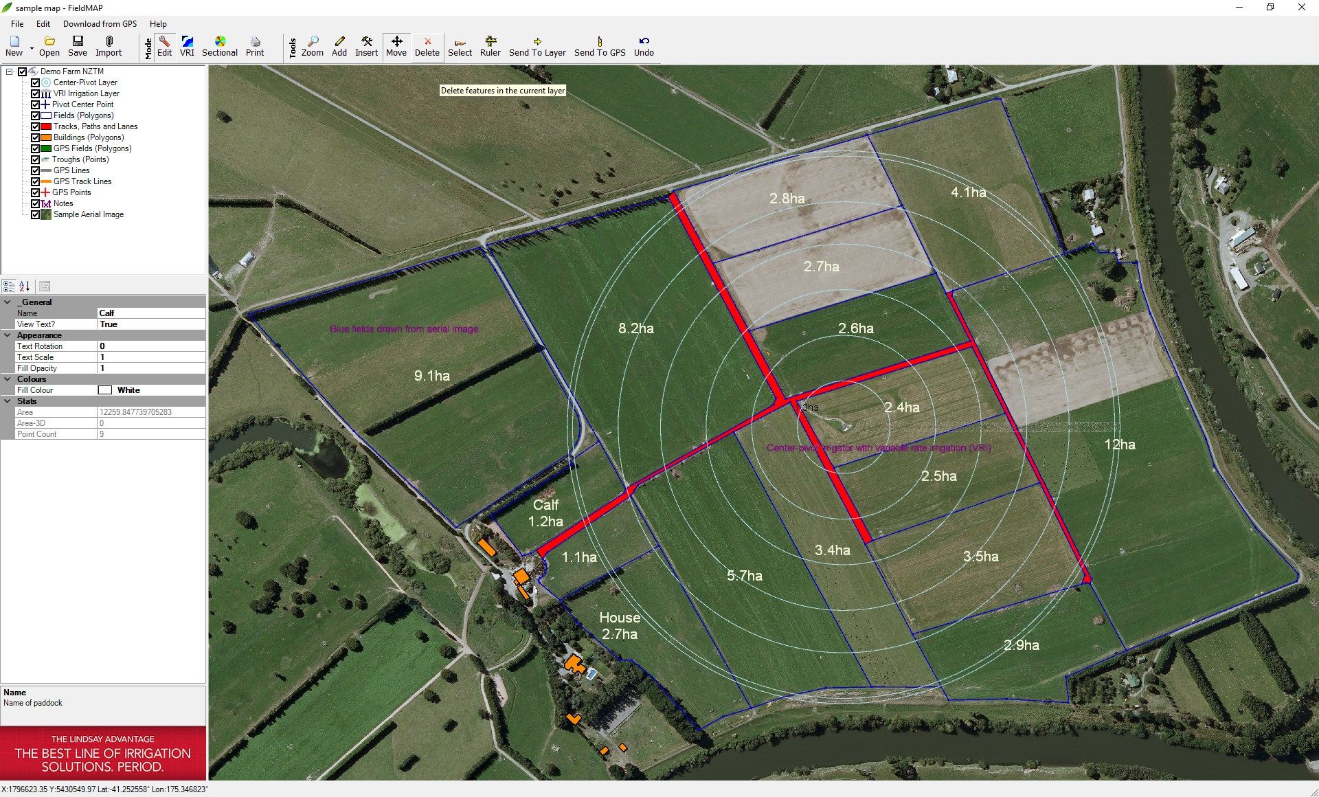
FieldMAP is an easy to use, powerful farm mapping and design software package that will enable you to draw, edit and print your own farm maps.
Designed by professional farm mappers to address our needs, FieldMAP has all the features you’ll need to map or design your farm layout, and is customised for farm-level mapping.
FEATURES
- Easily create and modify paddocks. Paddock areas update automatically as you drag fences
- Quickly and easily measure distances, altitudes and areas
- Upload and download points too and from your Garmin handheld GPS
- Compatible with new Garmin GPS models
- Create as many layers of information as you like, such as drainage, water lines, trees, etc which can be turned on or off for printing
- Import and export KML files to draw or view your map in Google Earth
- Import ortho-corrected, geo-referenced aerial photography
- Draw center-pivot irrigators, pod irrigation systems or long-lateral type irrigation systems
- Add a key (legend) title and scale to your map
- Print your map
- Show lengths of all individual lines (useful for calculating supplies for fencing, water systems, etc)
- Parallel line drawing tool (for vineyards, orchards, irrigation and paddock/field layout design)
- Import / export shapefiles, kml, dxf and gpx files
- Export layers into Garmin Oregon or Dakota GPS units
- Export maps and designs to TRACMAP head unit
- Export and import CSV files from other GPS units (including high accuracy RTK GPS)
Product ID:
9MSTKTJGJHC0
Release date:
2018-07-19
Last update:
2022-03-12