
Description
The FieldSeeker GIS for Mosquito Control cross-platform mobile app (CPMA) is an easy and convenient way for mosquito and vector control operations to record and view field activities related to larviciding (including storm drain), surveillance, and service requests.
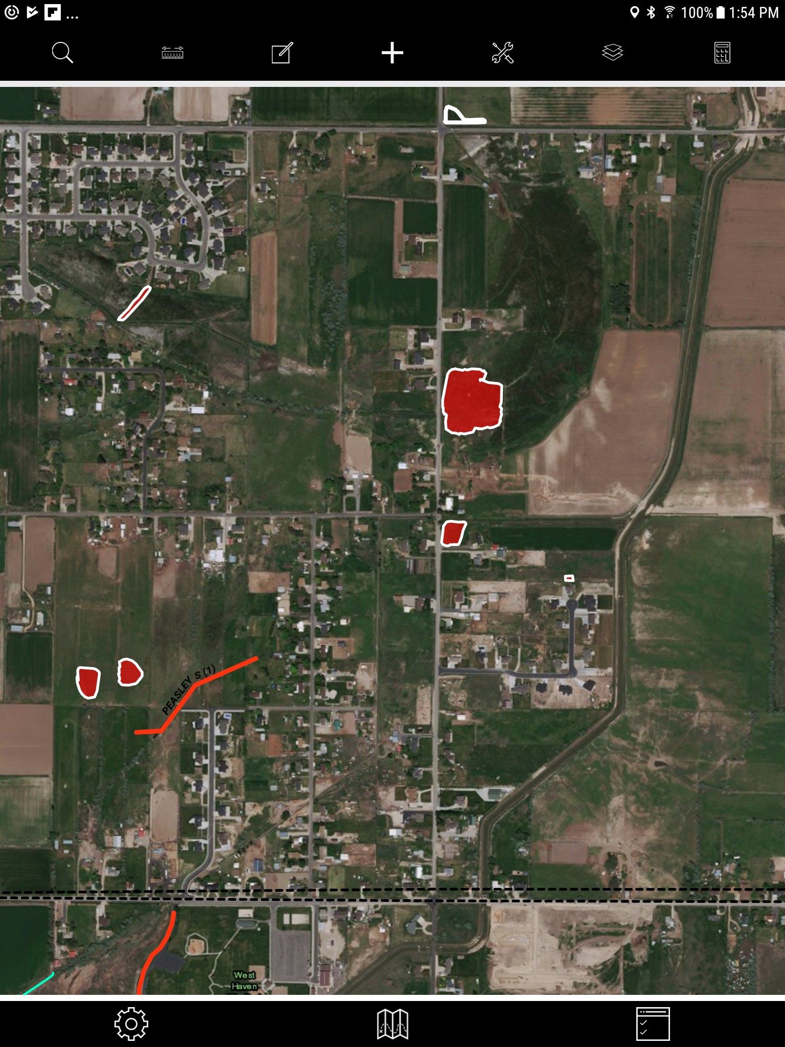
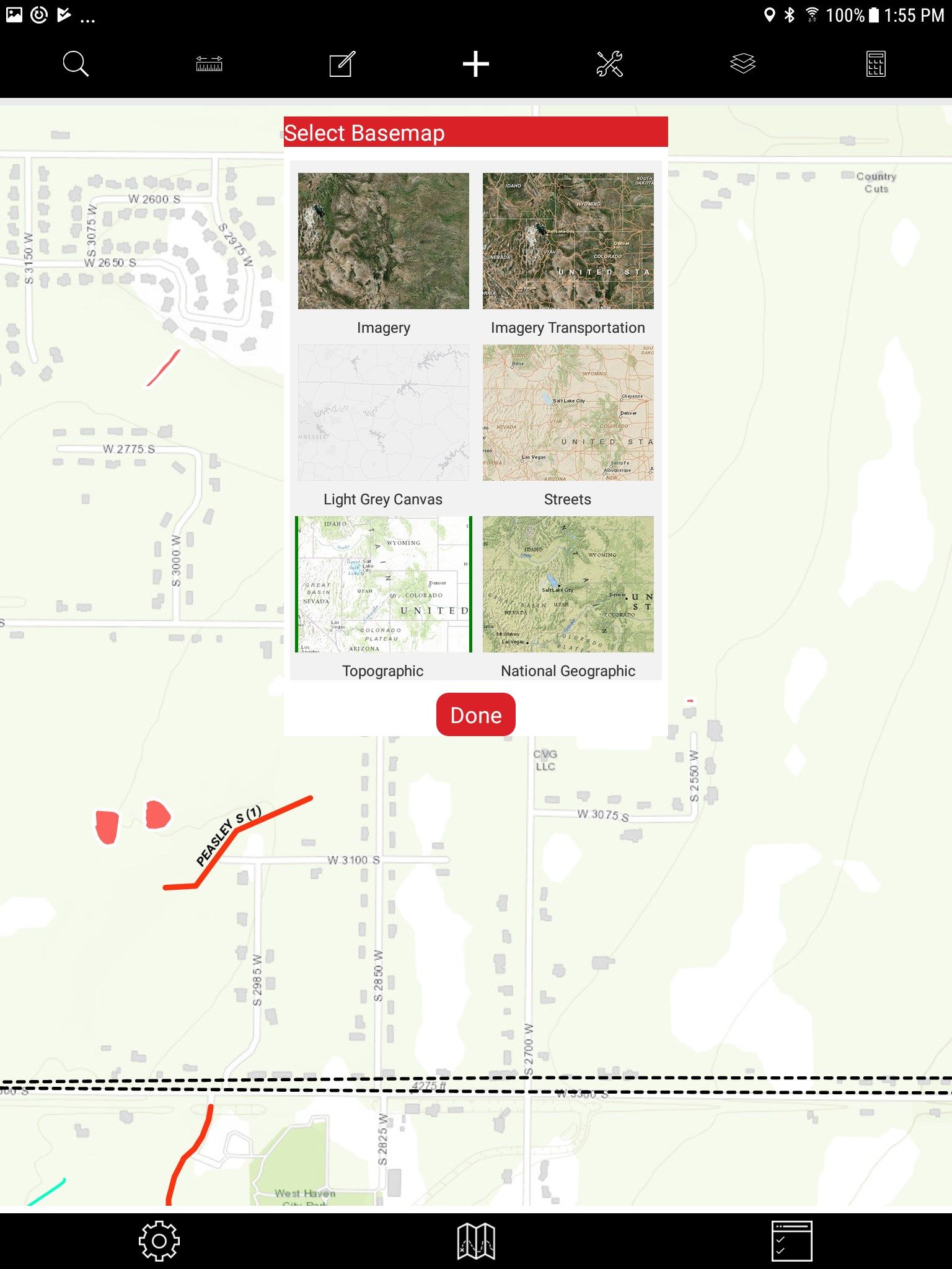
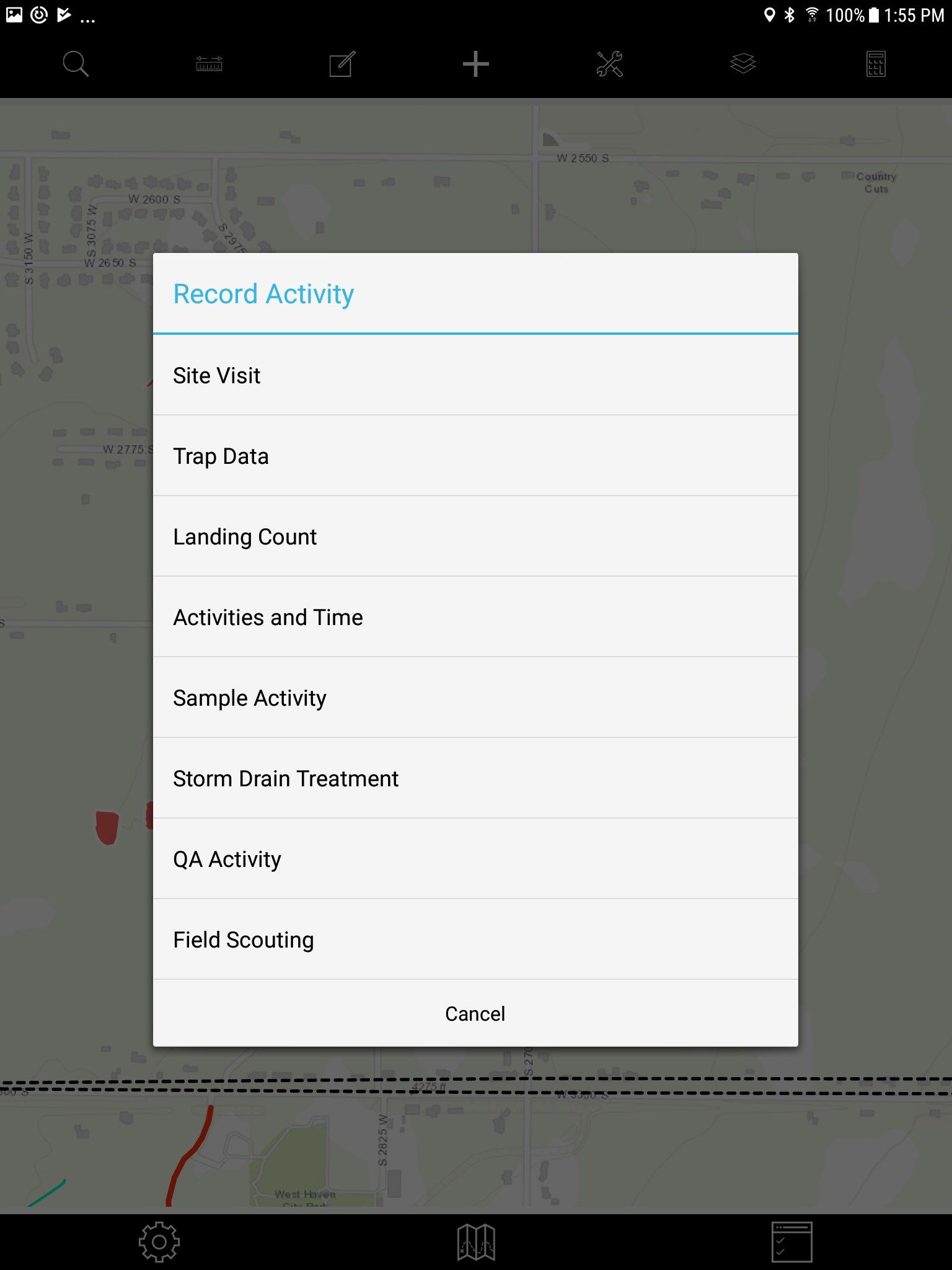
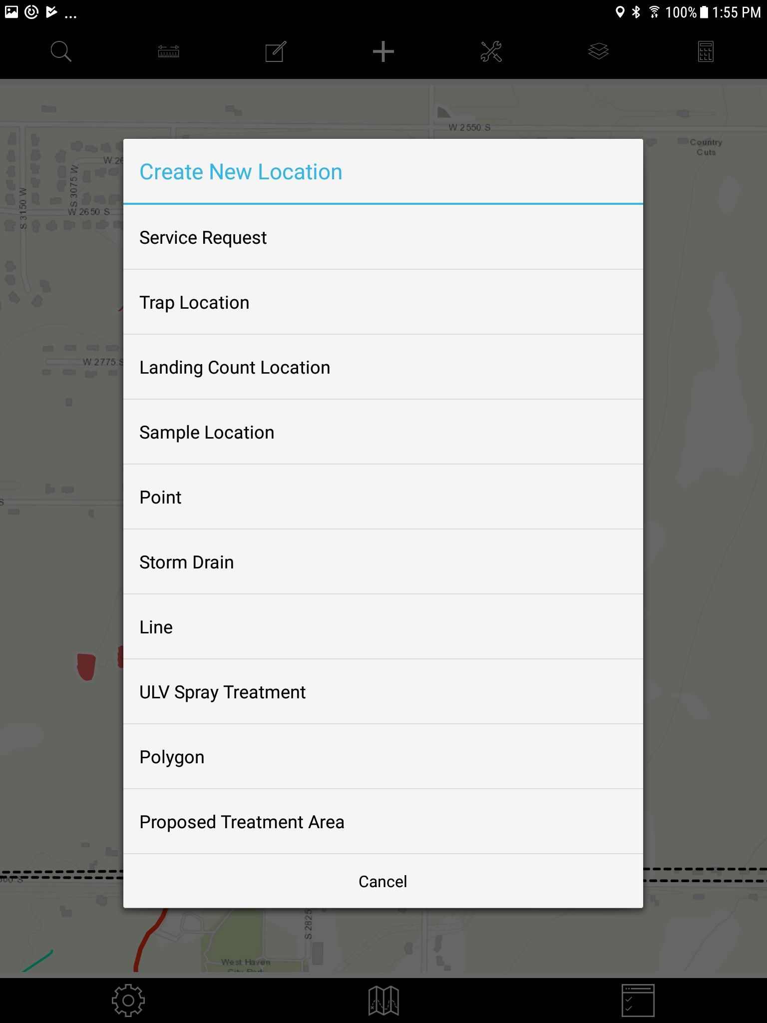
With FieldSeeker Mobile, field techs and supervisors can record and view activities such as site visits (inspections, treatments, larval samples), storm drain treatments, trap data, landing counts, field samples (dead birds, blood samples), and miscellaneous activities; map locations as points, lines, polygons as well as storm drains, service requests, trap sites, landing count sites, sample locations, and proposed treatment areas; view additional map layers such as restricted areas, zones, and routes; select from multiple Esri basemaps; respond to service requests; attach pictures; get directions; take measurements; etc. Everything you need in a mobile app for mosquito and vector control field operations is included.
FieldSeeker Mobile is built using the Esri Runtime SDK for Xamarin 100.3.x. The mobile app is pointed to a test and demonstration service and is not intended for production use. To use in production, the app must be pointed to a licensed and configured FieldSeeker Mobile Webmap and feature service in ArcGIS Online.
-
Larviciding with Storm Drain Treatment
-
Surveillance
-
Service Request
-
Search
-
Measure
-
Map
-
Product Calculator
-
On-Truck Inventory
-
Download Offline Data
-
Review Today's Work