

Description
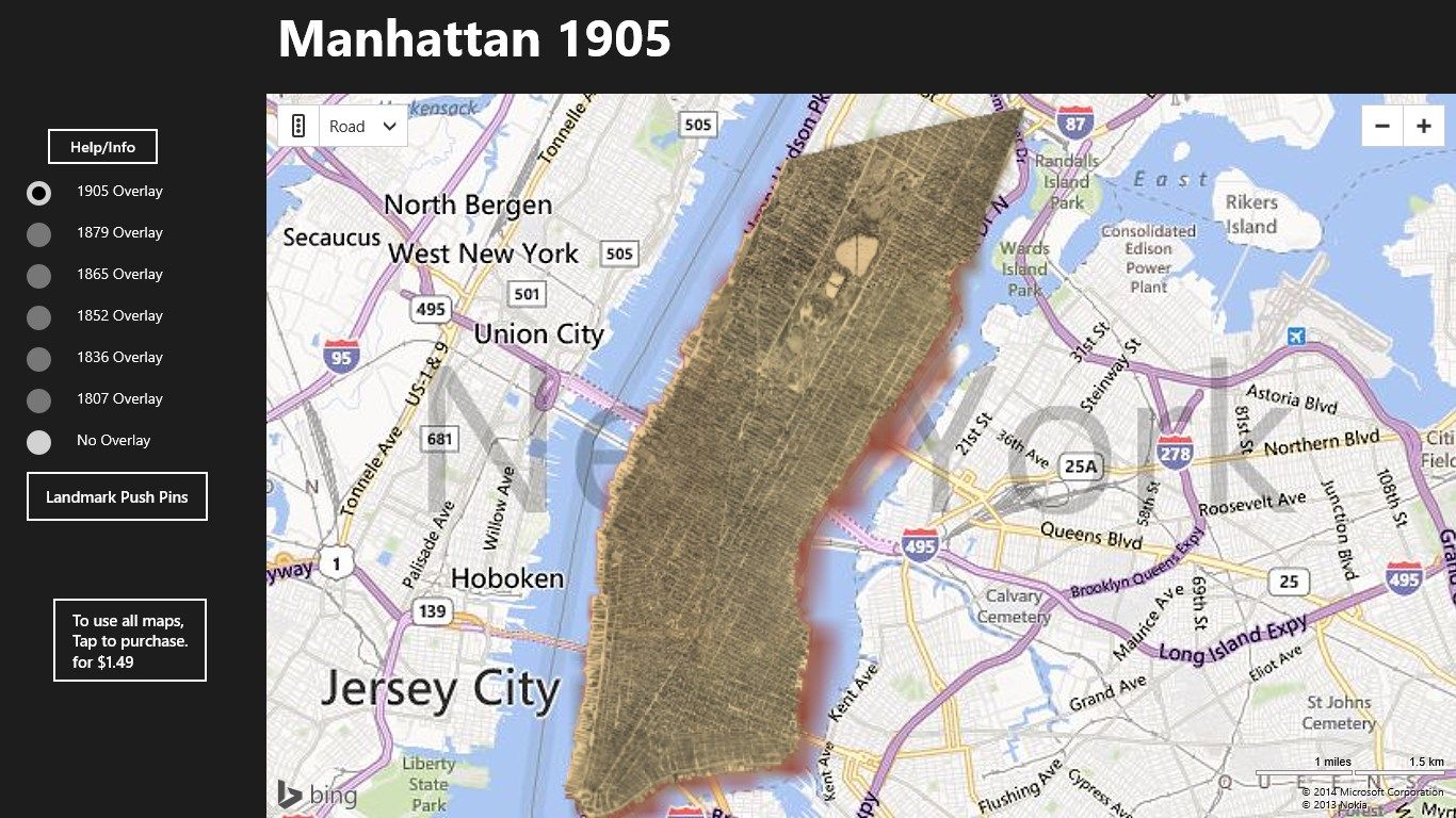
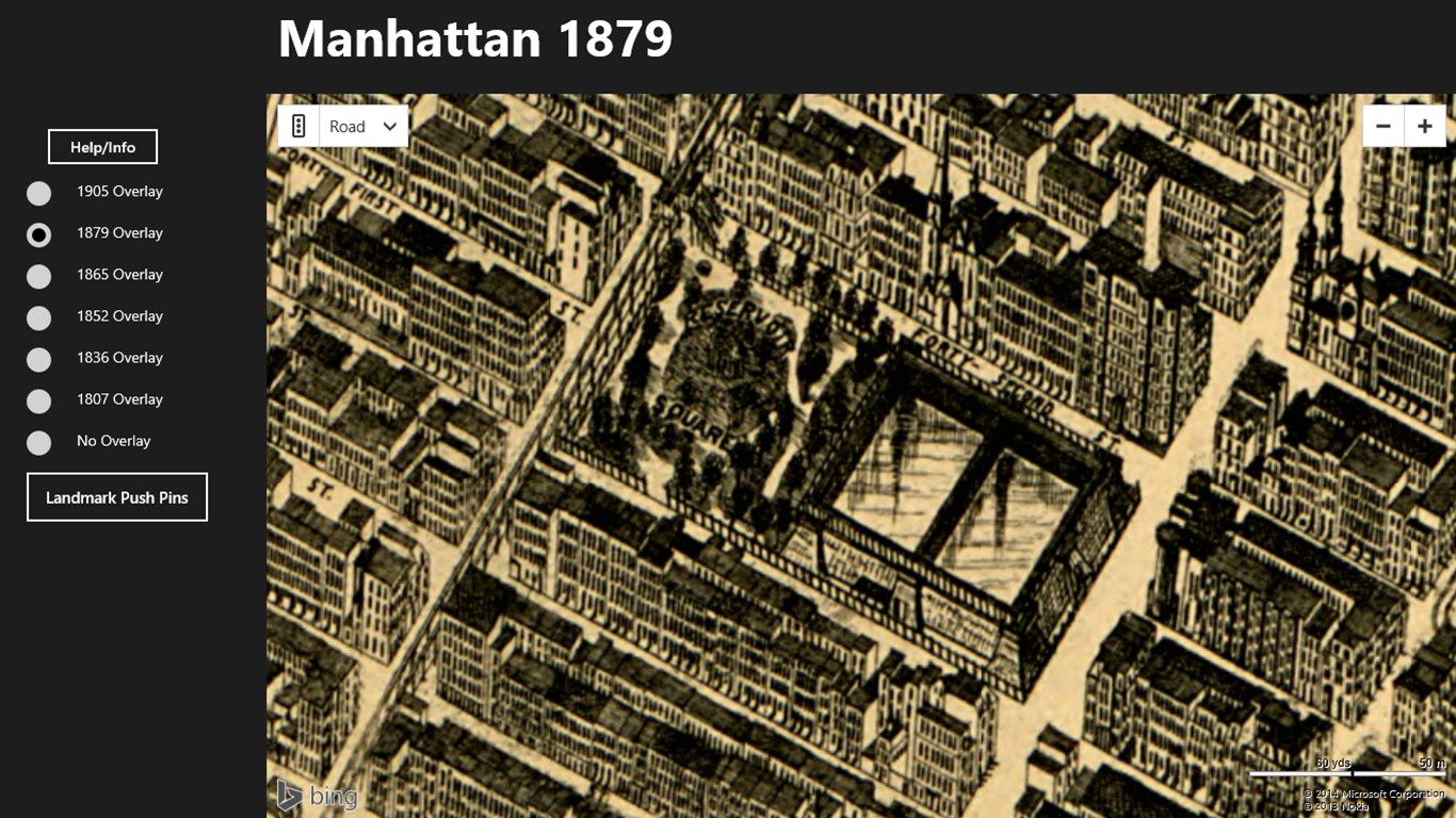
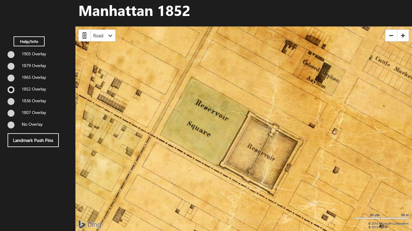
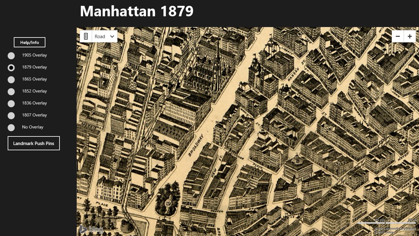
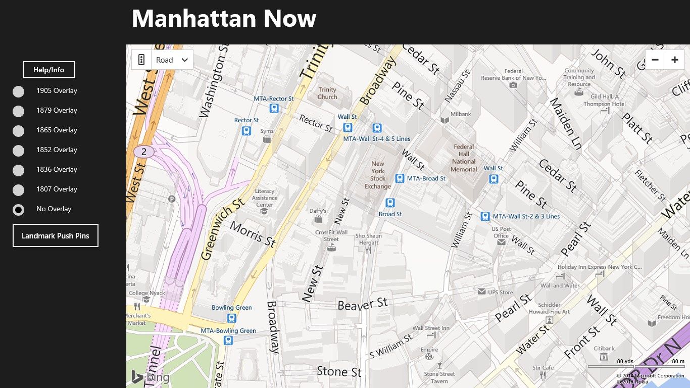
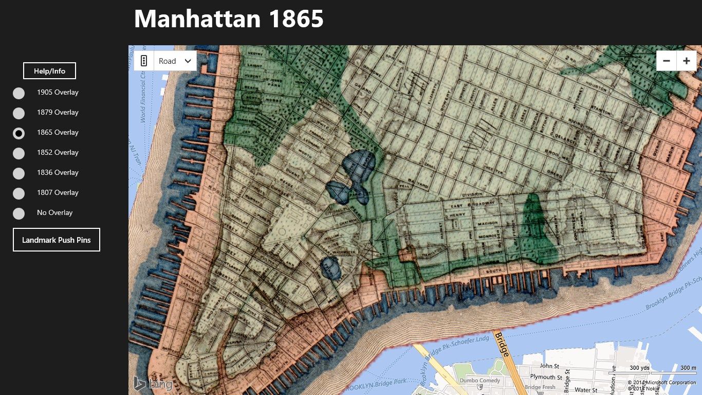
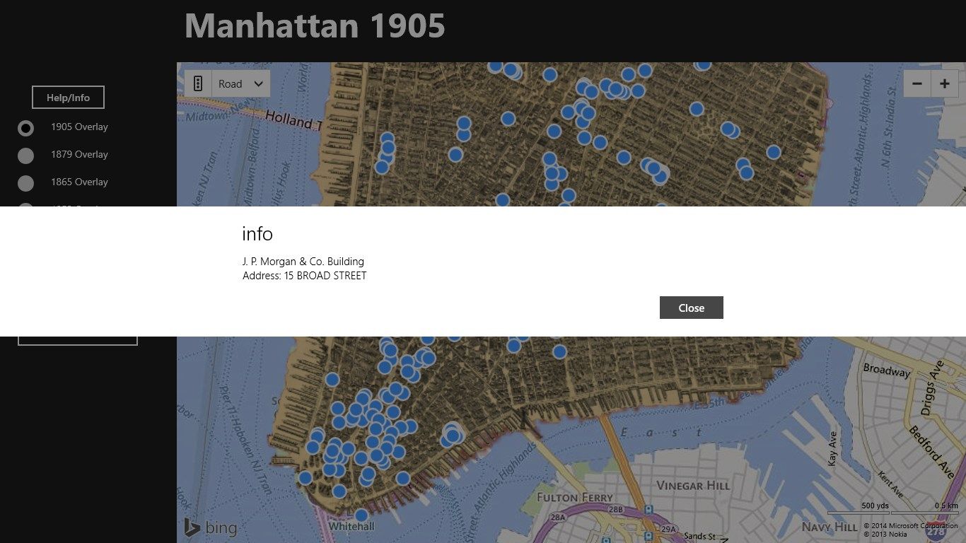
“Manhattan Then and Now” allows you to compare Manhattan as it appeared in the past with the present. This is accomplished by positioning an overlay containing an older map of Manhattan in an earlier time period over a current Bing map of Manhattan. There are six previous maps, 1807 – 1905, that may be used as overlays. The 1905 (estimated date) and the 1879 one are in fact, birds-eye views of Manhattan depicting the existing buildings of the time. The other four maps show the street grid with various places of interest such as cemeteries indicated. The 1865 map shows topographical features that existed previous to development and before 1865 such as water courses, marshes and meadows. So it really depicts an earlier time than 1865. Finally there are over 900 current landmark locations that may be displayed on the map.
To prepare the overlay, using mapping software over 200 points (primarily intersections of streets) on the old maps were matched to actual points on the Bing map. The result was that many points of interest (Bryant Park, St. Patrick’s Cathedral, Union Square, Central Park and many more) display an almost perfect correspondence, while others may be a bit off, perhaps as much as a half-block. The far Northwest and Northeast are the least accurate on some maps.
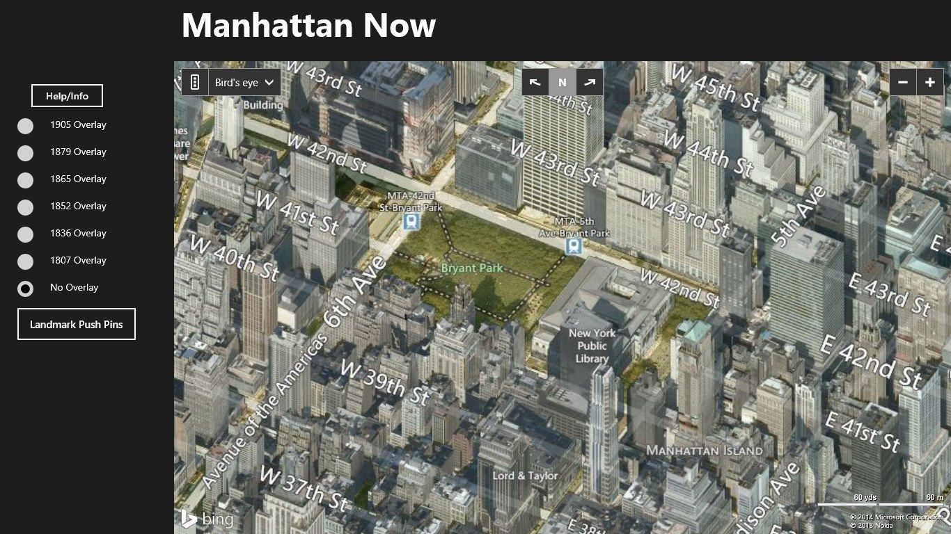
To use the app, you need a data connection, and the quality of your data connection will determine how fast the map overlays download. Have fun. See how well you know Manhattan in a time before the Empire State Building, the Chrysler Building, the NYC Public Library and all those Trump buildings.
The 1905 map is free. To use the other five maps, you will need to purchase the app.
This app collects no information about the user and uses no cookies. It does need to have an Internet connection so as to access the maps.
Comments and questions: William LaMartin, [email protected].
-
Early maps of Manhattan