
PhotOrganize
Description
With PhotOrganize you organize a photo collection so that the subjects of photos are always recognizable and a selection of photos can easily be presented in chronological order, manually or as a slide show. The main options are:
- From a selection of .jpg / .jpeg photos, the date / time stored by the camera that the photo was taken can be changed if the photos were taken in a different time zone and forgot to adjust the camera clock.
- A selection of one or more photos can be renamed as yyyymmdd hhmmss (= the saved date / time the photo was taken) + a subject to be chosen for that selection.
- The orientation captured by modern cameras can be adjusted (or filled in if not entered in the photo) so that the photo will be displayed correctly vertically or horizontally by programs that use this information.
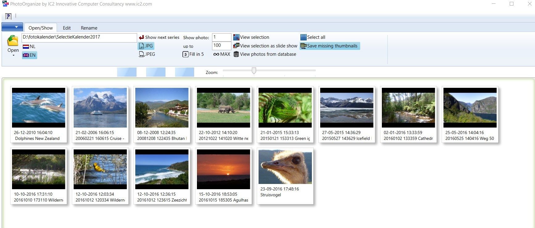
- A presentation of photos can be made with it, directly or via a pre-made selection of photos (possibly over several folders). These are stored as ‘databases’ that can be opened to display exactly these photos (full screen). Photos can be zoomed in or shifted and details can be pointed out with an extra large arrow
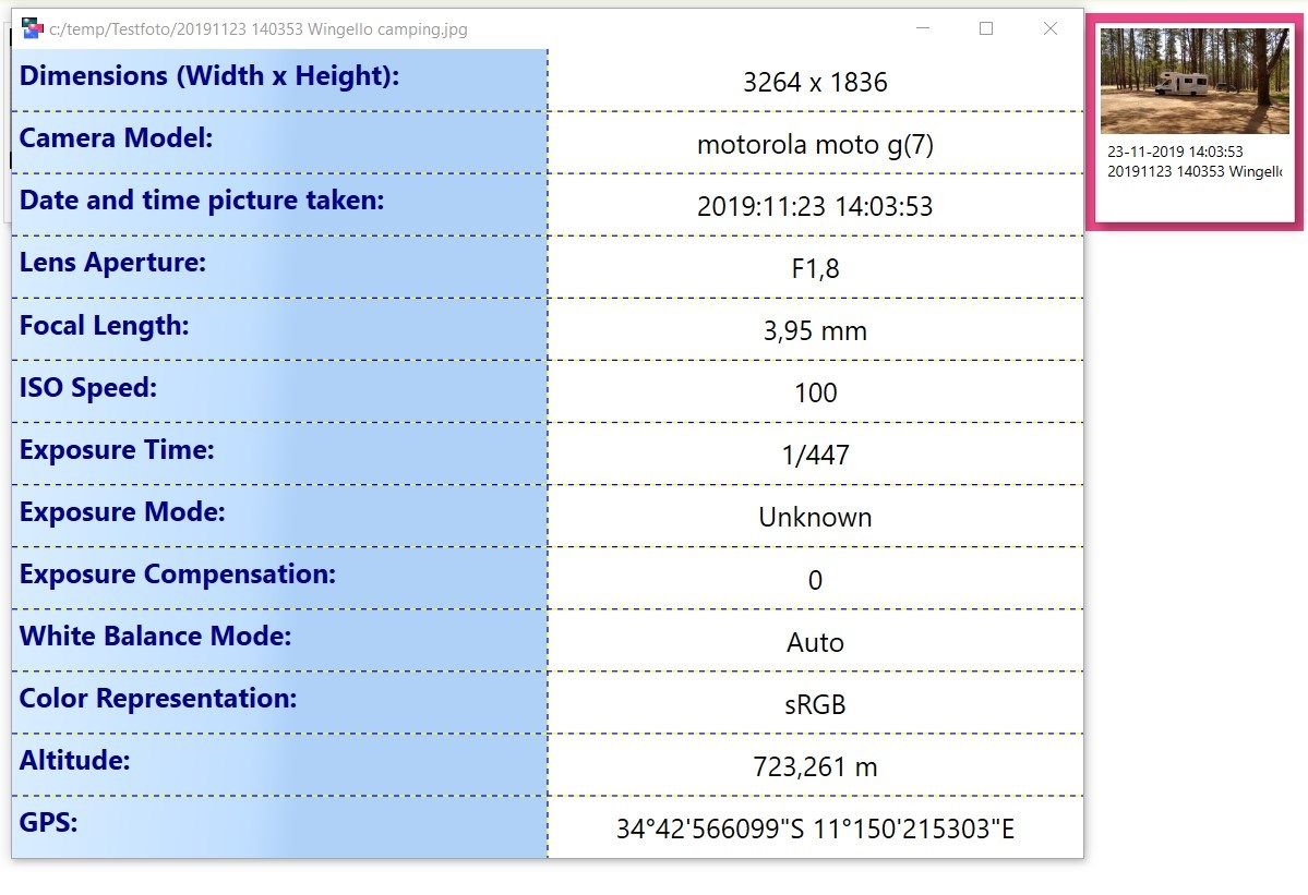
- The main EXIF information (technical details of the photo) can be displayed
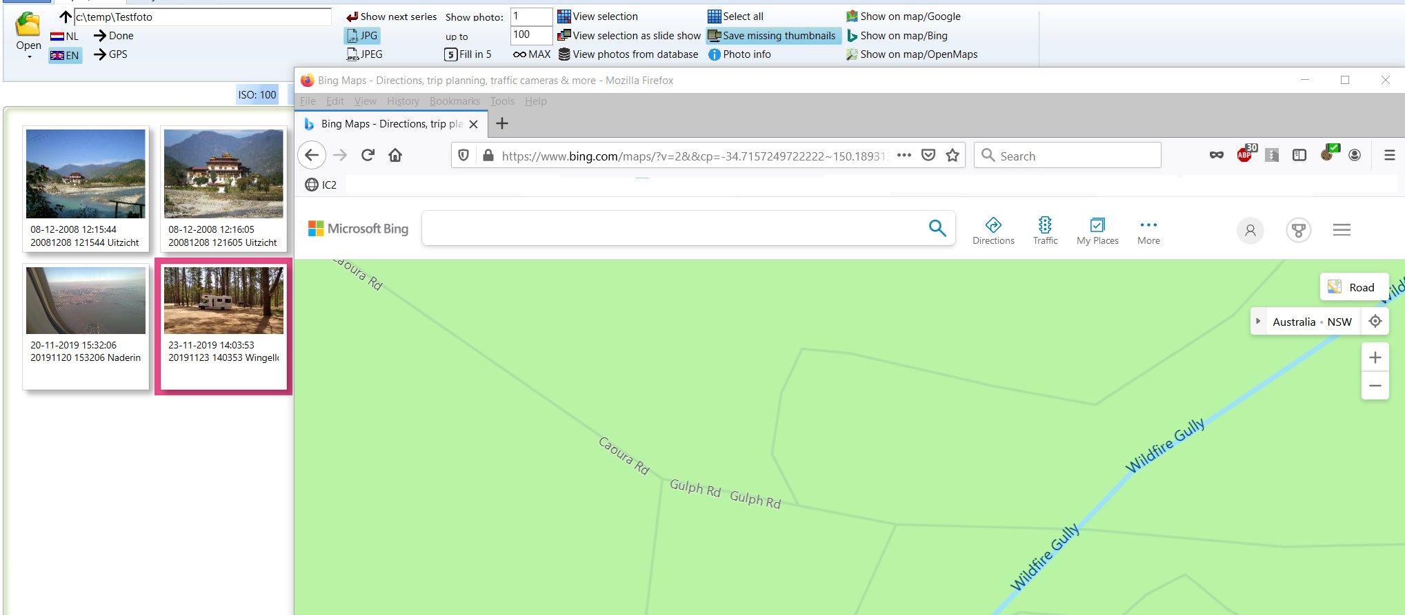
- For photos with a GPS tag (Geotag, such as from a smartphone), the location can be shown directly in Google Maps, Bing Maps or Open Street Maps in your browser
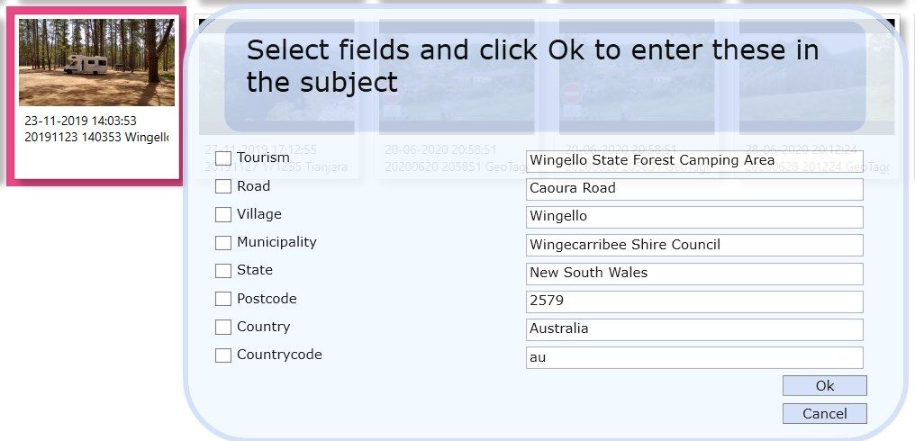
- With Reverse Geo Tags you can see up to 8 fields of information about the place with a photo with GPS coordinates that you can use directly to create the subject
- GPS coordinates can be added in a photo afterwards
-
Rename photo files with date and time + your own description or use the automatically retrieved geotags from photos with GPS.
-
Correct wrong date/time photo taken or orientation without changing the original photo data
-
Create multiple presentation to be displayed with or without the name given to the photos
-
Show photo information including location on a map (for geo-tagged photos) in GoogleMaps, Bing Maps or Open Street Maps
-
Copy your presentation selection photos to other media for use elsewhere
-
Add GPS coordinates to photos without GPS info
-
Retrieve Reverse Geodata (if GPS in photo) and use descriptions directly in the subject of the photo
-
When mixing photos from multiple cameras they are presented in chronological order after renaming
Product ID:
9P4DDL0SGVRH
Release date:
2017-07-18
Last update:
2022-03-12