

Radar Imagery
Description
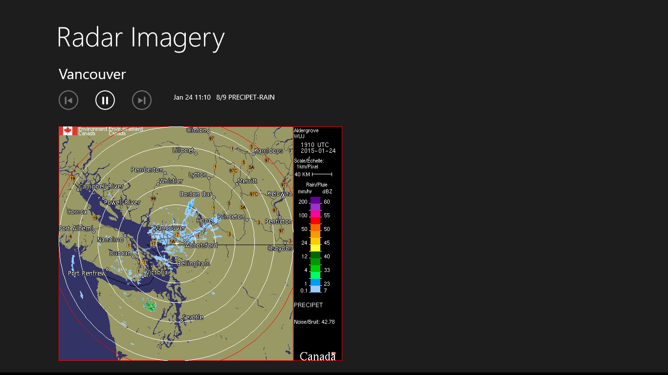
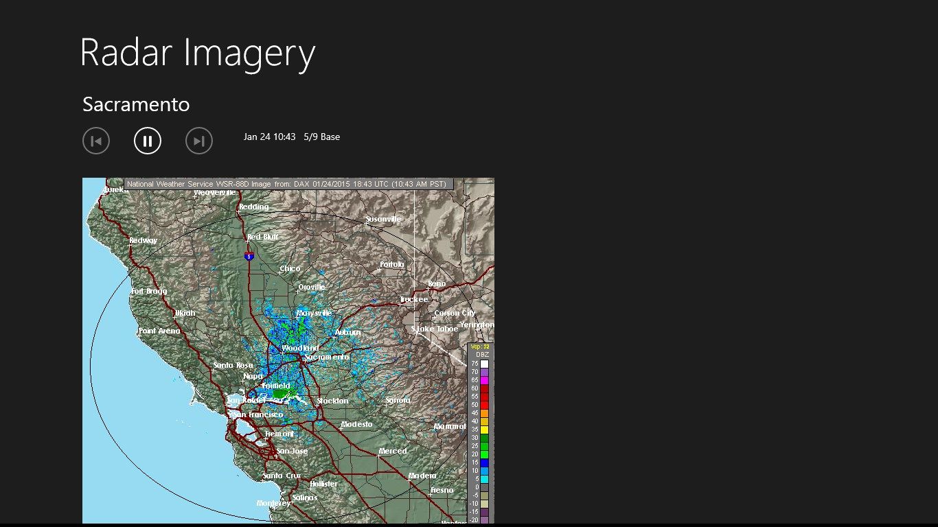
The Radar Imagery app provides a quick source of advanced weather information from Environment Canada and the National Oceanic and Atmospheric Administration (NOAA) for mobile users on the go.
-
Displays up-to-date radar imagery from Environment Canada and the NOAA.
-
Examine data from individual radar sites and regional composites across Canada and USA.
-
Manual and automatic navigation through images in the loop.
-
Changes to selections are saved automatically.
Product ID:
9WZDNCRCWDKD
Release date:
2015-02-03
Last update:
2020-10-19