
Description
See the location of the International Space station, Chinese Space Station, SpaceX Starlink, and all other earth orbiting satellites.
Did you know the brightest man-made object orbiting the earth is the International Space Station?
And, did you know it is very easily seen on a clear night?
With the Satellite Tracking application, you can determine when the space station or other satellites are visible from your location for viewing or communicating.
There are over 8000+ satellites currently orbiting Earth.
Some of these include amateur radio, Hubble space telescope, GPS, navigation, communication, earth and science, scientific, plus many more!
The Satellite Tracking application features include:
IO-117 (GreenCube), FO-118 (CAS-5A), and HO-119 (XW-4, CAS-10).
Tevel satellites.
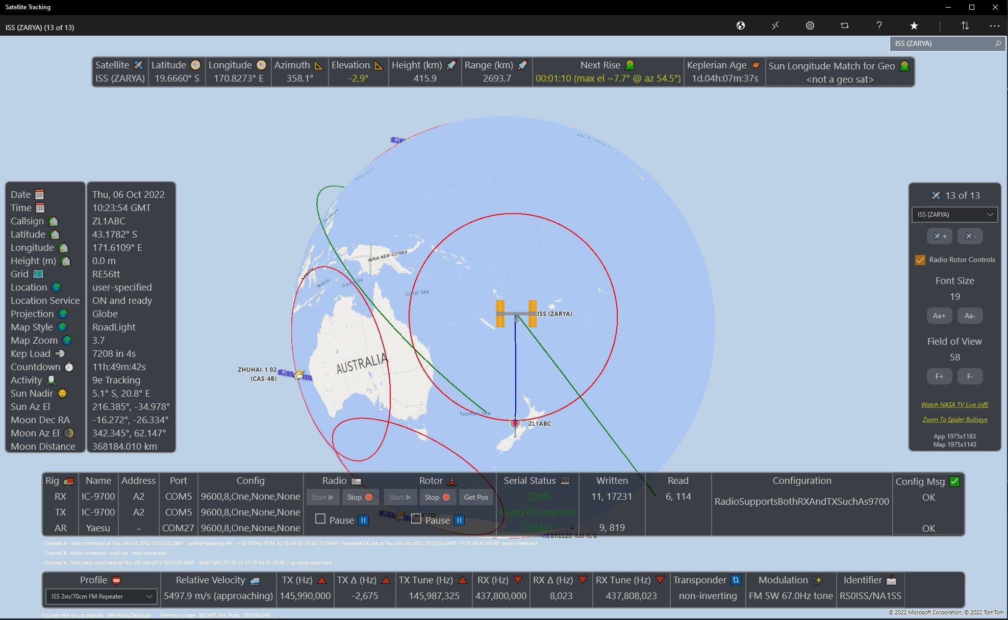
Yaesu and compatible rotor support.
Icom and compatible radio support.
Airspy SDR# plugin to control SDR# as a receiver.
Dark mode maps.
Notifications.
Road globe projection.
Maidenhead grid square and distance between two stations and great-circle.
Es’hail 2 has launched and tracking #qo100.
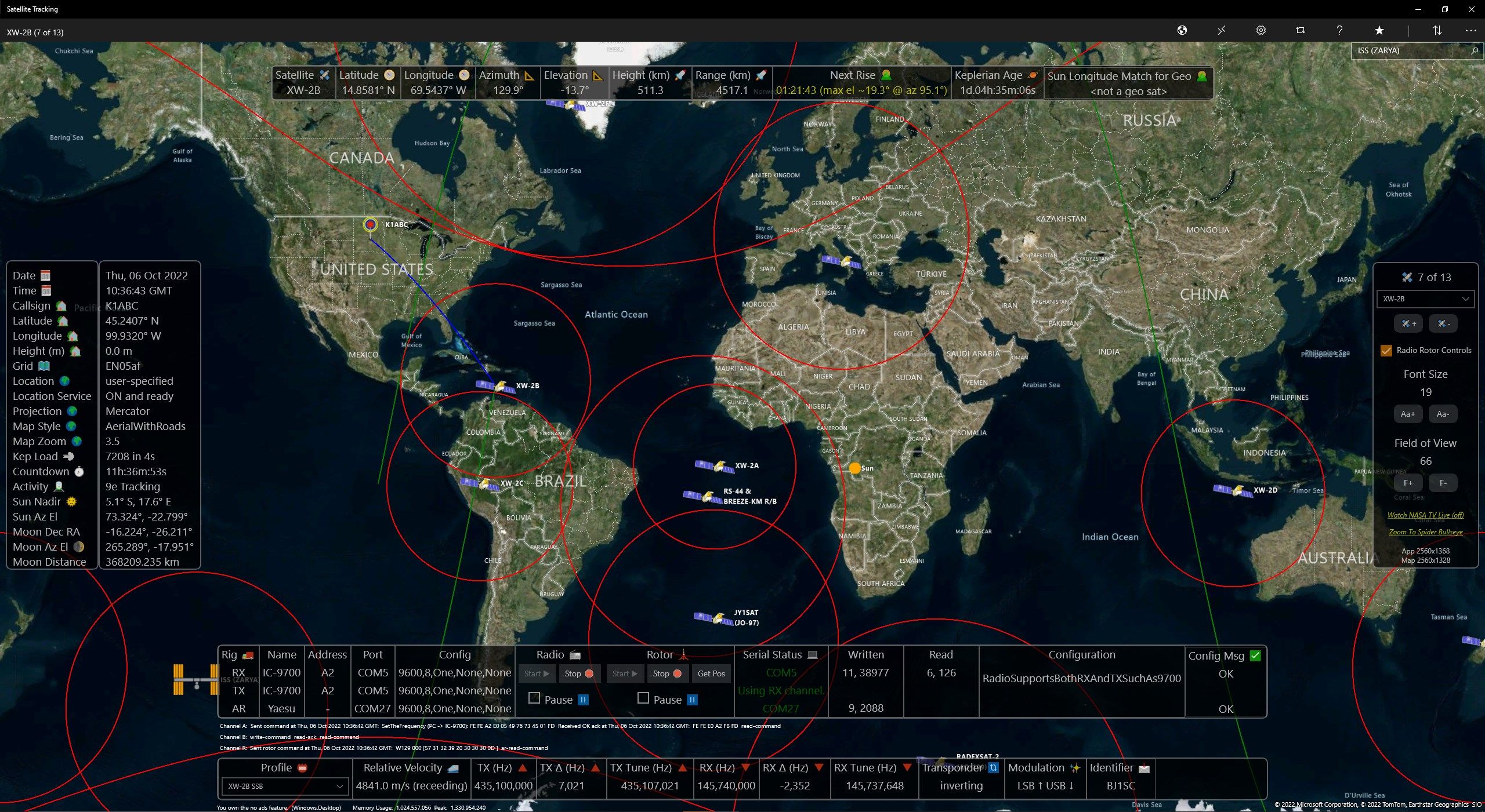
Show all geostationary satellites at same time on equator - click to track
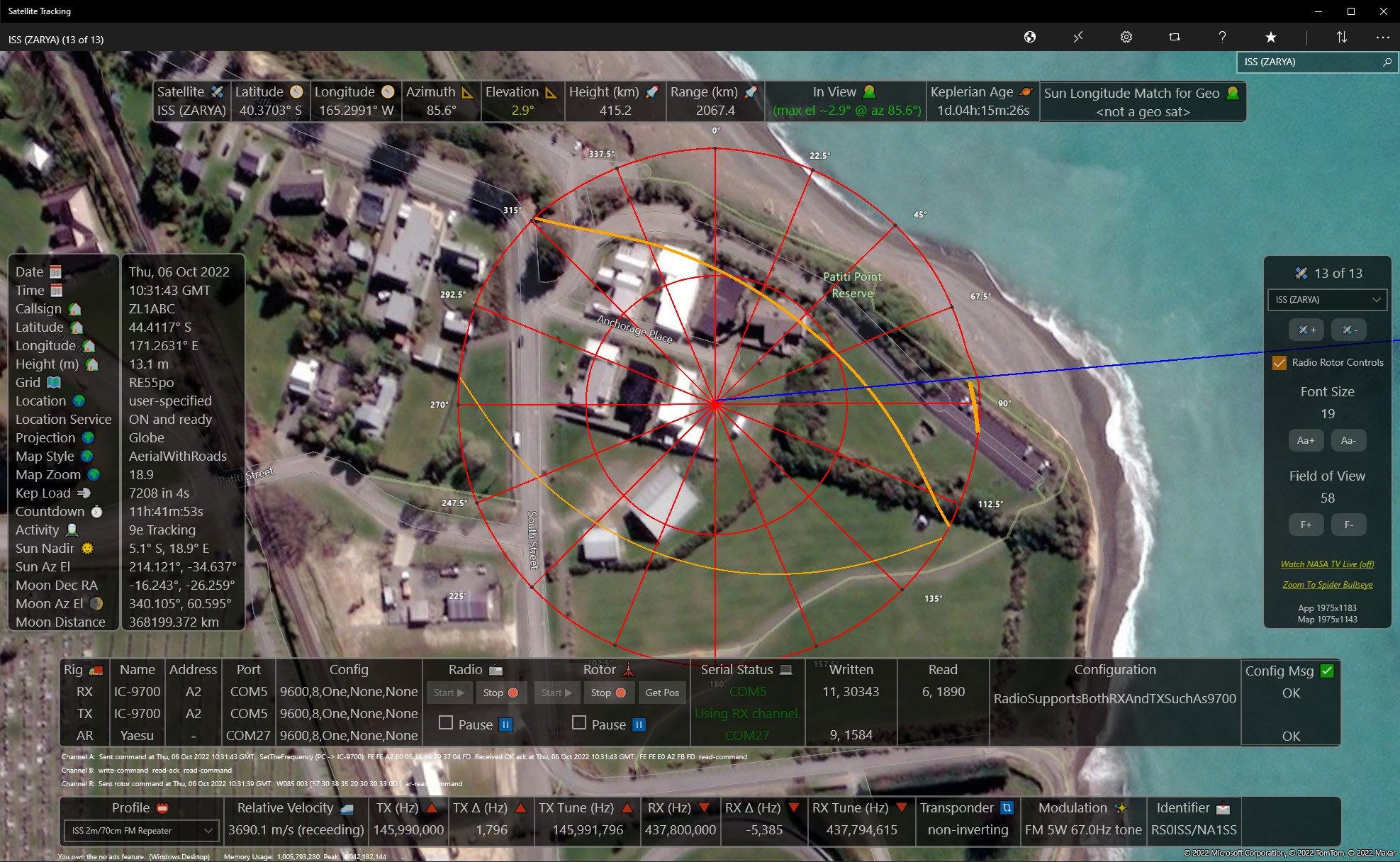
Show antenna direction line to satellite - deep zoom
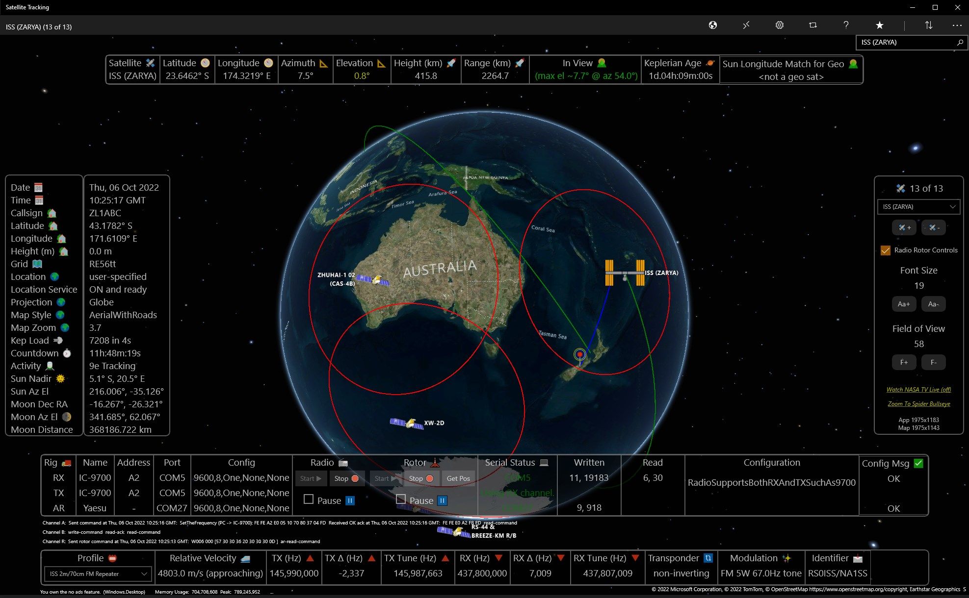
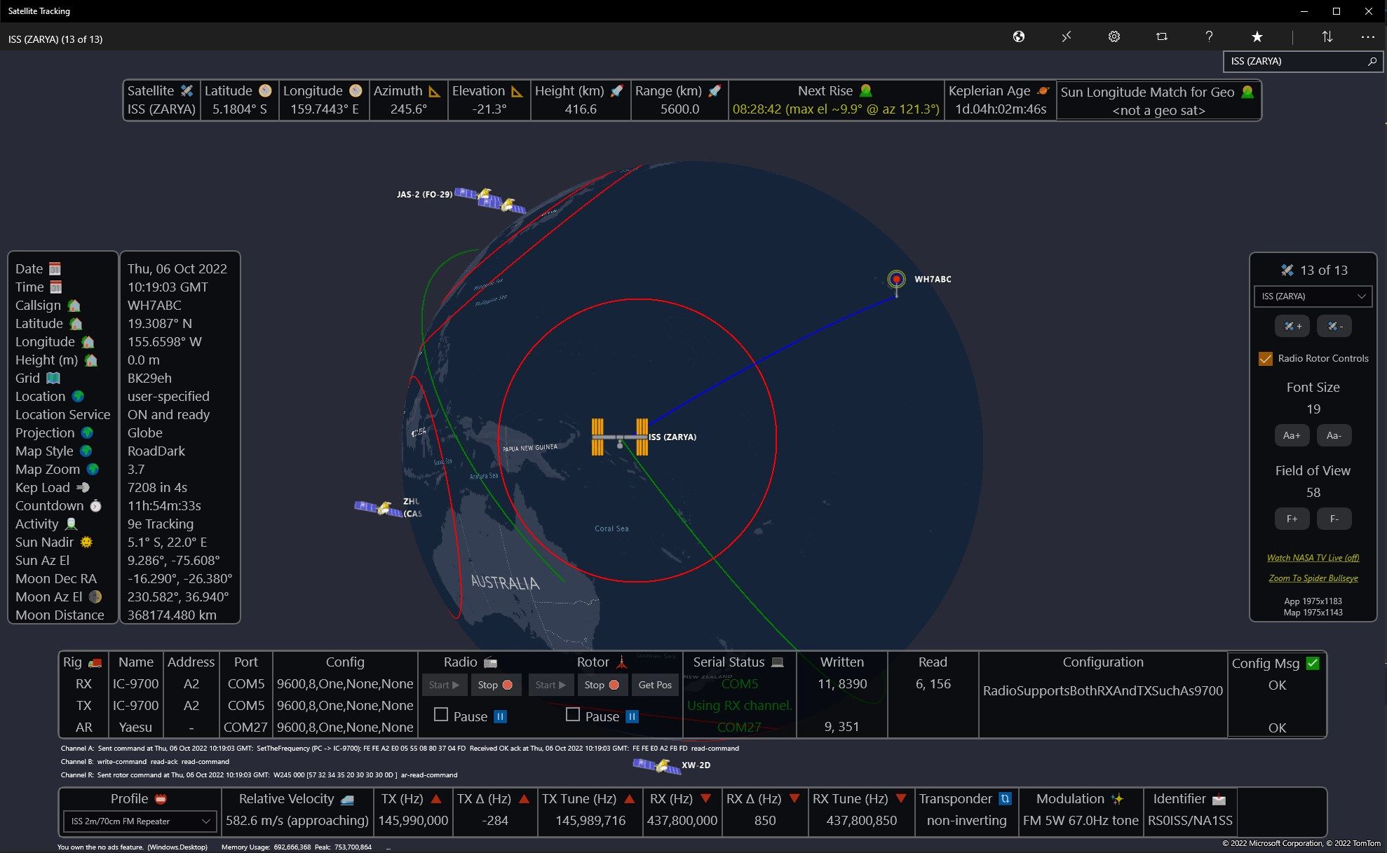
2D or 3D map (road, aerial, terrain)
Zoom in and out on maps
User and satellite position icons
Satellite footprint
Satellite future location
GPS location service or manually entered position
of satellites loaded from the internet
Satellite designator and sub-satellite position
Azimuth and elevation from your position
Height above earth
Range from your location
Countdown timer for next rise at your location
GMT date display
Satellite category and selection
Settings for map style
Setting for map centering on user, satellite, or free roaming map
Location override to manually enter your position
Equator, date-line, and prime-meridian lines on map
Share your map and position data to popular social media and other applications registered on your system such as Twitter, mail, etc.
Help documentation and tool-tips to aid in your usage
Toggle switch to allow position information to be displayed on map or not for pure-view map examination
Orbit information such as catalog number, latitude, longitude, elevation, azimuth, range, height, orbit #, phase, next rise, period, and footprint radius
For given category, show all satellites currently in view or all
Future passes showing date and time, azimuth, and elevation
Radio communication frequency bands, links, and modes to use for Amateur Radio satellites
Keplerian information such as catalog number, epoch orbit, epoch year, epoch day, raan right ascension of node, eccentricity, mean anomaly, mean motion, and decay rate
Application details shown in about, perform an application review, ask for support if need, send feedback, or view other applications written by the authors
DXCC countries can be shown on the map
DXCC calculator to show what countries can be communicated to via the satellite
Perhaps you want to spot the station, get current position of ISS, or ask yourself where is the international space station?
The following categories of satellites can be selected:
Amateur
Brightest
Communication
Earth-weather
Geo-sync
Miscellaneous
Navigation
New
Old
Scientific
Stations
Starlink SpaceX
These are just some of popular satellites to track:
Amateur
Es’hail 2
OSCAR 7 (AO-7)
UOSAT 2 (UO-11)
LUSAT (LO-19)
EYESAT-1 (AO-27)
ITAMSAT (IO-26)
RADIO ROSTO (RS-15)
JAS-2 (FO-29)
TECHSAT 1B (GO-32)
ISS (ZARYA)
FUNCUBE-1 (AO-73)
UWE-3
SPROUT
DUCHIFAT-1
CHUBUSAT-1
NUDT-PHONESAT
XW-2A
XW-2B
XW-2C
XW-2D
XW-2E
XW-2F
LILACSAT2
DCBB
AO-85 FOX-1A
Brightest
ATLAST CENTAUR 2
THOR AGENA
SL-3
SL-8 R/B
CUSAT 2 & FALCON 9 R/B
Communication
MOLNIYA
O3B
Earth-Weather
NOAA
GOES
TDRS
SCD
HST Hubble Space Telescope
METEOSAT
Geosynchronous
DIRECTV
SKYNET
INTELSAT
NATO
OPTUS
ASTRA
AMSC
ECHOSTAR
MSAT
PALAPA
Eshailsat
INMARSAT
EUTELSAT
GALAXY
SUPERBIRD
BRASILSAT
CHINASAT
THOR
SIRIUS
AFRISAT
ASIASAT
TELKOM
HISPASAT
ASIASTAR
TURKSAT
SAUDISAT
SPACEWAY
BADR
FENGYUN
ZHONGXING
Misc.
CALSPHERE
LCS
OPS
FLOCK
CENTENNIAL
New
EXPRESS
GAOFEN
2015-49A
Old
ATLAS CENTAUR 2
THOR
SL-3 R/B
Scientific
STARLETTE
HST
MMS
Stations
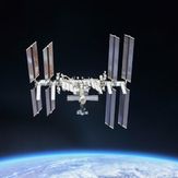
ISS International Space Station ZARYA
Enjoy the galaxy and look for those shooting-stars as all kids do!
Privacy Policy: Location data is stored within the application and is only used for satellite position calculations. You can turn off usage of your position in settings.
Functional Policy: Accuracy of positions calculations are not guaranteed.
-
realtime satellite tracking of over 5000+ orbiting satellite objects
-
amateur radio satellite tracking for communications
-
determine when the International Space Station (ISS) is in view
-
determine when you can talk with the astronauts or cosmonauts
-
DX, NOAA, Spy, GPS, geo tracking, space communications, NASA, astronomy
-
spacex and starlink satellite tracking
-
James Webb Space Telescope