

Seis2Kml
$1,599.99
Description
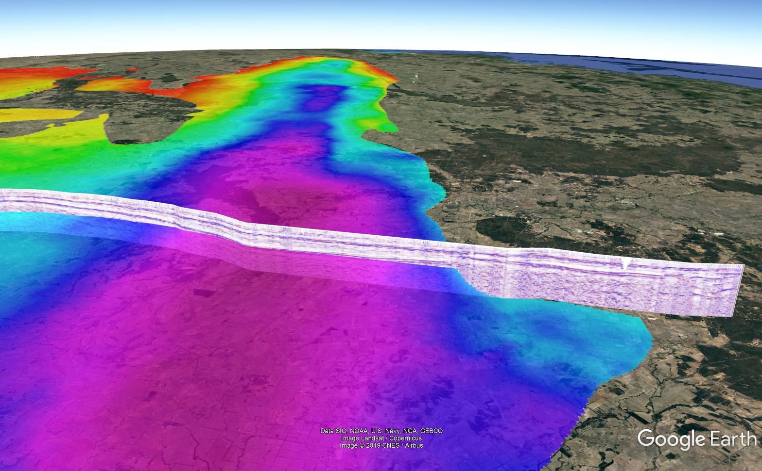
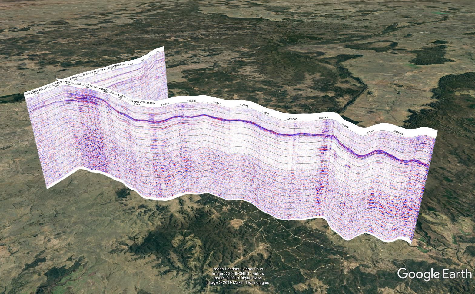
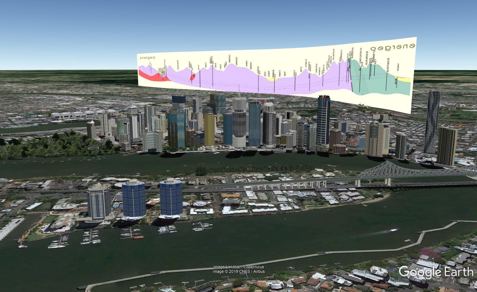
Seis2KML was written to allow users to quickly make and display seismic images in a 3D space, namely GoogleEarth.
Simply, this application hangs vertical seismic line images in 3D Google Earth space using navigation data.
Quick to Generate!
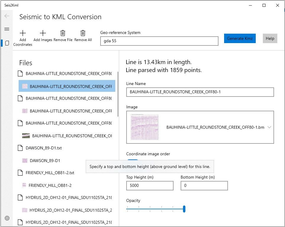
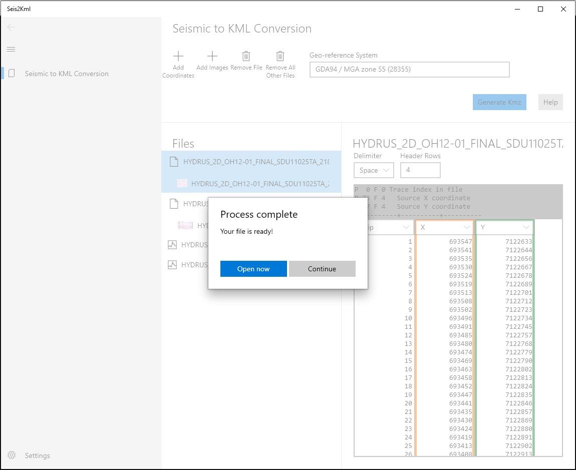
Using Seis2Kml is simple!
- Add your X,Y coordinate file, choose a Geo-reference System
- Add your image file
- Associate the files
- Generate
- Open your new georeferenced image in Google Earth!
-
Generates KMZ
-
Supports ASCII header format
-
Extensive list of Coordinate Reference System options
Product ID:
9NKN0KDFQDSG
Release date:
2019-06-03
Last update:
2022-03-16