

TheodoliteTraverse
Description
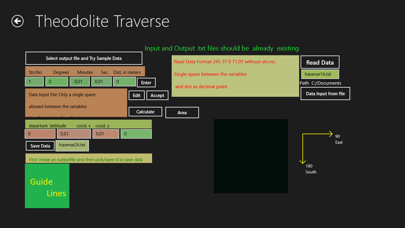
Theodolite traverse calculates coordinates from direction and distance of survey lines and then calculates the area of enclosed polygons.
A graphical plot is displayed as you enter the degress,minutes,seconds and the distance in meters.
This is just the first module of a fifty module programme to encompass land surveying,photogrammetry including matrix and maths.
Product ID:
9WZDNCRDF60R
Release date:
2013-05-24
Last update:
2019-02-03