
Description
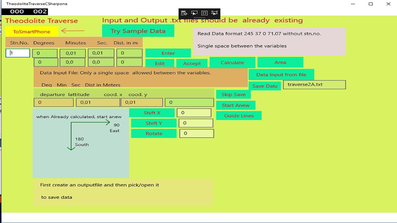
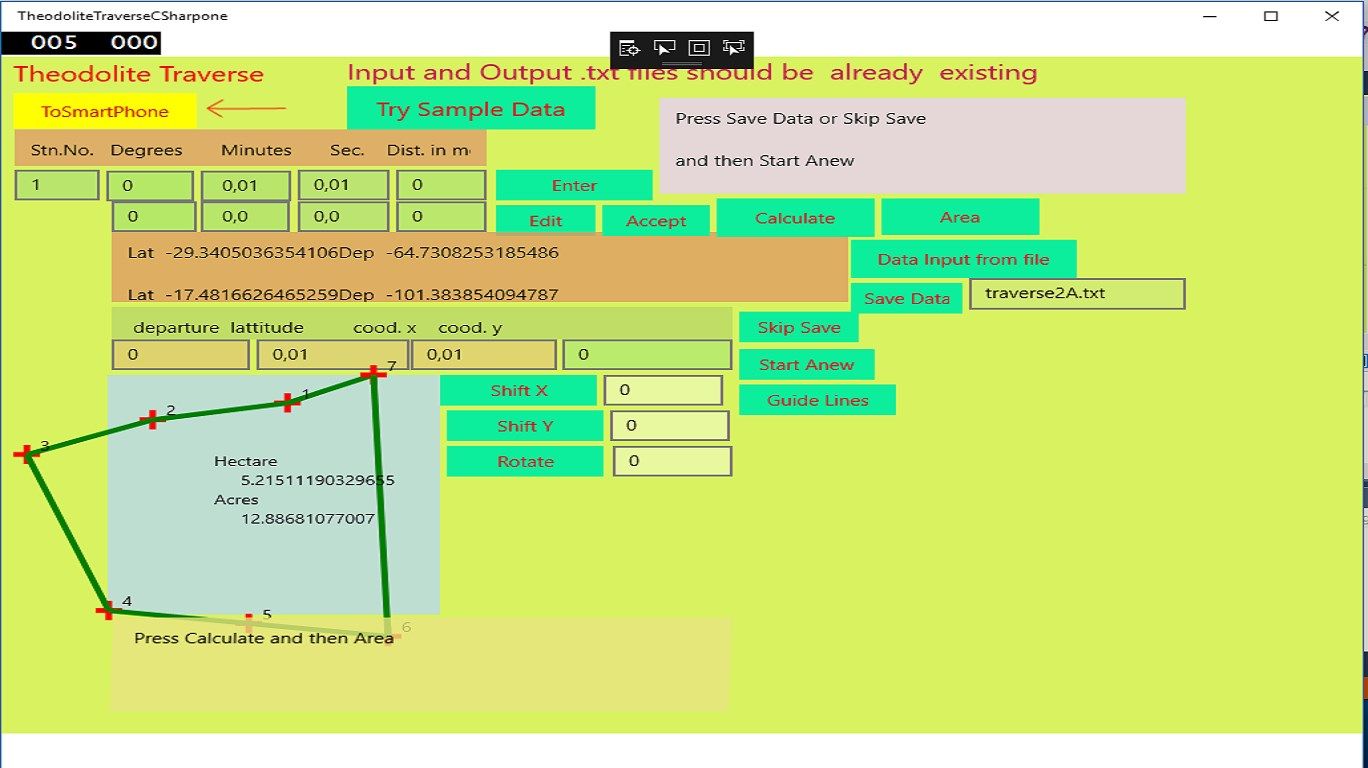
This App is meant for Land Surveyors, students and all those involved in measuring the perimeter of a land and calculating the area within the closed polygon encompassing the plot of land.
One need not necessarily have a theodolite to measure the angles of the survey lines from a reference line. Magnetic compass or any other method of measuring the angle of the traverse line would do.
The Cartesian coordinates are calculated for the survey stations and then the area from these coordinates.
The survey lines are plotted and displayed for each entry of the distance of each line and the corresponding horizontal azimuth angle.
It is possible to call data of any station in the list saved or downloaded and make corrections.
Reading in data from text files and saving is also possible.
It is also possible to enter the vertical angle of slopes to get the projected horizontal distances of the lines in the traverse.