
Description
This app gives you easy access to the population and housing data from the 2000 and 2010 United States Censuses.
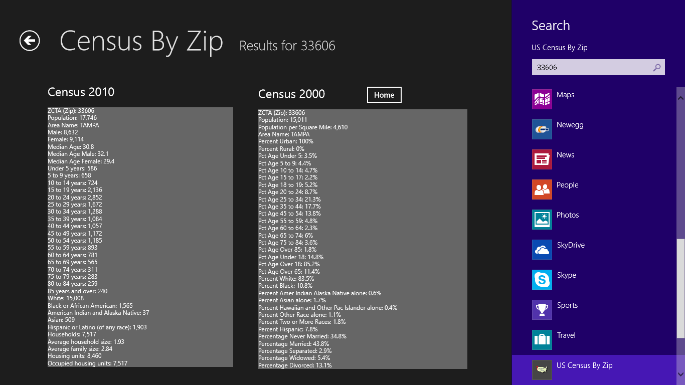
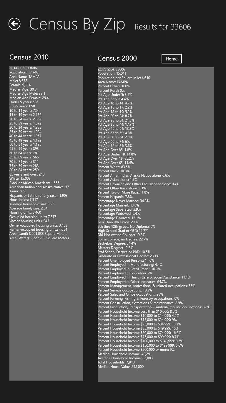
The 2000 census contains much more information than does the 2010 census, since it additionally provides data on the education level, employment and income level for each ZCTA. The census data also differs in that for the 2000 census, much of the data are presented as percentages, and for the 2010 it is presented as numbers.
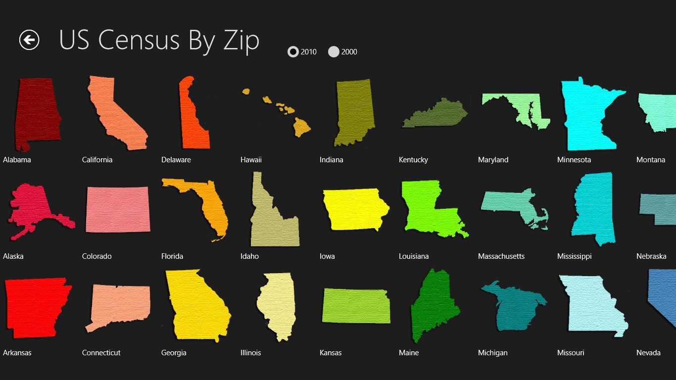
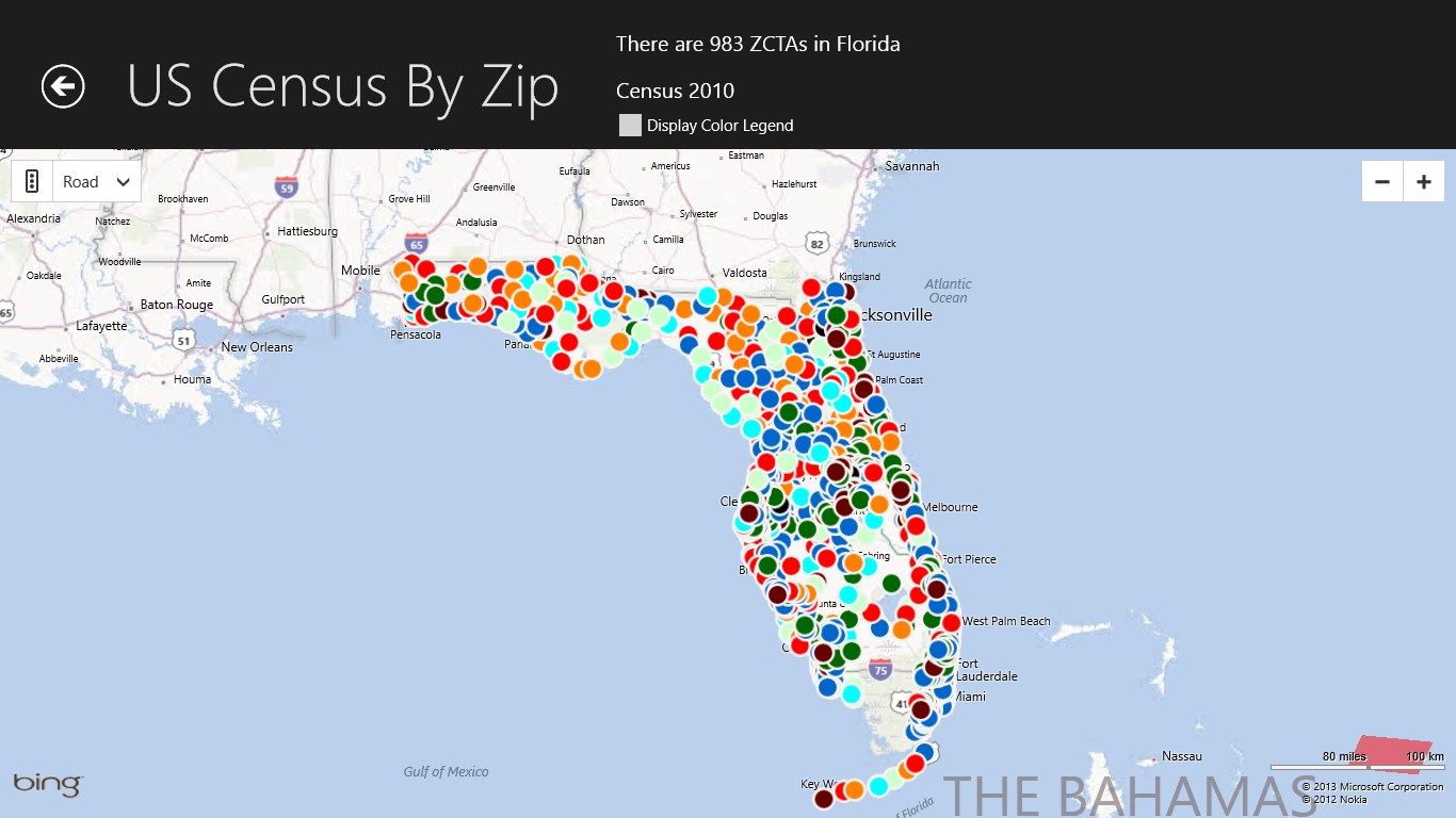
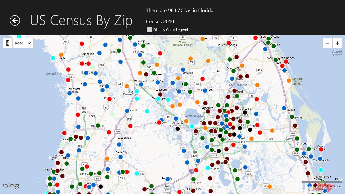
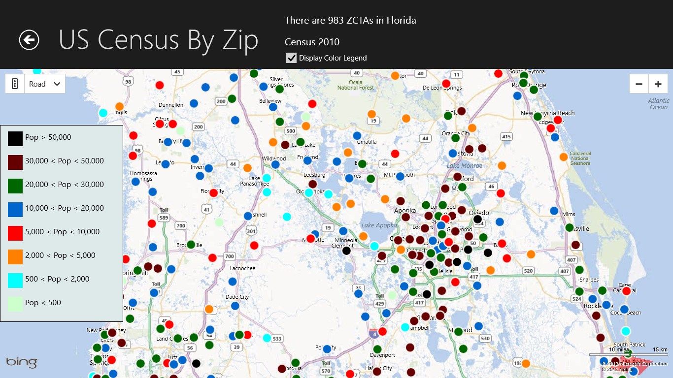
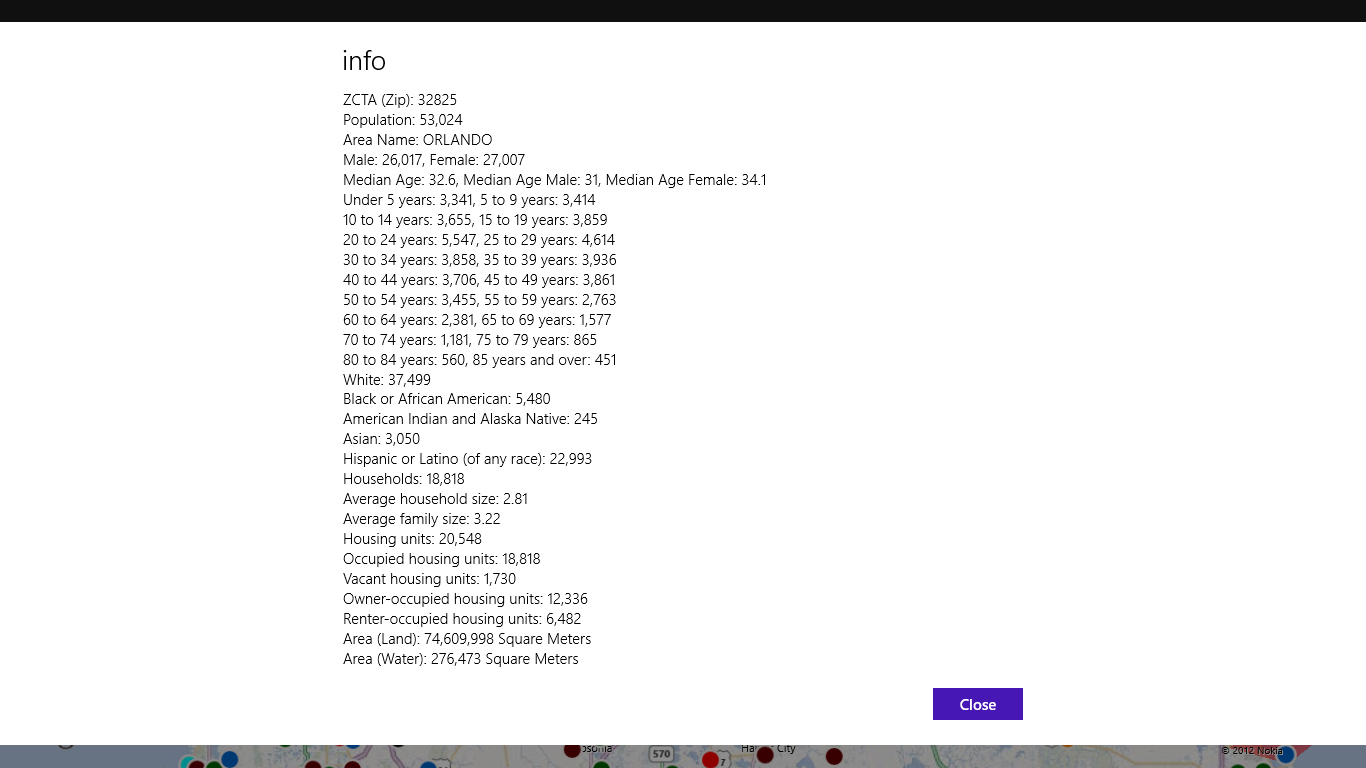
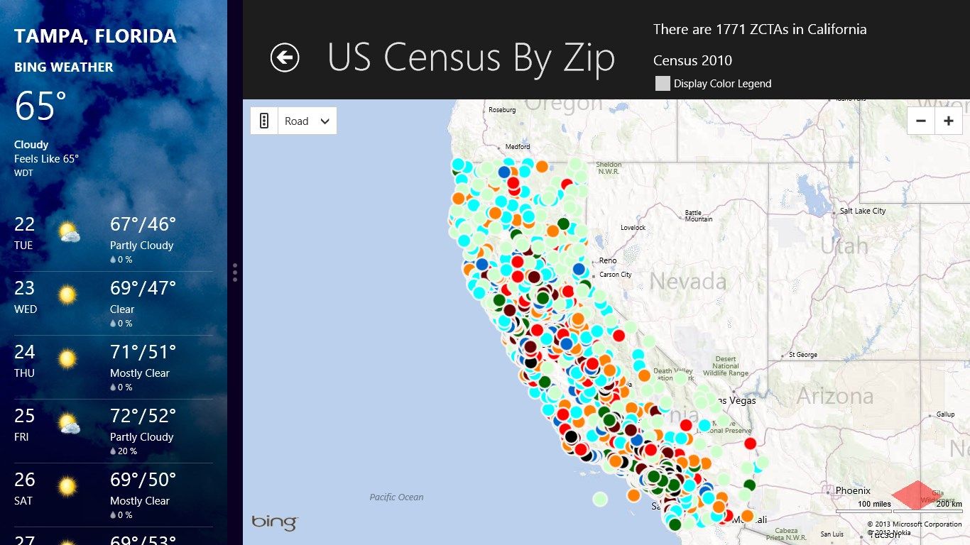
The Home Page consists of a scrollable collection of images of the 50 states. A tap on a state will bring up a Bing map centered on that state with a pushpin for each Zip Code Tabulation Area (ZCTA). The ZCTAs in most instances are the same as the standard 5 digit ZIP Codes that the Post Office Uses. A tap on a pushpin will display census information about that ZCTA. The pushpins are color-coded as to population ranges. To see a table of the different colors, simply check the Display Color Legend check box.
The search feature allows you to search both censuses for the data on a particular ZCTA. To use the Search, simply open the Search Charm and enter a valid five digit zip such as 33606.
The app obviously works best with a multi-touch screen.
-
Search 2000 and 2010 United States Censuses