
Description
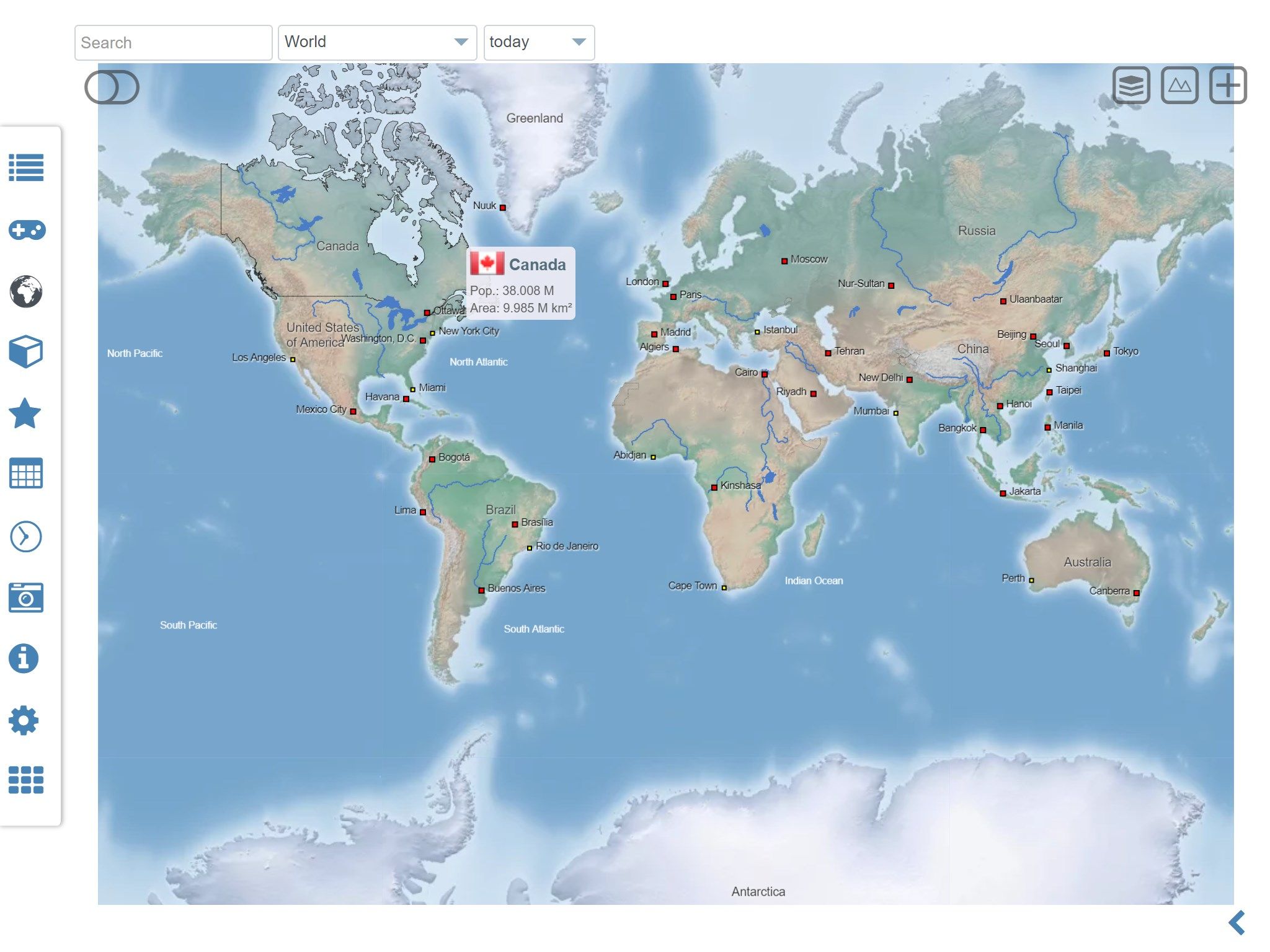
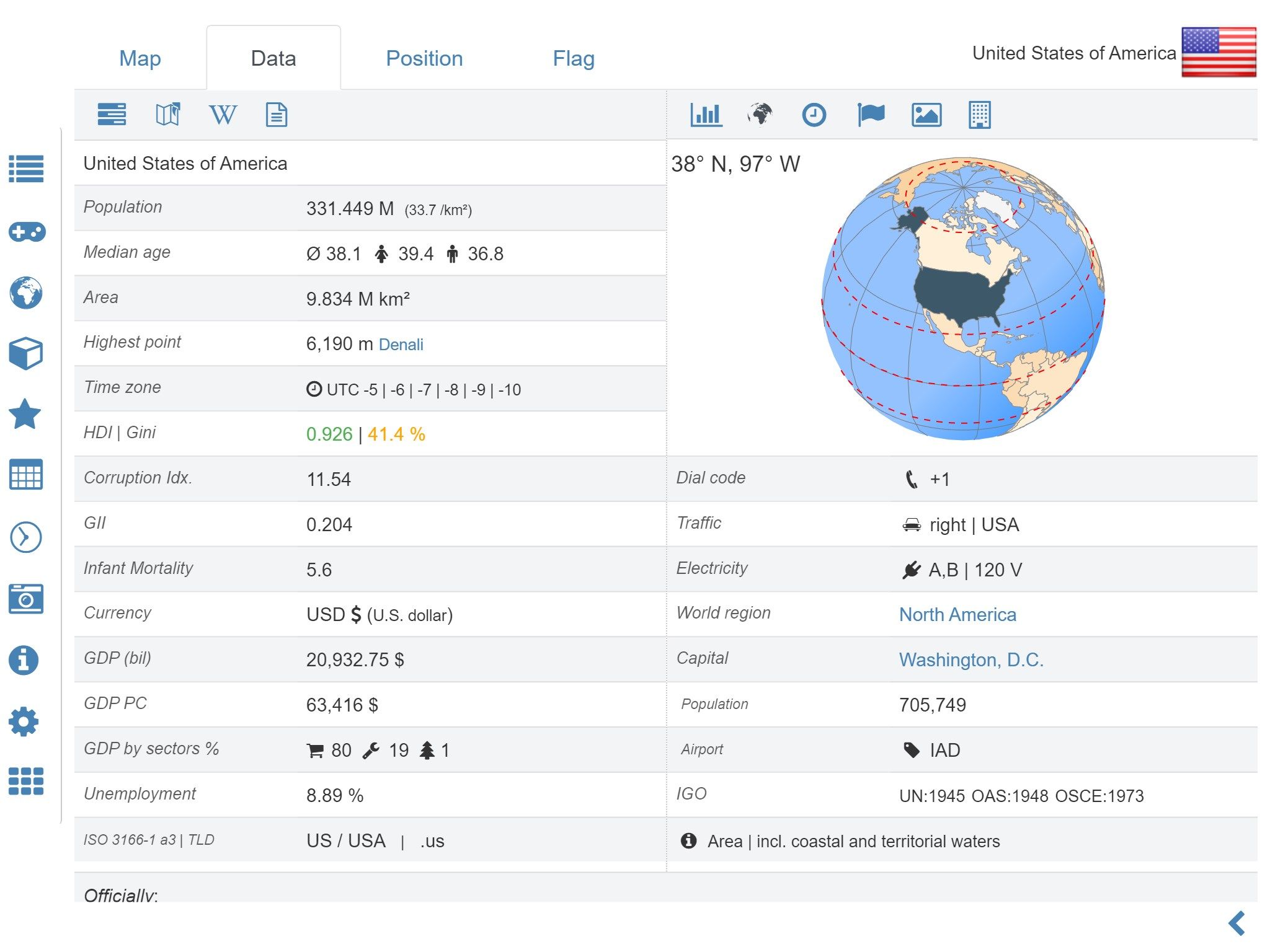
World atlas, world map and educational app for geography. Offers more than 260 countries and territories of the world with comprehensive economic and geopolitical data. Political maps with regional units (provinces), capitals and major cities included.
• Maps, flags and comprehensive data for more than 260 countries and territories of the world
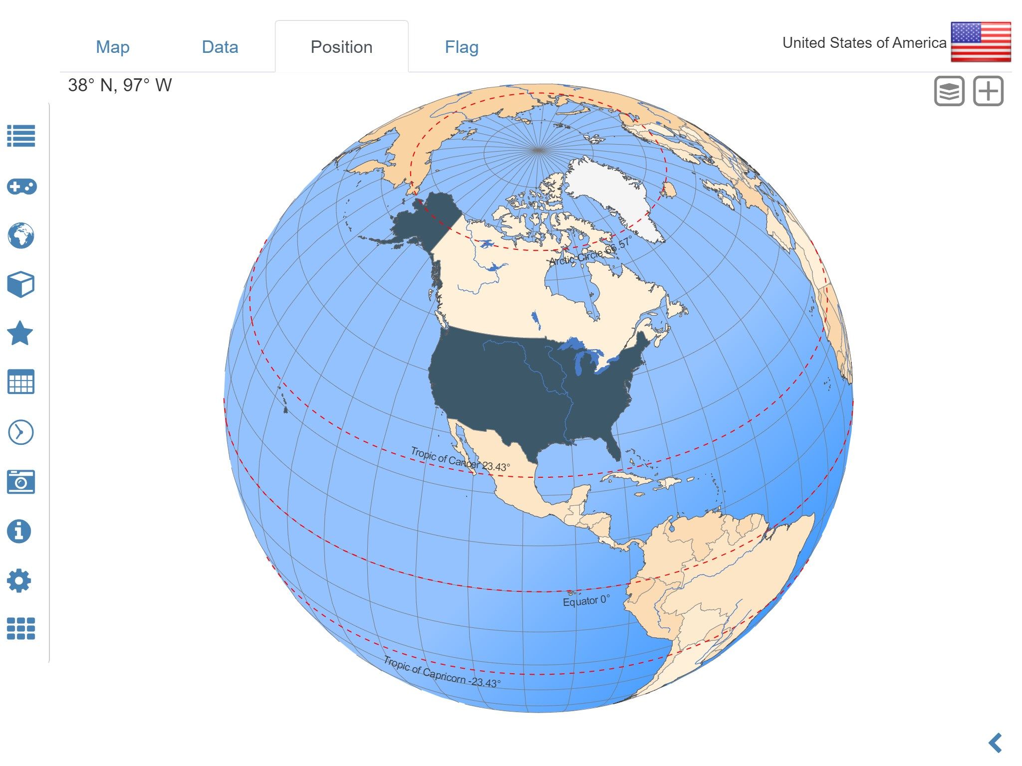
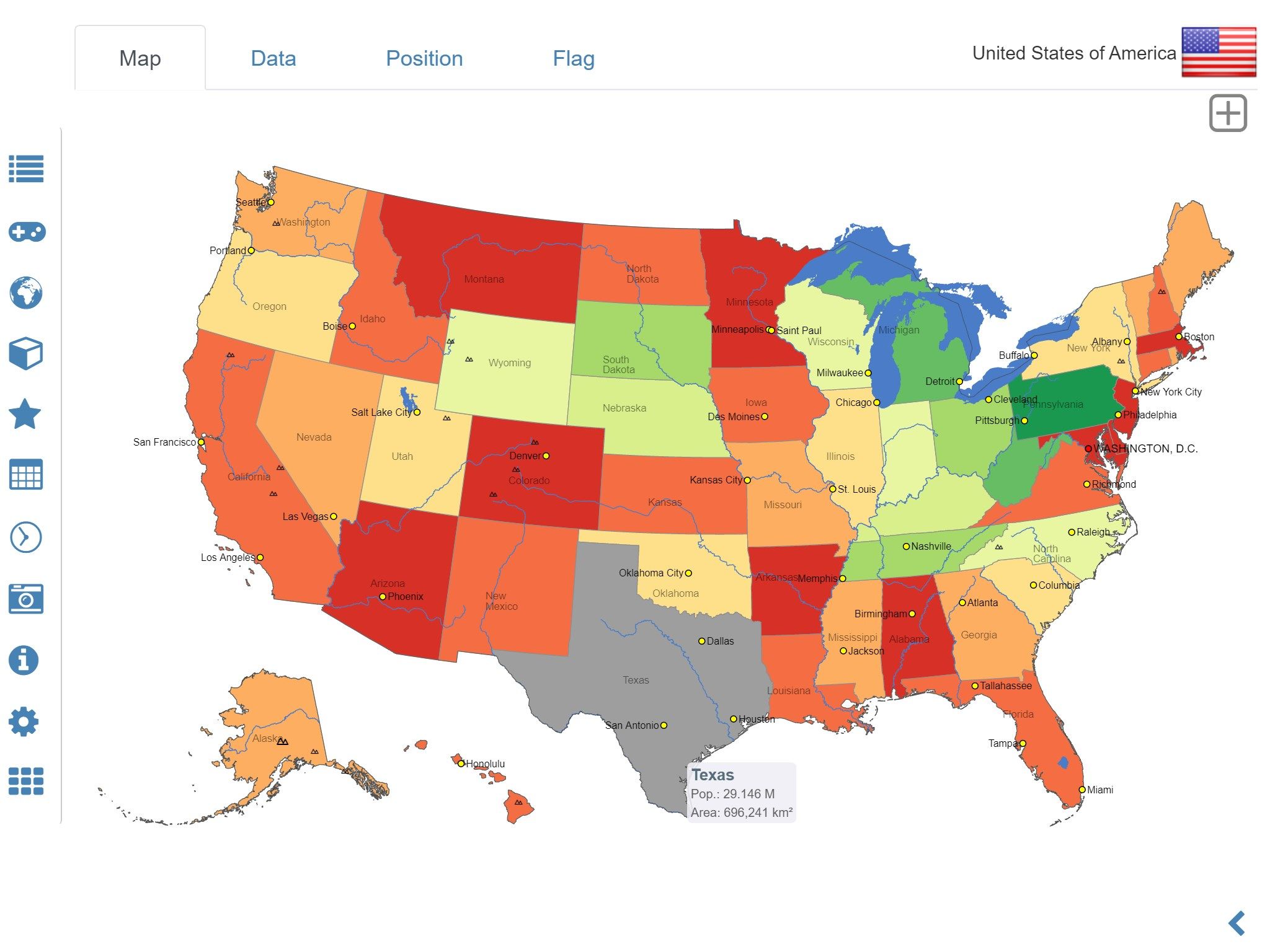
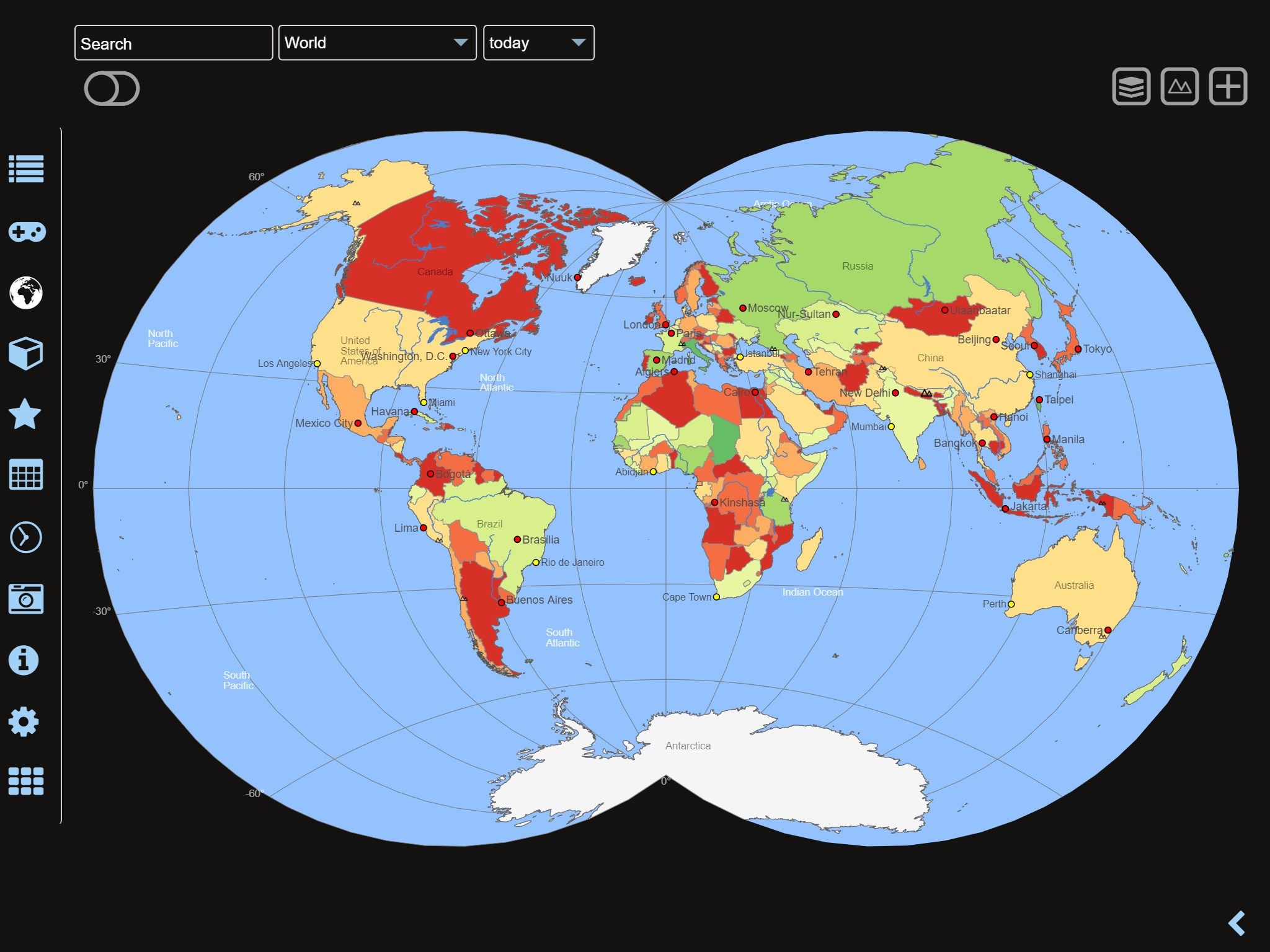
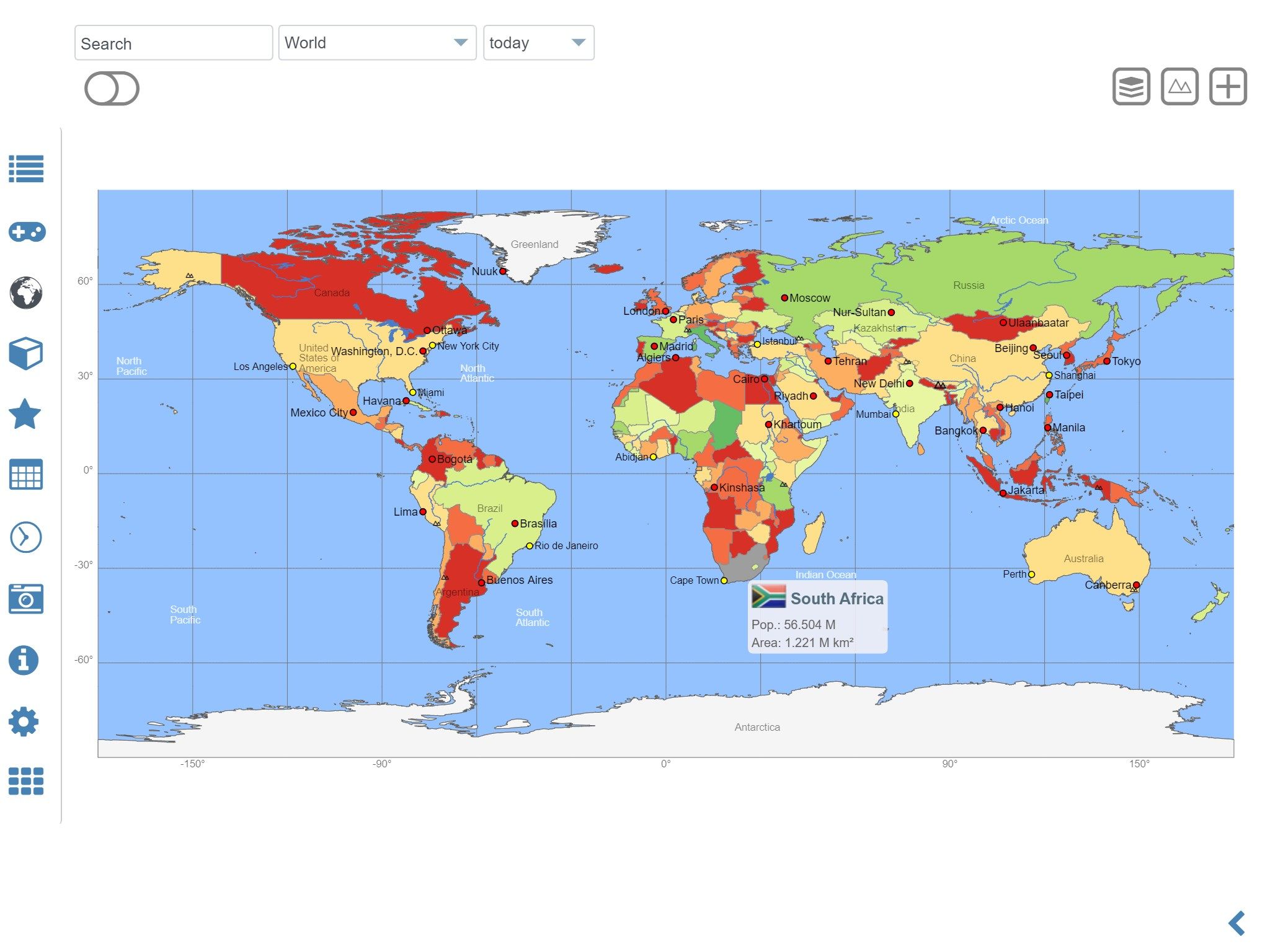
• Interactive political world, continent and country maps
• Print maps and country data overviews
• Search for countries, major cities, rivers, deserts, lakes, mountains or coordinates
• Shaded relief layer for world and continent maps
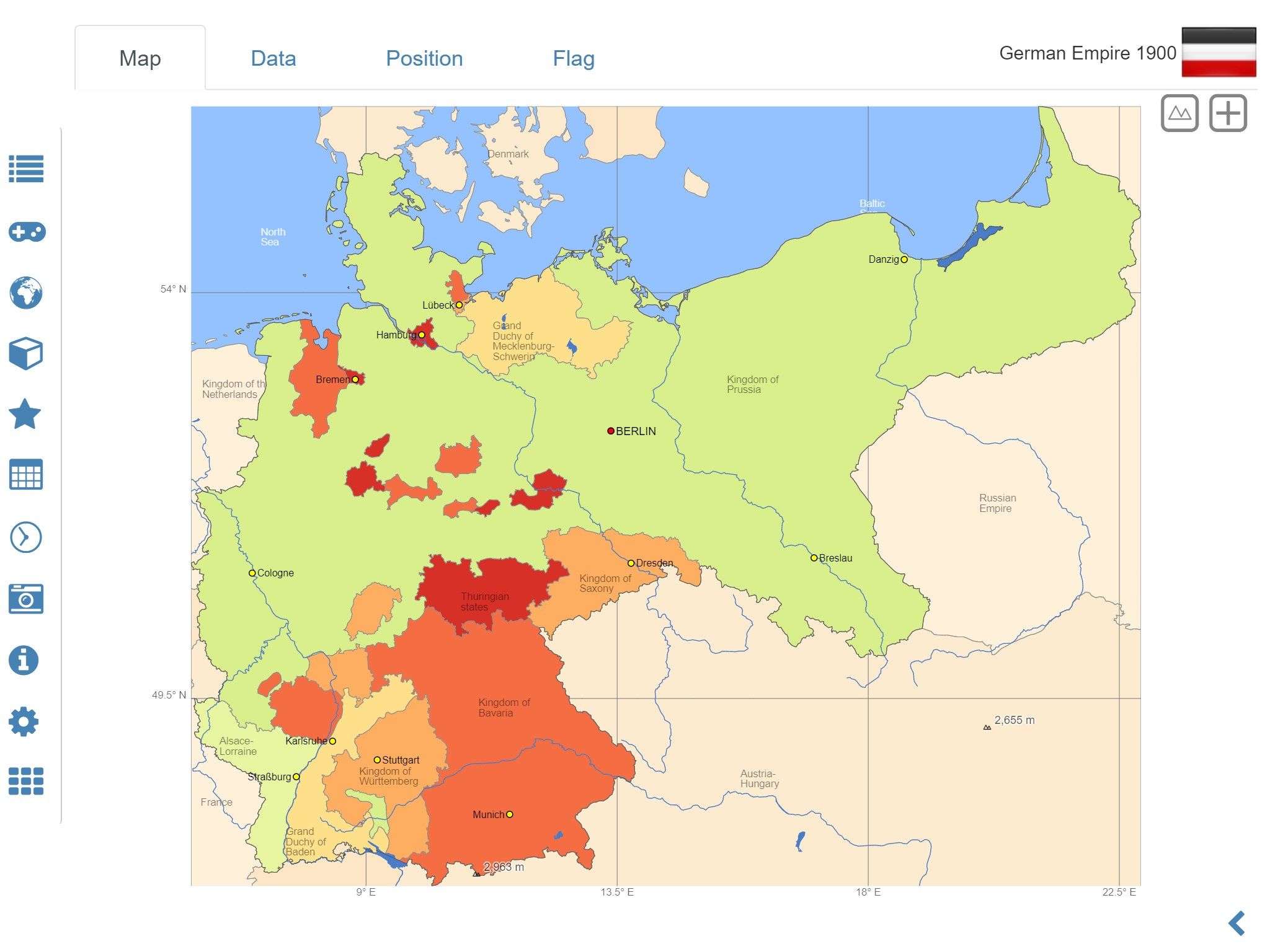
• Historical political world and continent maps of 1900, 1930 and 1960
• Geography quiz: capitals, flags, rivers, federal states, …
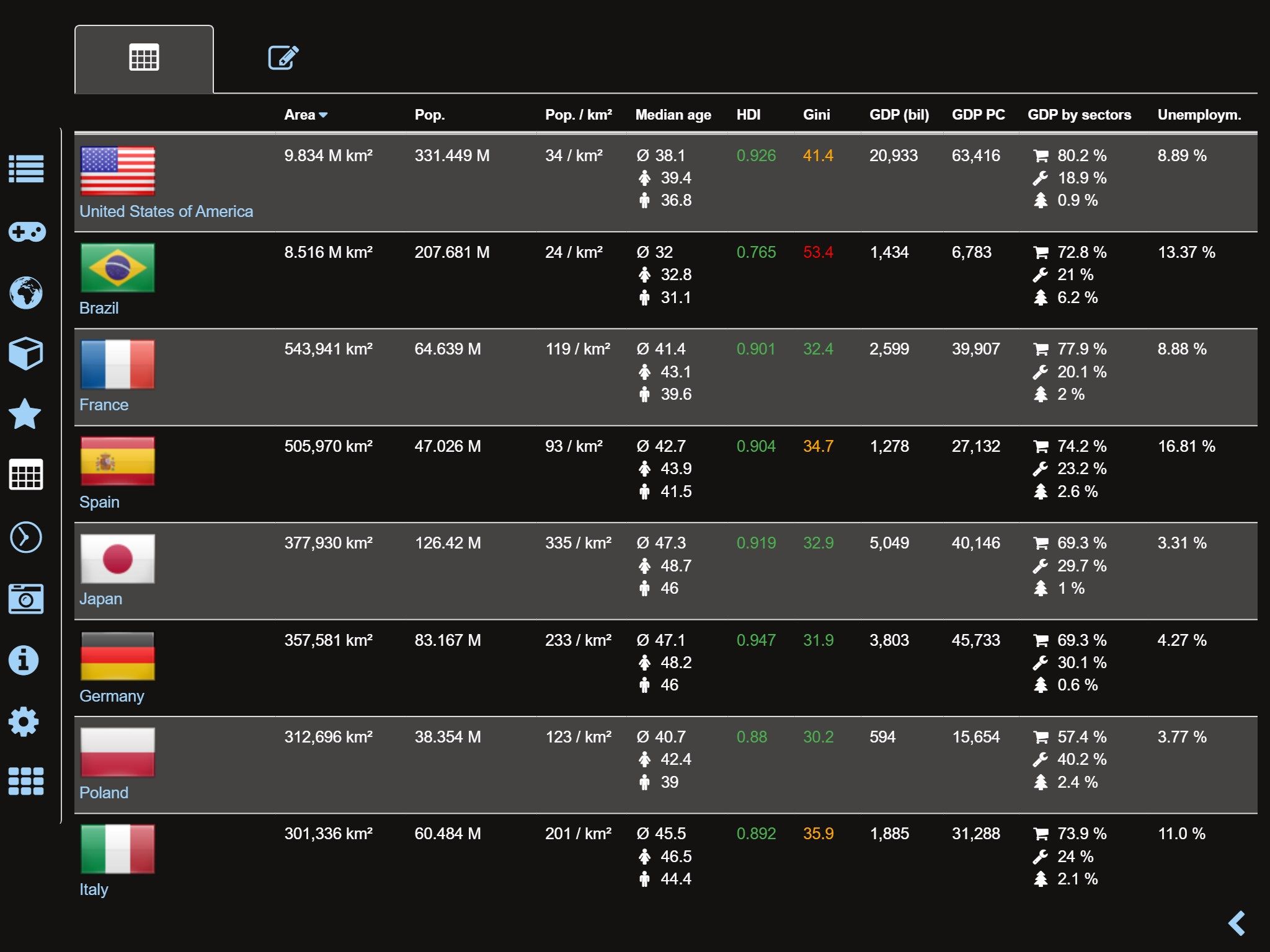
• Country comparison, favorites and distance calculator
• World clock and time zone map
• World-explorer: the smallest, largest, wealthiest, and most populated countries of the world
• World Explorer: largest cities, longest rivers and highest mountains
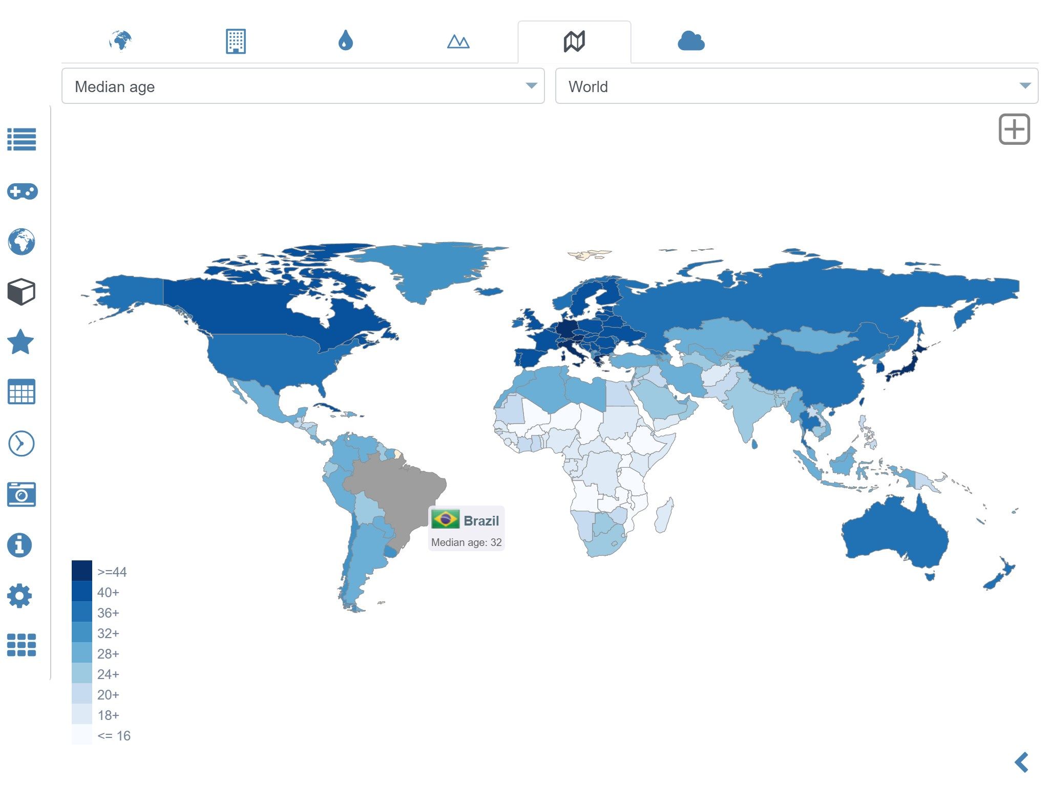
• Choropleth maps: GDP, area, HDI, population, …
Explore the world through political continent and country offline maps. Whether Europe, Africa, Asia, Oceania, South and North America: maps of all continents and countries are included. Learn where each country in the world is located. View its position highlighted on a digital globe. Create your favorite color theme or choose from different color schemes for map display.
Do you know the flag of Mauritius? Yes? Perfect. Do you also know in which country the Mount Everest is located? Increase your general geography knowledge in a playful manner. MxGeo Quiz: test your geographic literacy on various topics:
• Do you know the longest rivers on Earth?
• New quiz: federal states / provinces for selected countries
• Test your knowledge about the capitals in the world
• Do you know the mountains of the world?
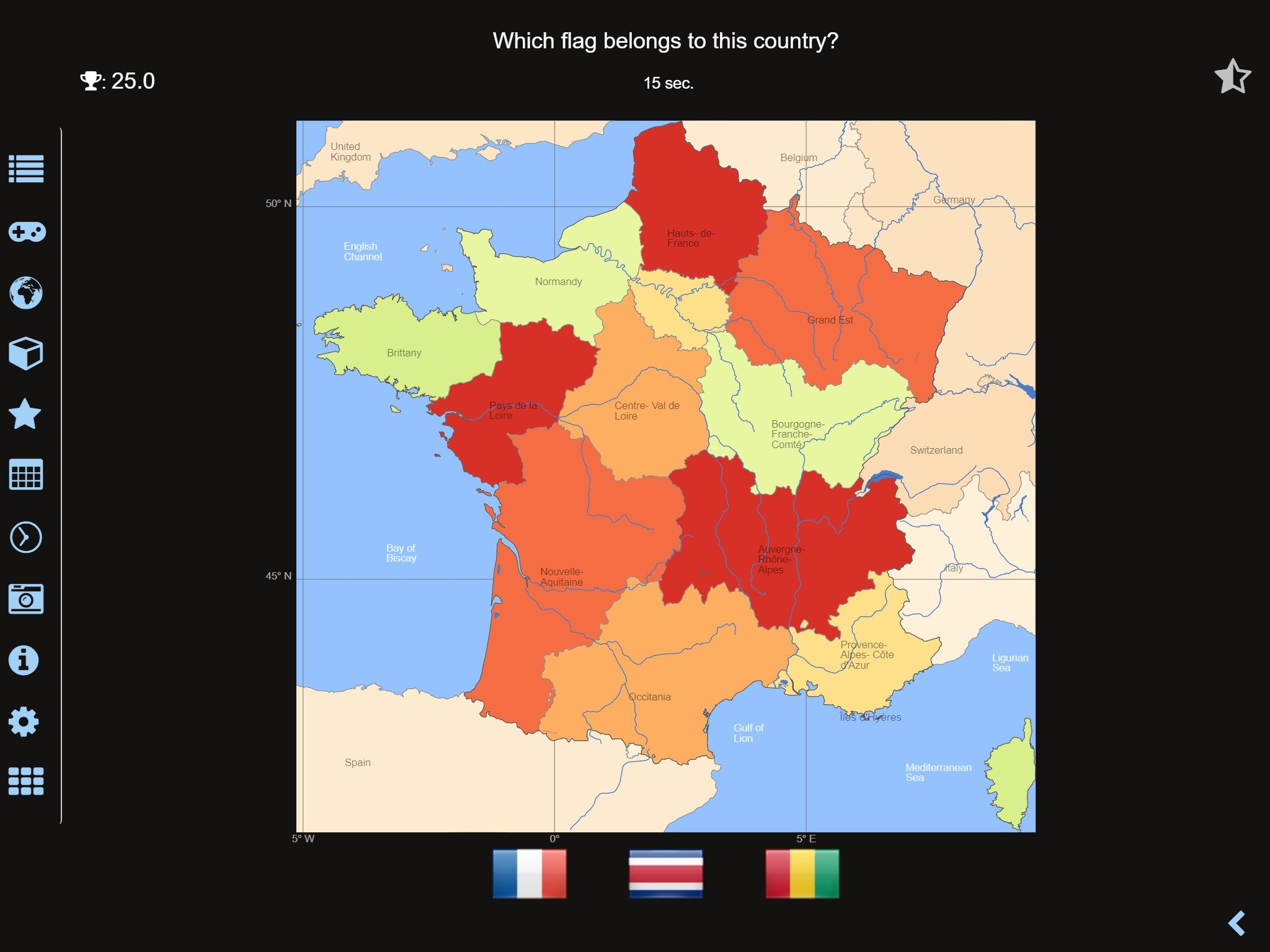
• Recognize the proper country flag based on the outline map
• Do you know the top-level domains of the world’s countries?
• Guess the highlighted country on the virtual globe
• Do you know the ISO countries codes of the world?
• Guess the right country by the flag
Each quiz offers seven regional variants: World, Europe, Africa, Asia, Oceania, South or North America.
Geo learning app and educational game which is fun for everyone whether children, adults, seniors or teachers. Get ready for your next stay abroad while enjoying this great world almanac including time zones and statistical data, such as population growth, unemployment rate, average age, gross domestic product (GDP) by sector and other key figures. Or prepare for your next geography lesson with this genius digital world map. If not traveling our world atlas lets you explore the world just only virtually.
Enjoy the comprehensive atlas of the World including Europe, Asia, North America, Africa, Oceania and South America with all countries and regional units, capitals and flags.
-
Maps, flags and comprehensive data for more than 260 countries and territories of the world
-
Interactive political world, continent and country maps
-
Geography quiz: capitals, flags, rivers, federal states, ...
-
Country comparison, favorites and distance calculator
-
World-explorer: the smallest, largest, wealthiest, and most populated countries of the world
-
Historical political world and continent maps of 1900, 1930 and 1960
-
Choropleth maps: GDP, area, temperature, HDI, population, ...
-
World Explorer: largest cities, longest rivers and highest mountains
-
Print maps and country data overviews
-
Search for countries, major cities, rivers, deserts, lakes, mountains, islands or coordinates