
Earthquake Explorer
Rating
3
Reviews
10
App details
About Earthquake Explorer
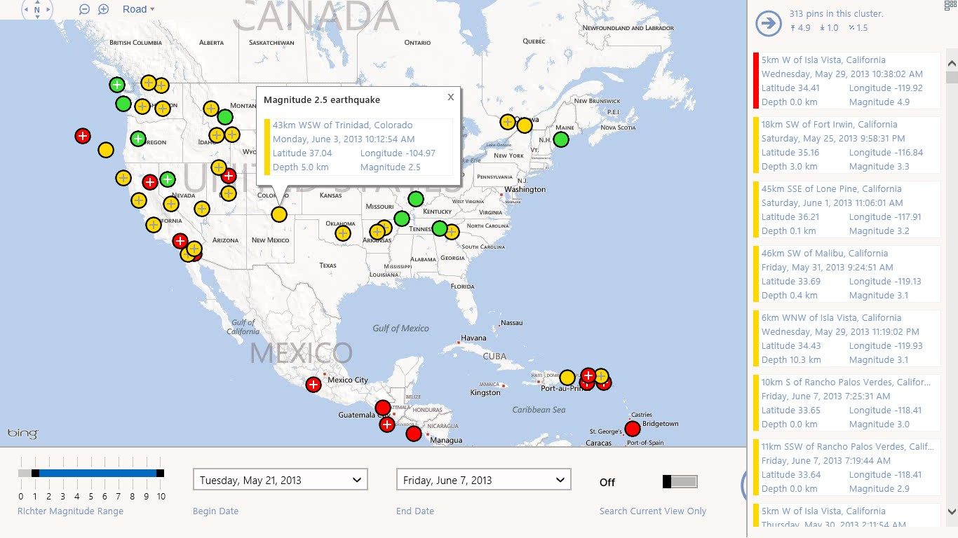
Earthquake Explorer is an easy to use application for exploring earthquake data from the US Geological Survey. Explore the earthquakes across the globe, search by magnitude and filter by date.
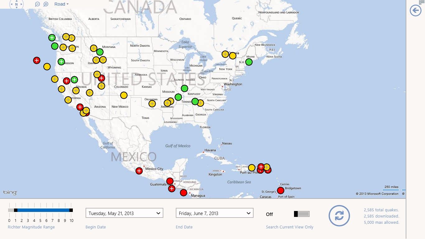
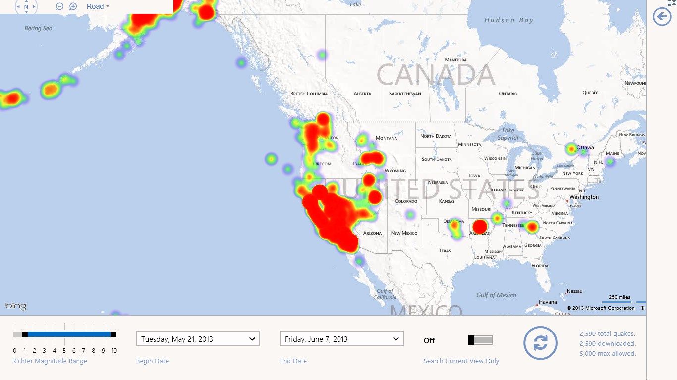
Most similar applications are limited to the data in the existing feeds from the USGS – Earthquake Explorer stores data in the cloud-based back-end, allowing it to be searched/filtered. Pin clustering means that potentially thousands of earthquakes can be displayed on the map, and are expanded as you zoom in.
And, finally, you can configure the live tile to update when new earthquakes occur, typically within minutes.
Key features
-
Search earthquake data by magnitude or over a range.
-
Supports pin clustering and heat maps!
-
Configurable live tile notifies you of new earthquakes as they happen.