
Easy Map 3D
App details
About Easy Map 3D
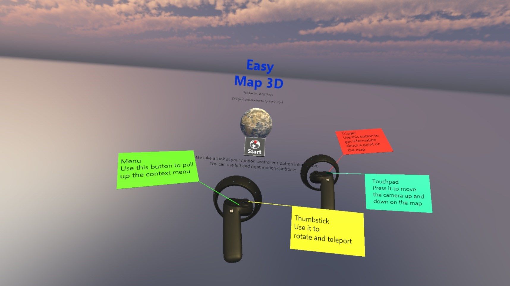
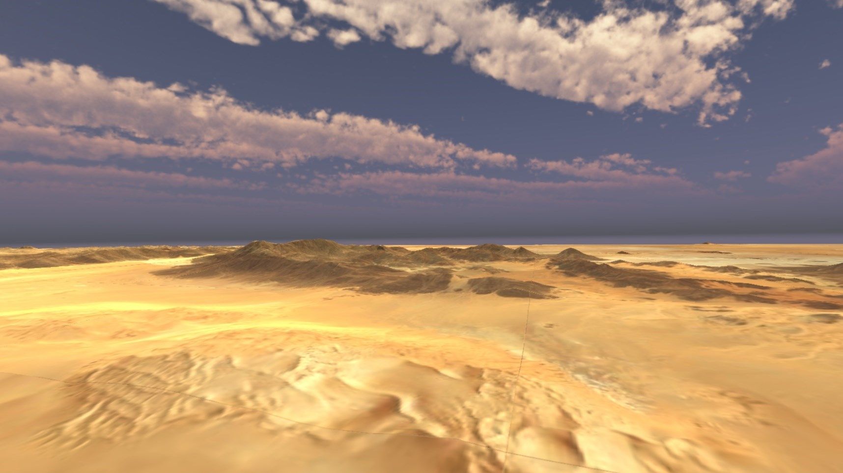
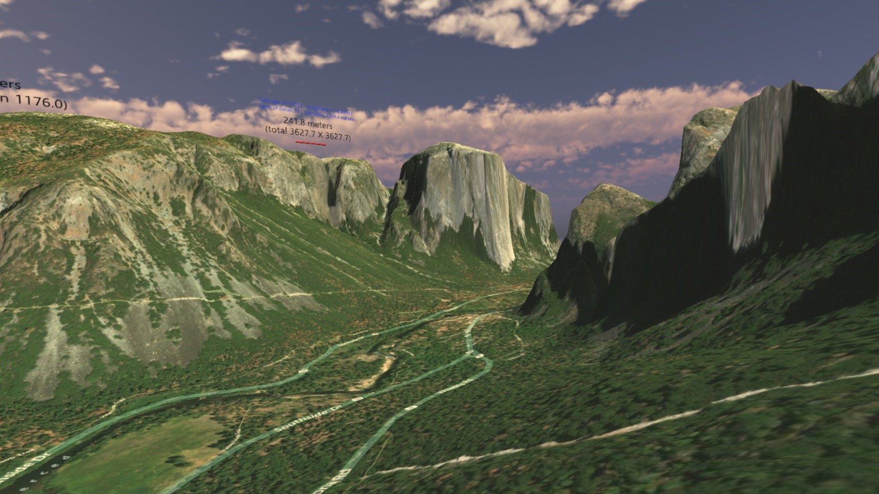
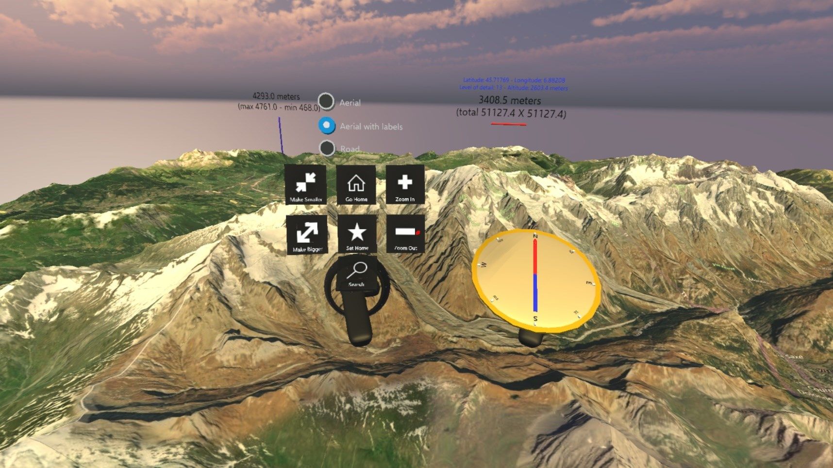
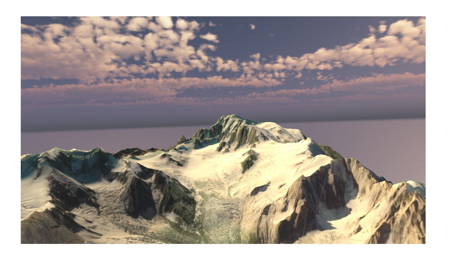
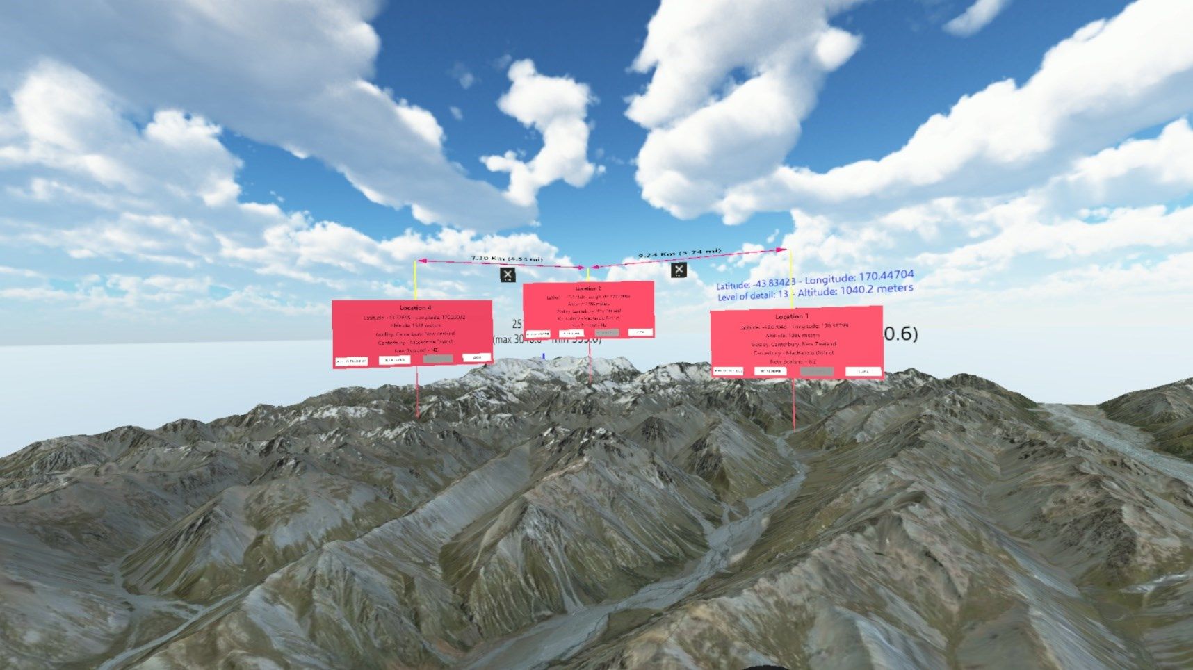
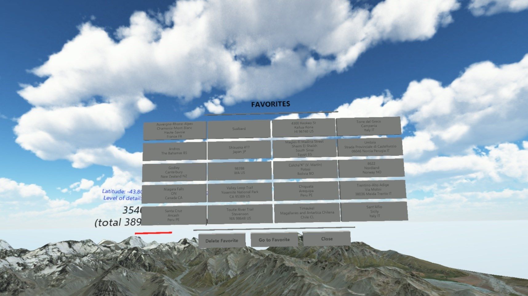
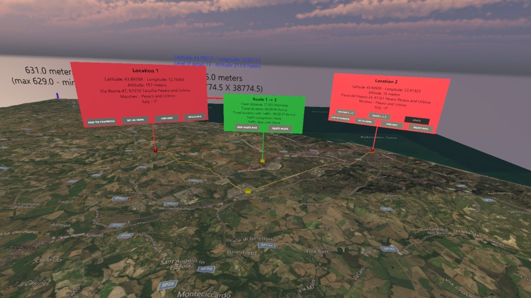
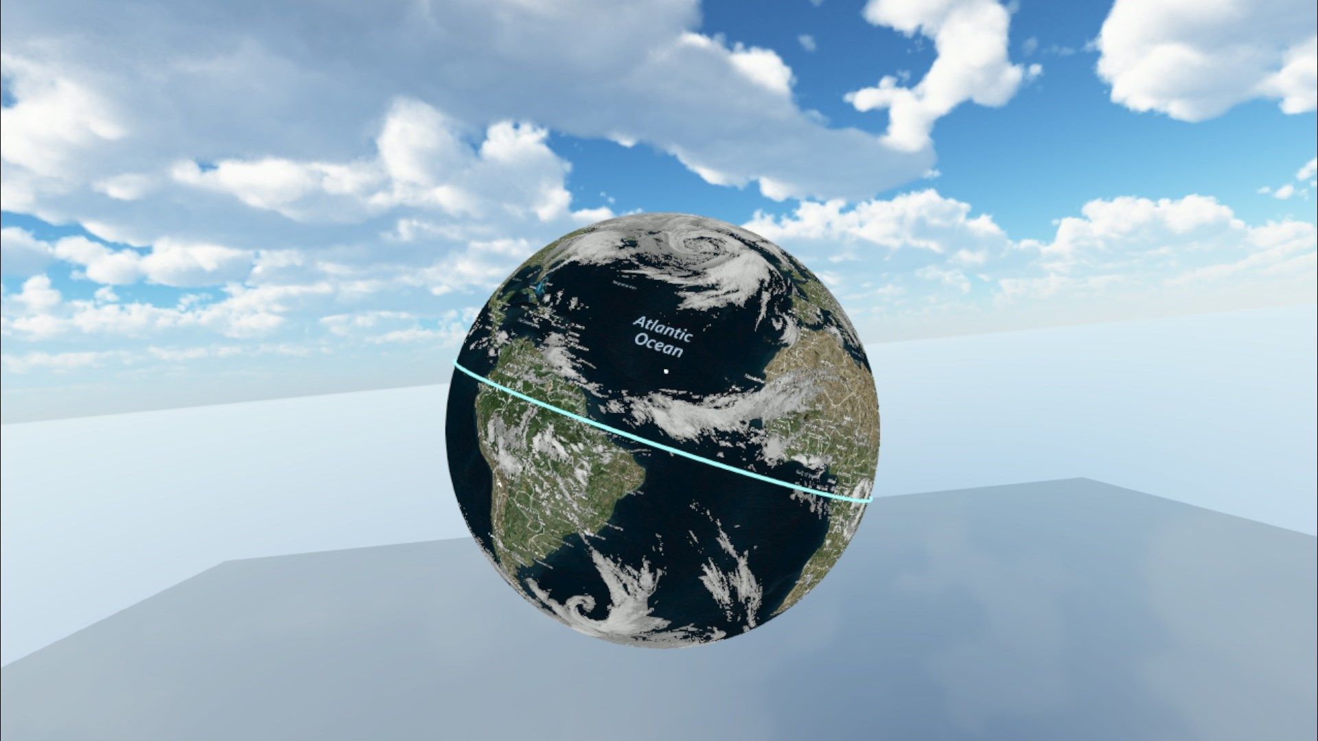
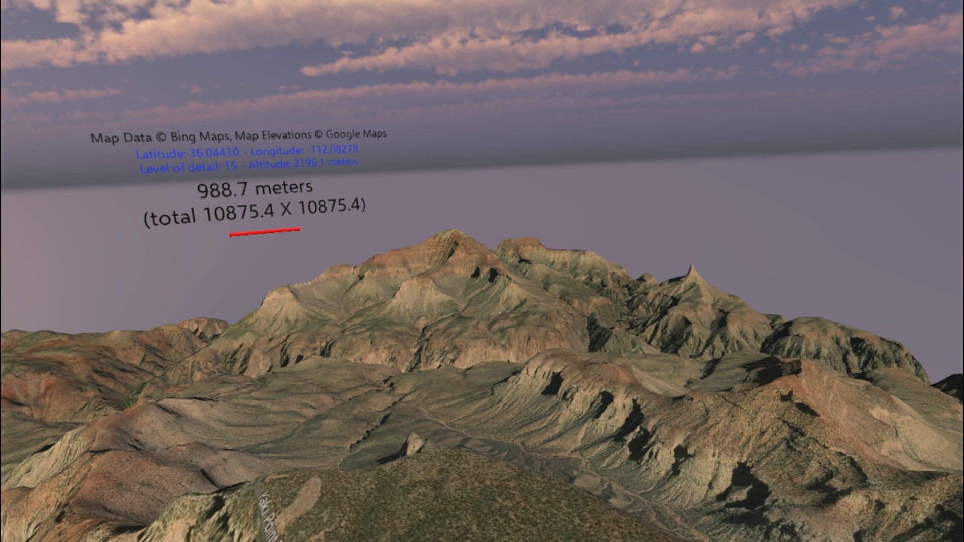
With Easy Map 3D installed on your PC, you can view street and satellite 3D maps of the whole world (Bing Maps, OpenStreetMap and Mapbox). You can move around, widen, narrow, zoom in and out on the map using the controllers. The application automatically enlarges the map when you approach an edge. You can do custom searches based on the name of a location or selecting a point on the map of the world (“Globe”). Favorites manager and distance measurement between points on the map. Route calculation ( get a walking, driving or transit route by specifying a series of waypoints). GPX file visualization. OpenSnowMap and WaymarkedTrails data visualization on every available map. RealEarth data (https://realearth.ssec.wisc.edu/) visualization on the globe. Export the model of the map and view it with 3D Viewer (https://www.remix3d.com/user/3ddp-XCHx35?section=models).
The app supports Augmented Reality (https://sites.google.com/site/easymap3d/easy-map-3d-ar)
Key features
-
Maps
-
Navigation
-
3D Maps
-
Mixed Reality
-
Globe
-
Map of the world
-
Education
-
GPX visualization
-
Routes calculation
-
Bing Maps
-
OpenStreetMap
-
Export map model
-
Export globe model
-
Mapbox
-
RealEarth
-
OpenSnowMap
-
WaymarkedTrails
-
Augmented Reality