
Expedition Map Tool
Rating
1
Reviews
1
App details
About Expedition Map Tool
EMT is a tool designed to support serious travelers who needs advanced information and tools during the trip.
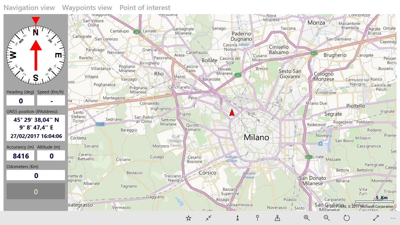
EMT use Microsoft vector maps so it can be downloaded and used offline.
The tool allow to load waypoints and “points of interest” from KML files. KML can be produced using many tools including Google Earth. A EMT Planner will be available soon.
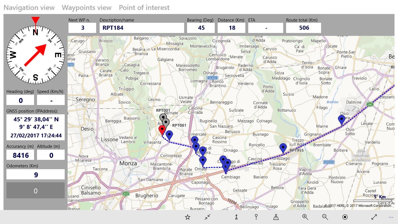
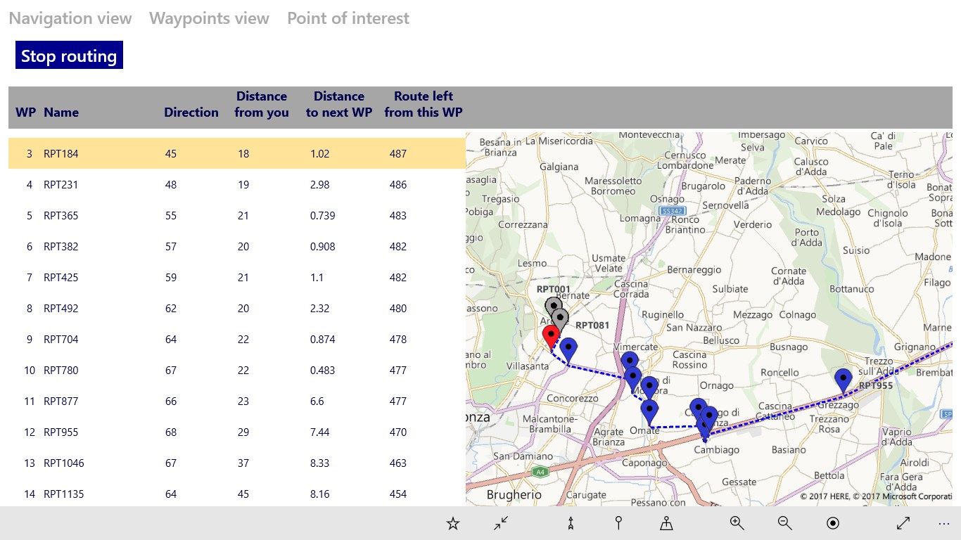
A list of waypoints is automatically considered a Route. You can ask EMT to guide you along the root waypoint after waypoint.
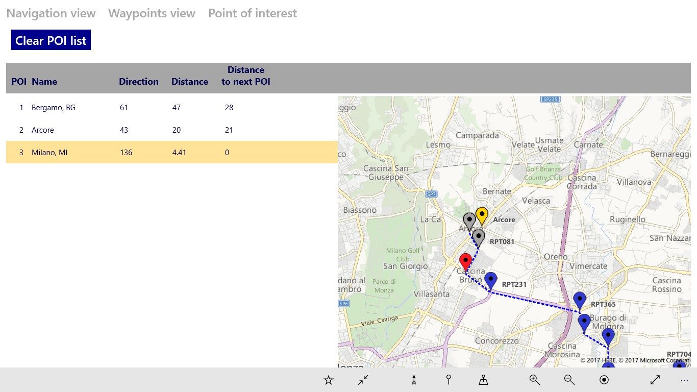
Points of interest are visible on the map to provide additional information to the traveler.
Key features
-
Add your own waypoint datafiles: EMT can open your KML and show waypoint on vector maps
-
Offline maps: EMT uses Microsoft Bing vector maps while you are offline. Simply download the maps you need.
-
Geolocation: your position is automatically displayed on the map.
-
Directions: EMT guide you along your waypoint list. If included in the loaded KML file, EMT show the street path between the waypoints.
-
Points of Interest: EMT display your points of interest (POI) on the map
-
Advanced data visualizzazion: EMT shows all tecnical data you need along your trip to decide how to drive along the route.