
FlightLib
Rating
5
Reviews
1
App details
About FlightLib
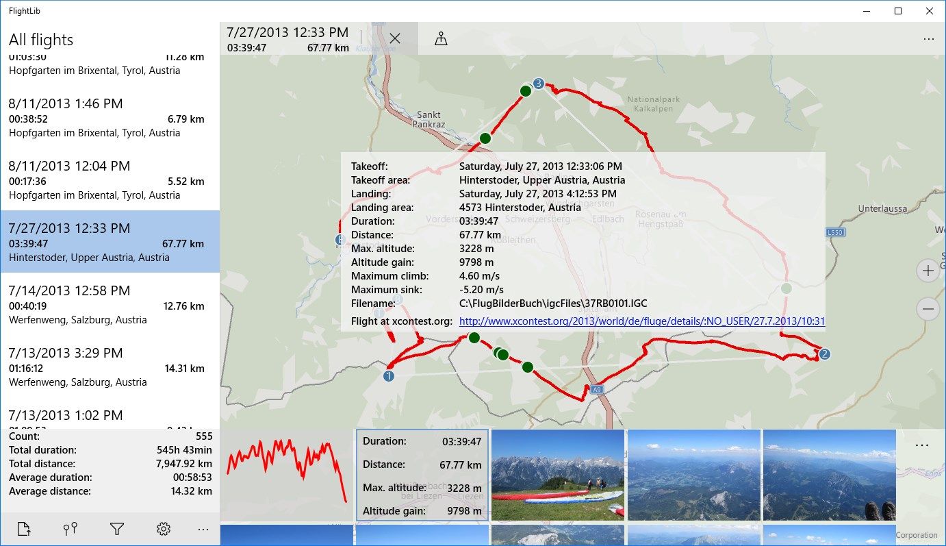
FlightLib is an App for pilots (paragliding, hang glider, sailplane) who record their flights in igc or gpx file format and would like to view the flights on screen.
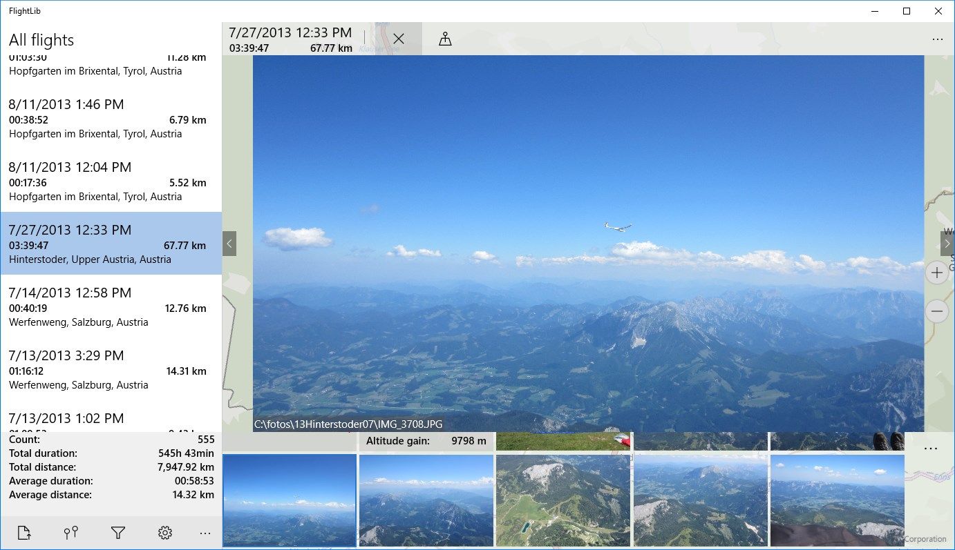
Select the directory where your igc/gpx files are stored, the igc/gpx files will be loaded automatically. Photos which are in windows photo library with the same date as the flight will be displayed with the flight.
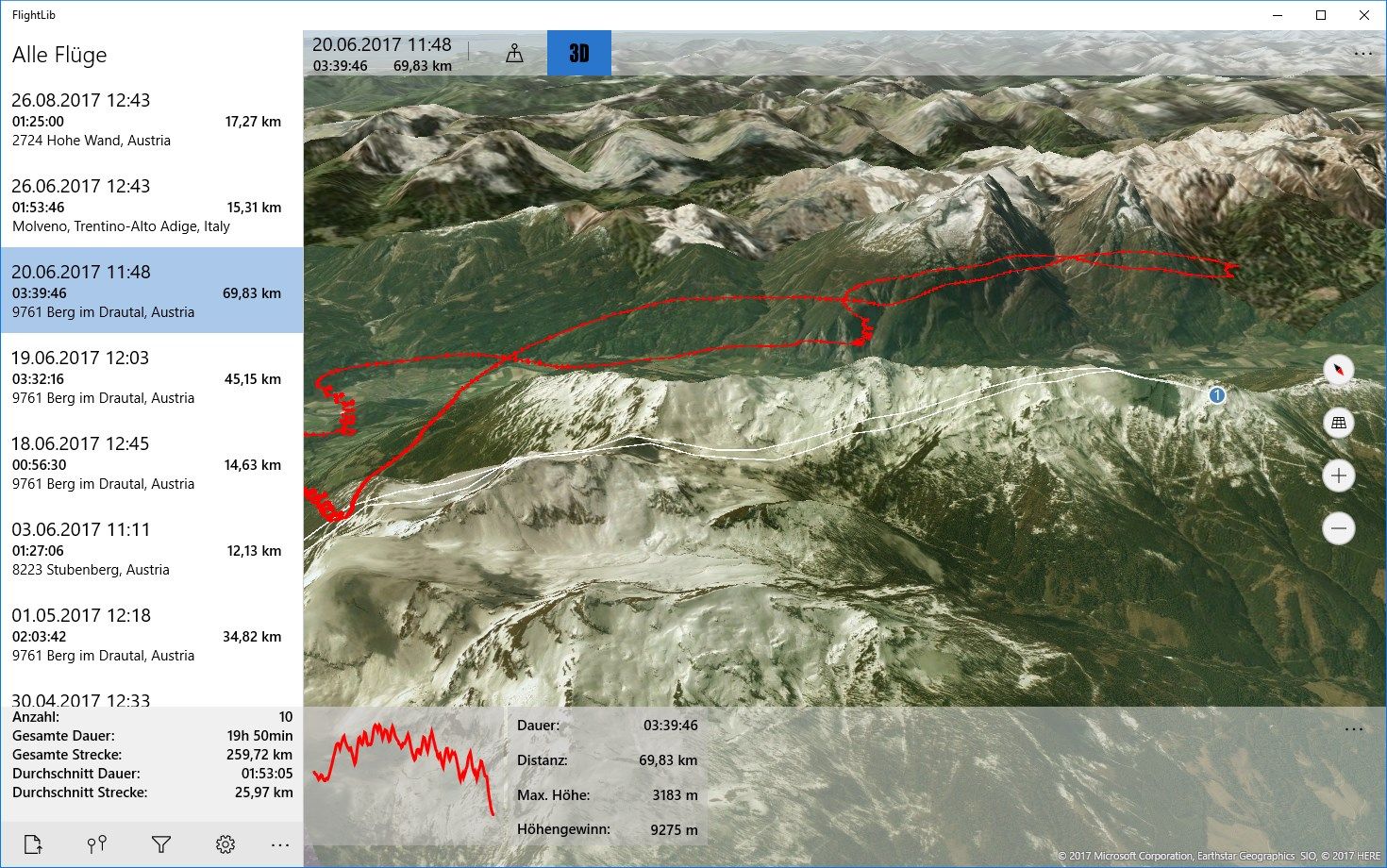
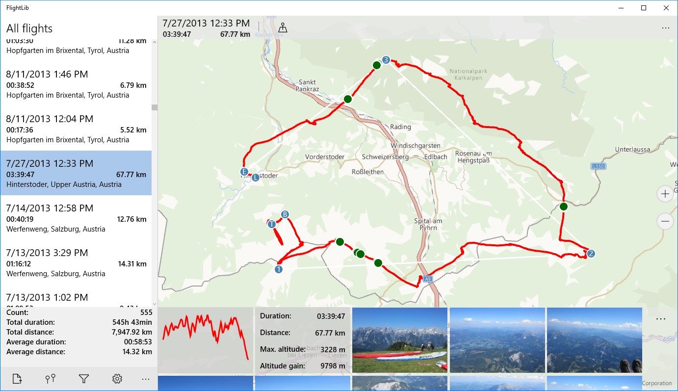
View flights in Bing Maps (also in 3D) or Google Maps.
For paragliding, hanggliding, and all pilots with an IGC or GPX flightrecorder.
Key features
-
List of all flights (.igc or .gpx files) from selected directory
-
Shows the flight-track in a map, also in 3D
-
Displays all photos with the same date as the flight, shows the position in the map
-
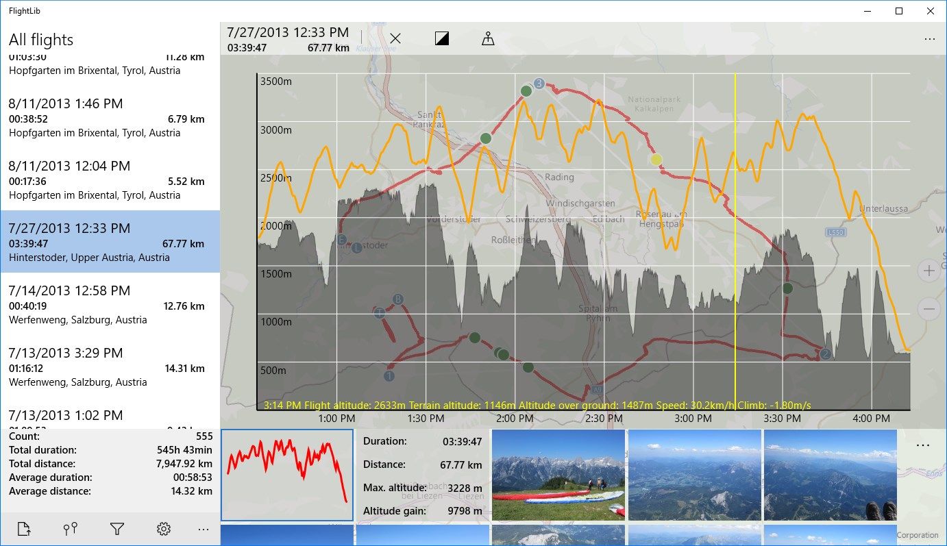
Height profile of flight
-
Statistic values of flight
-
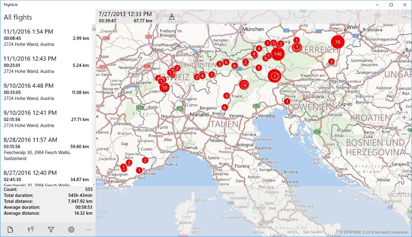
Statistic over all flights
-
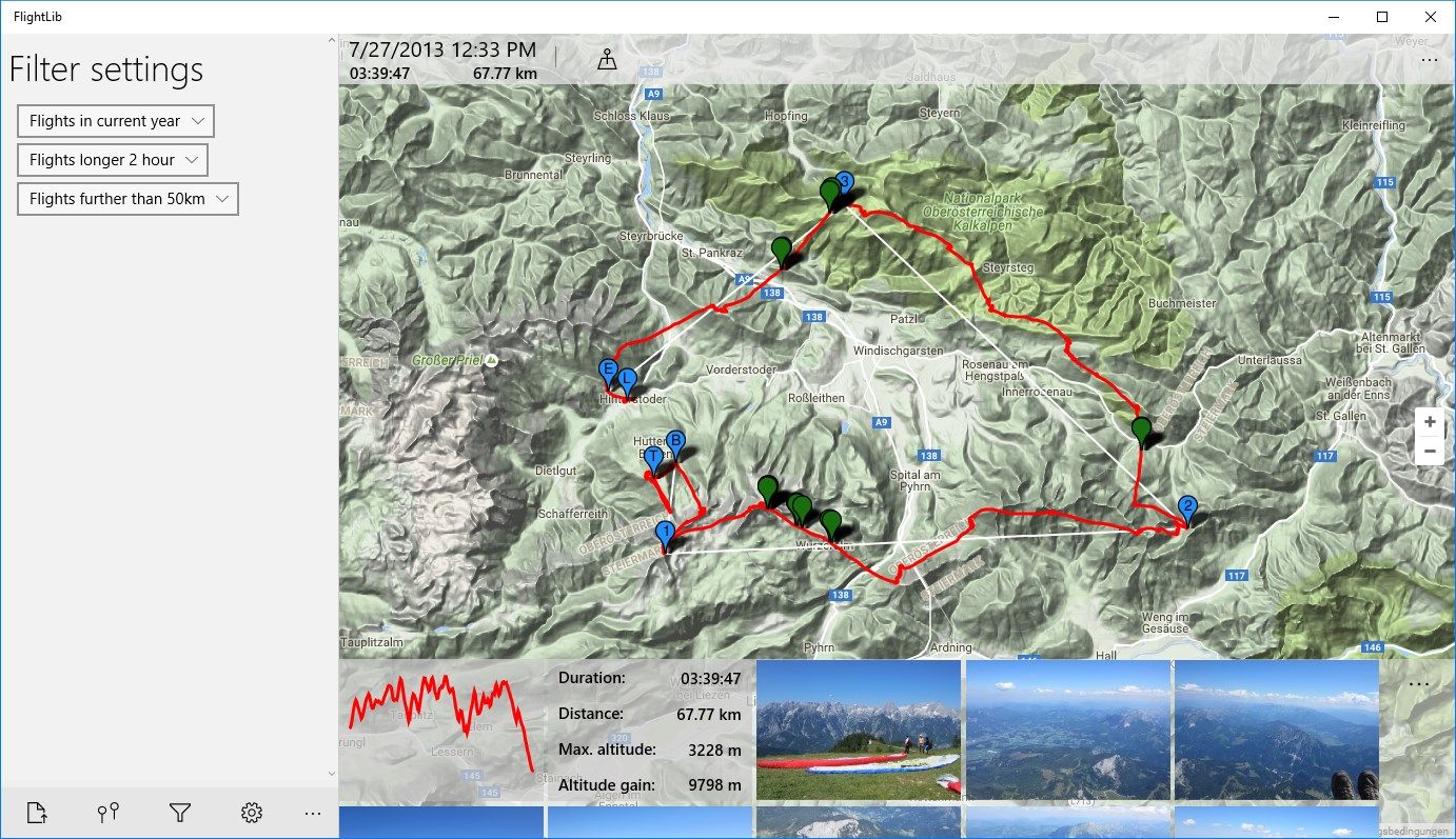
Flights filterable by date, distance and duration
-
Shows all take-off areas on one map
-
Show flights in BingMaps or GoogleMaps