GlobeViewer
App details
About GlobeViewer
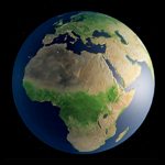
GlobeViewer is a high resolution 3D terrestrial globe with topography and surface maps.
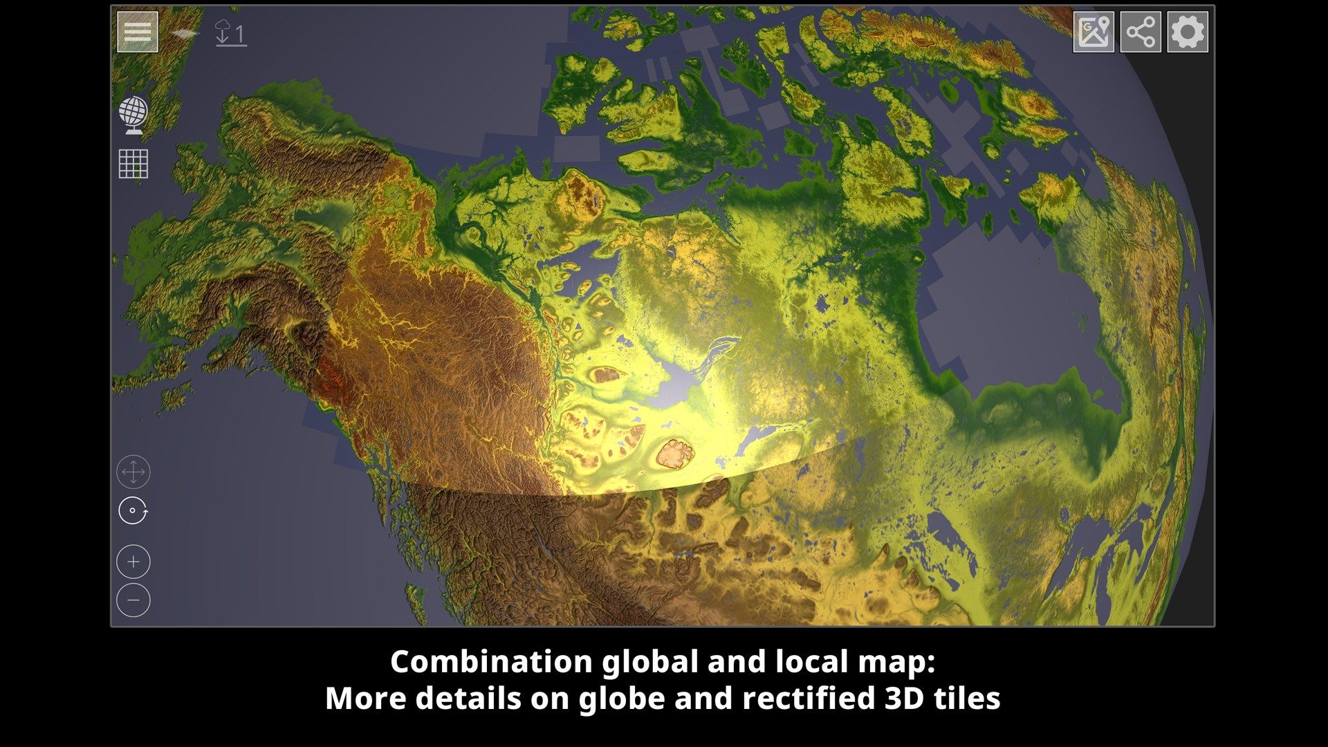
This app allows a high quality view of the surface of our blue planet. It is divided into two areas: the rotatable, global view as an interactive globe and a high-resolution 3D map display of the earth’s topography.
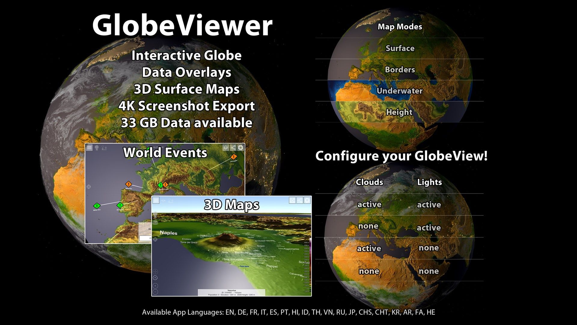
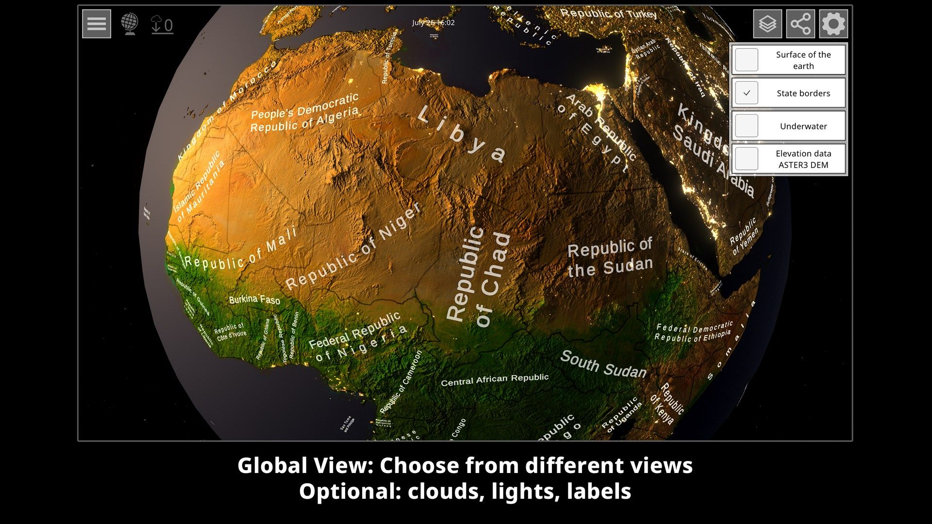
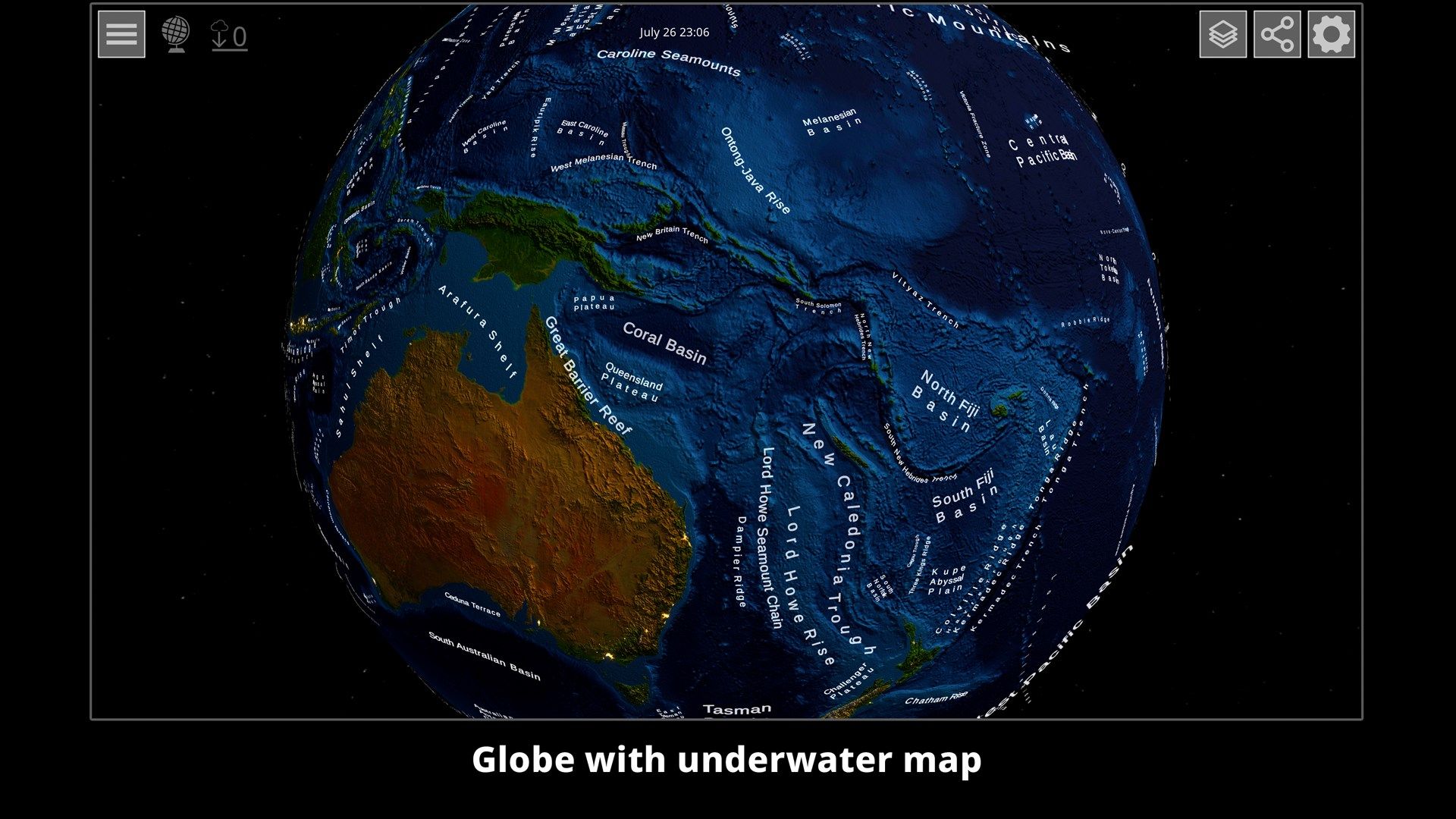
- Interactive 3D globe with surface, underwater and topography map
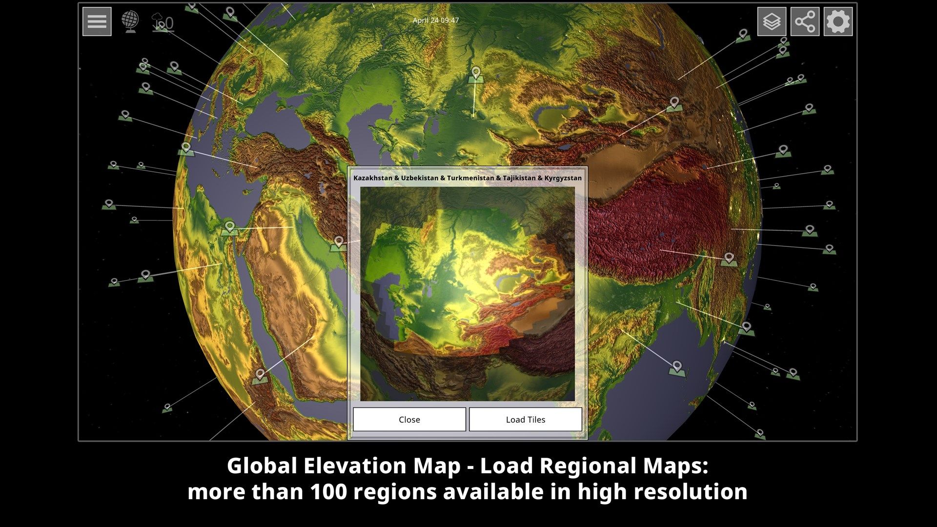
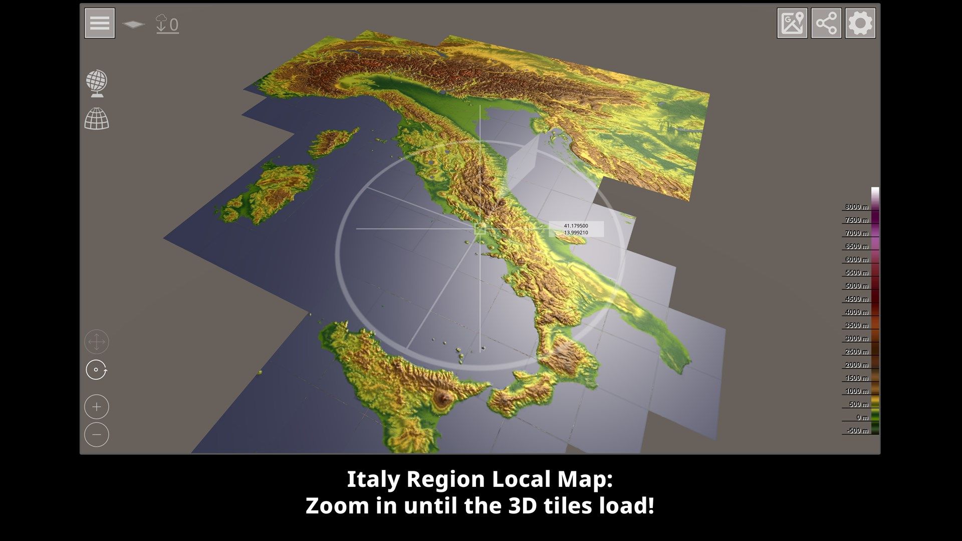
- High-resolution 3D topography map set of the entire earth’s surface - divided into 22,912 individual tiles.
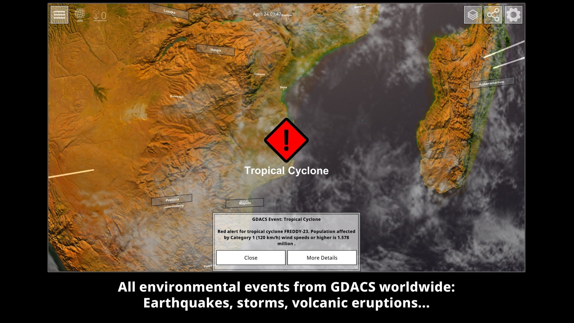
You can load 110 different regions on the interactive globe, which then present the many individual tiles in a meaningful way and load them automatically. The app initially only contains the textures for the globe in low resolution. All required downloads are loaded automatically from our server. A total of approx. 33 GB of data is available. The data remains in the cache on your device for offline use, but can be deleted at any time in the main menu. Furthermore, all events recorded by the GDACS, such as hurricanes, earthquakes, etc. are entered on the globe.
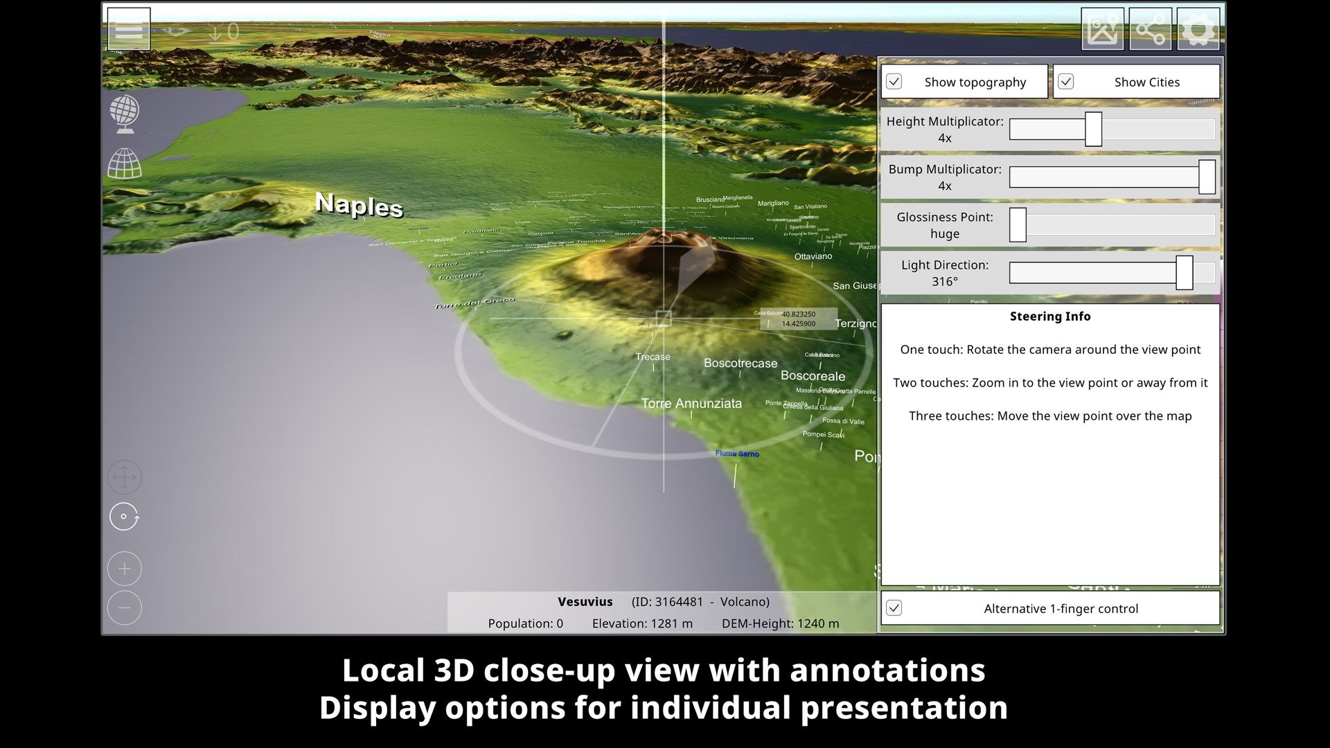
The 3D topography map is based on the elevation data from NASA’s Terra probe, which recorded 83° of the northern and southern hemisphere between 2000 and 2013 - resulting in the ASTER3-DEM. With version 0.10.0 the map is enriched with approx. 7.5 million place names from geonames.org. This means that all the towns, mountains, lakes, deserts and many other geographical features entered there are drawn on the map.
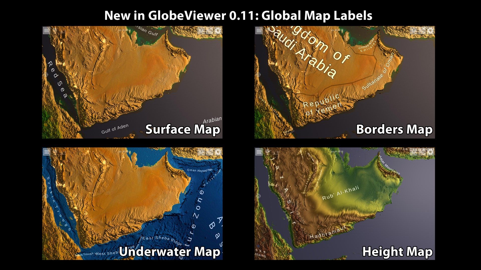
Use the tutorial in the app to familiarize yourself quickly or read the manual to find out which functions are in this app. As the app is still under development, some features are subject to change.
We hope you enjoy using the GlobeViewer!
Key features
-
Interactive 3D globe with surface, underwater and topography map
-
High resolution 3D topography map set of the entire earth's surface - divided into 22,912 individual tiles
-
Load 110 different regions as 3D model
-
A total of approx. 33 GB of data is available for download
-
Map is enriched with approx. 7.5 million place names from geonames.org