GOES Satellite Imagery
Rating
1
Reviews
6
App details
About GOES Satellite Imagery
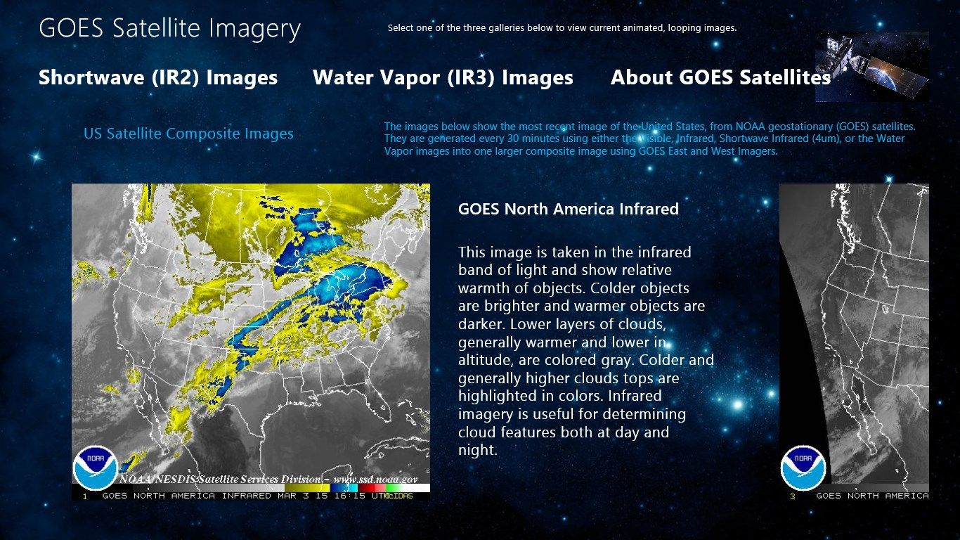
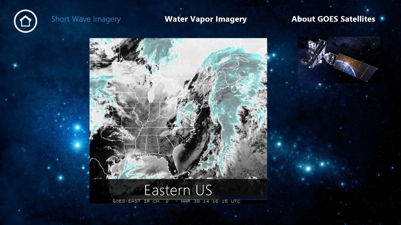
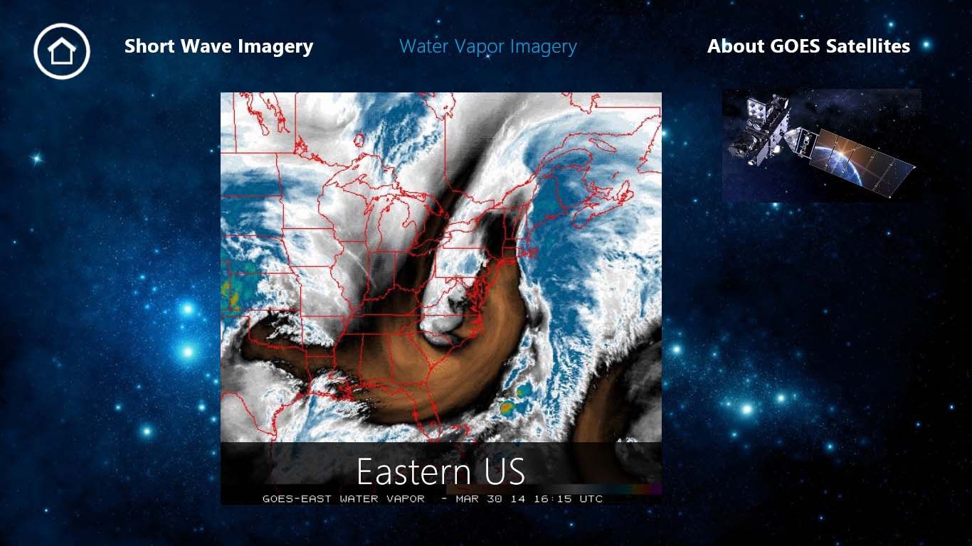
GOES Satellite Imagery pulls images from the GOES Satellite and offers Short Wave and Water Vapor images. Animation will display when available. Images are pulled from NOAA and are updated approximately every 30 minutes.
Key features
-
Regional Weather Satellite Images, Water Vapor/Visible IR and NOAA Composite USA Images