JpgMAP
Rating
0
Reviews
0
App details
About JpgMAP
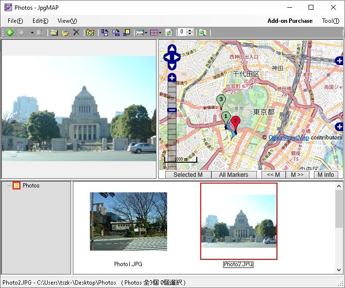
It is a viewer that uses geotags (Exif) recorded in photos taken with GPS, digital cameras with electronic compasses, and smartphones to display latitude, longitude, and direction at the time of shooting, as well as multiple positions on maps at the same time.
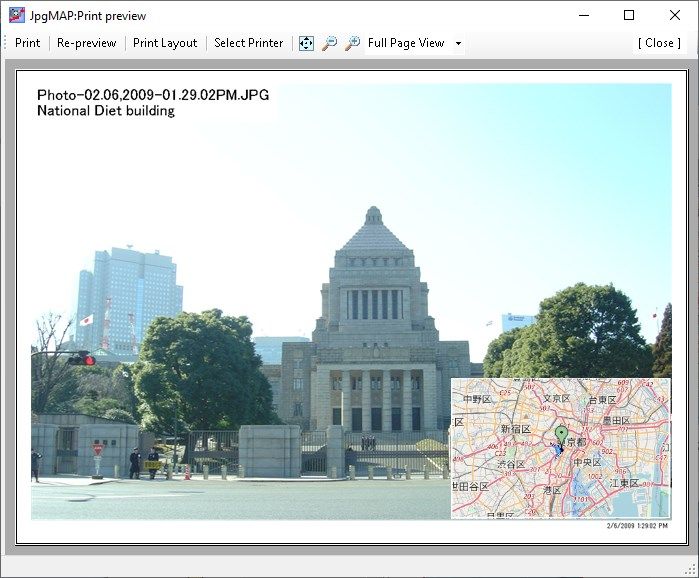
You can also edit and add new geotags, print photo with maps and free comments in any layout, rename files by geotag at once, photo search by geotag, and manipulate files for easy photo organization.
Key features
-
Displays multiple positions at the same time.
-
Displays latitude and longitude and direction when shooting.
-
Edits and add new geotags.
-
Prints photo with maps and free comments in any layout.
-
Renames files by geotag at once.
-
Slideshow
-
Photo search function by geotag,etc.