
OutdoorMaps
App details
About OutdoorMaps
OutdoorMaps - the app with swisstopo and many more offline-maps, compass, tracks and POI.
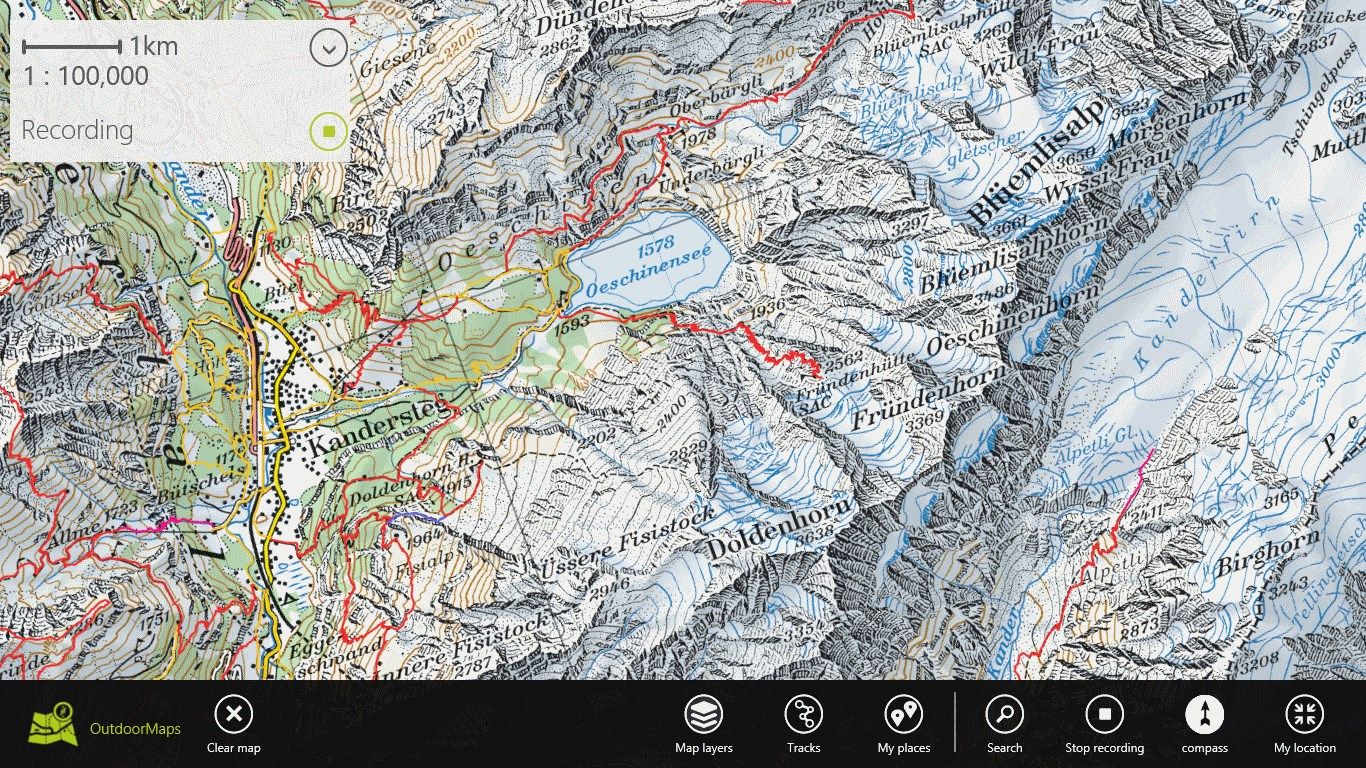
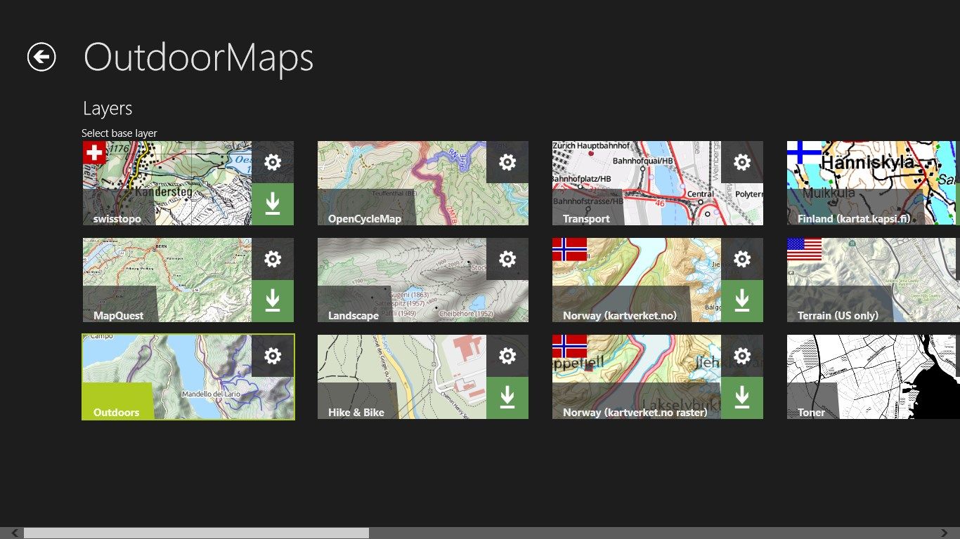
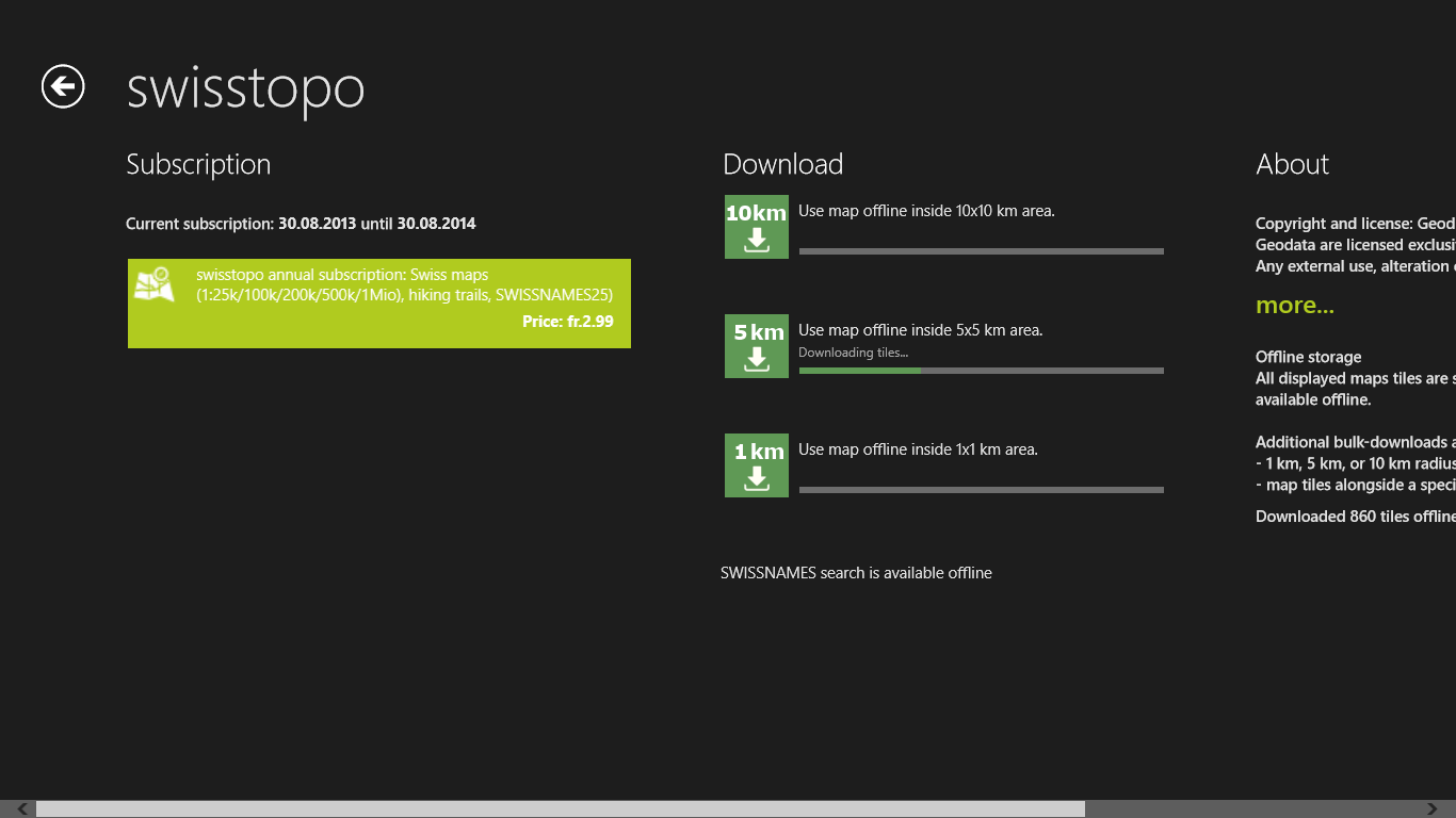
OutdoorMaps is the leading app for hikers, mountain climbers, mountain bikers, cyclists, inline skaters and other outdoor enthusiasts. A rich offer of free maps (MapQuest, Outdoors, OpenCycleMap, Landscape, Hike & Bike, Terrain, Norway, Finland and more) is bundled with this app. Additional popular high quality maps by swisstopo, featuring the official Swiss hiking trails, are available as extra subsciptions.
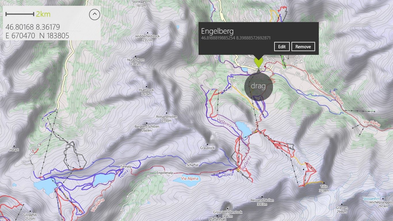
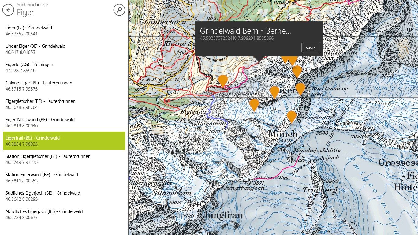
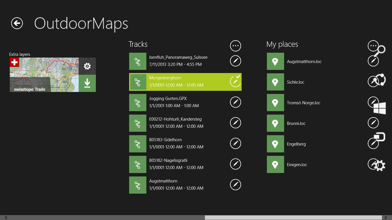
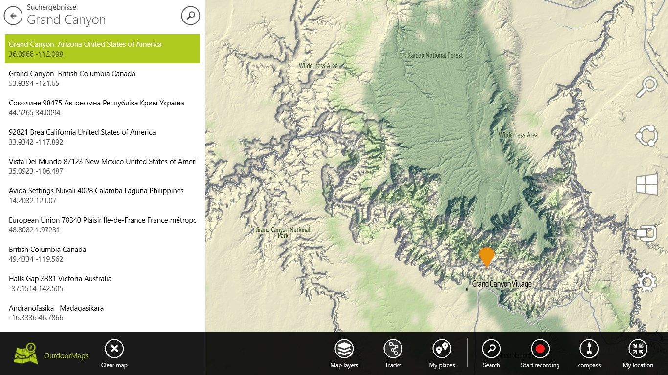
Load your existing tracks in GPX format and continue to use them in OutdoorMaps. The app supports recording new tracks in the background while you are underway. Mark your own points of interest (POI) or use the app’s powerful search to find relevant POIs. Share your favorite tracks with your friends right within the app.
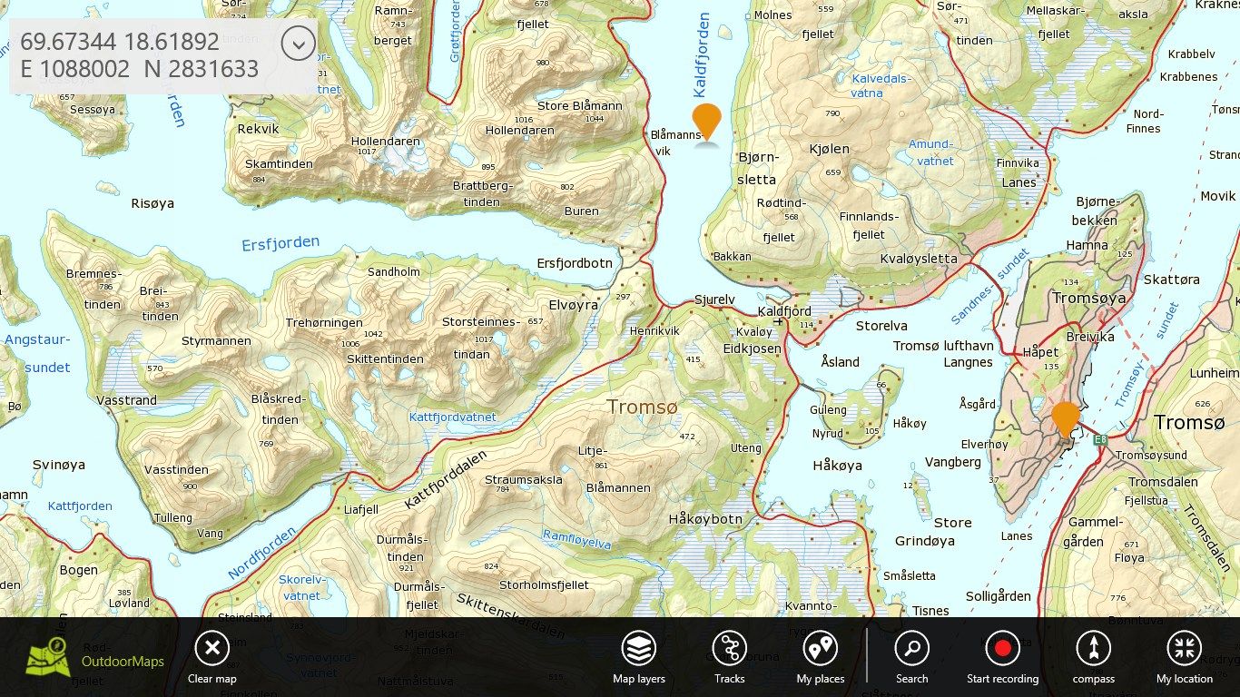
Maps and tracks may be downloaded for offline use, independent of an internet connection. Self-rotating maps based on an integrated compass and moving maps tracking your GPS position make it very easy to navigate outdoors.
OutdoorMaps is running on Windows 8 desktop, laptop and tablet PCs as well as smartphones.
Key features
-
full screen map display with touch operation
-
rich choice of maps (Swiss national maps by swisstopo*, MapQuest, Outdoors, OpenCycleMap, Landscape, Hike & Bike, Terrain, etc)
-
download maps for offline use
-
tracks displayed as separate layers (Swiss national hiking trails by swisstopo*, hiking, mountain biking, cycling and inline skating trails)
-
map rotation based on compass heading
-
GPS positioning and tracking (moving map)
-
recording and displaying of tracks
-
saving of points of interest (POI)
-
search for POIs (OpenStreetMap-Nominatim or SwissNames 25*)
-
sharing of POIs and tracks (email, SkyDrive)
-
* subscription required