RadarScope
App details
Release date
Invalid DateTime
Last update
0001-01-01
Product ID
XPDLKQ7WM0H758
Categories
News & weatherAbout RadarScope
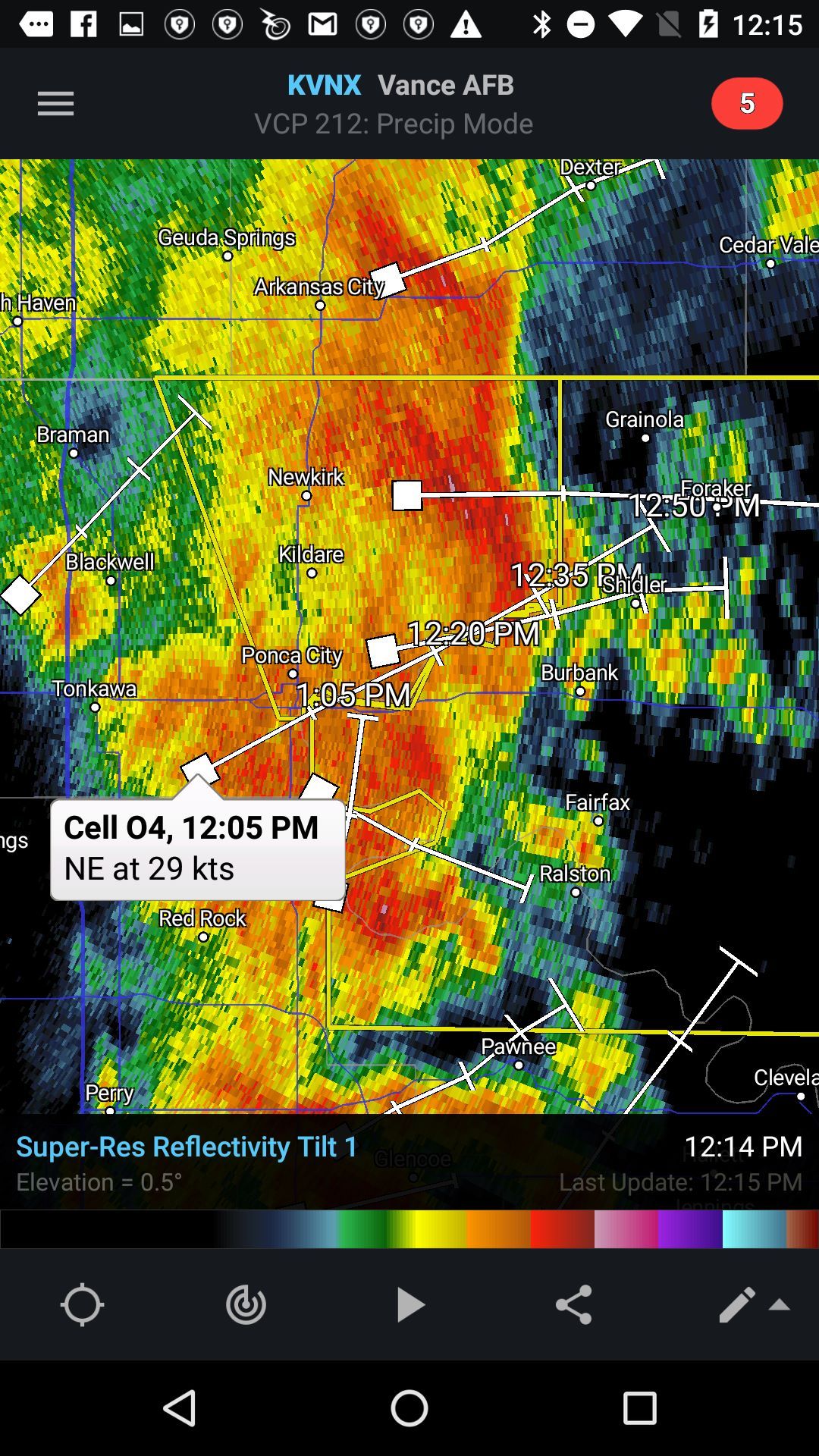
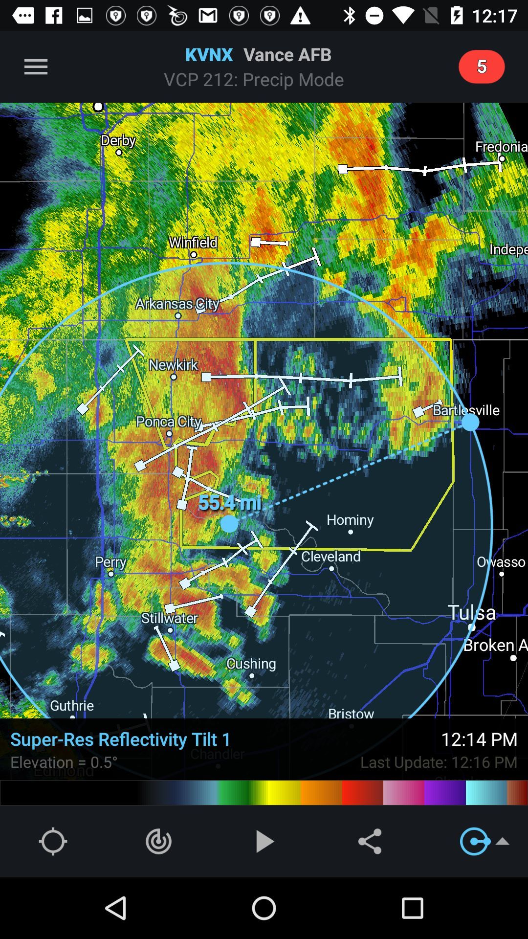
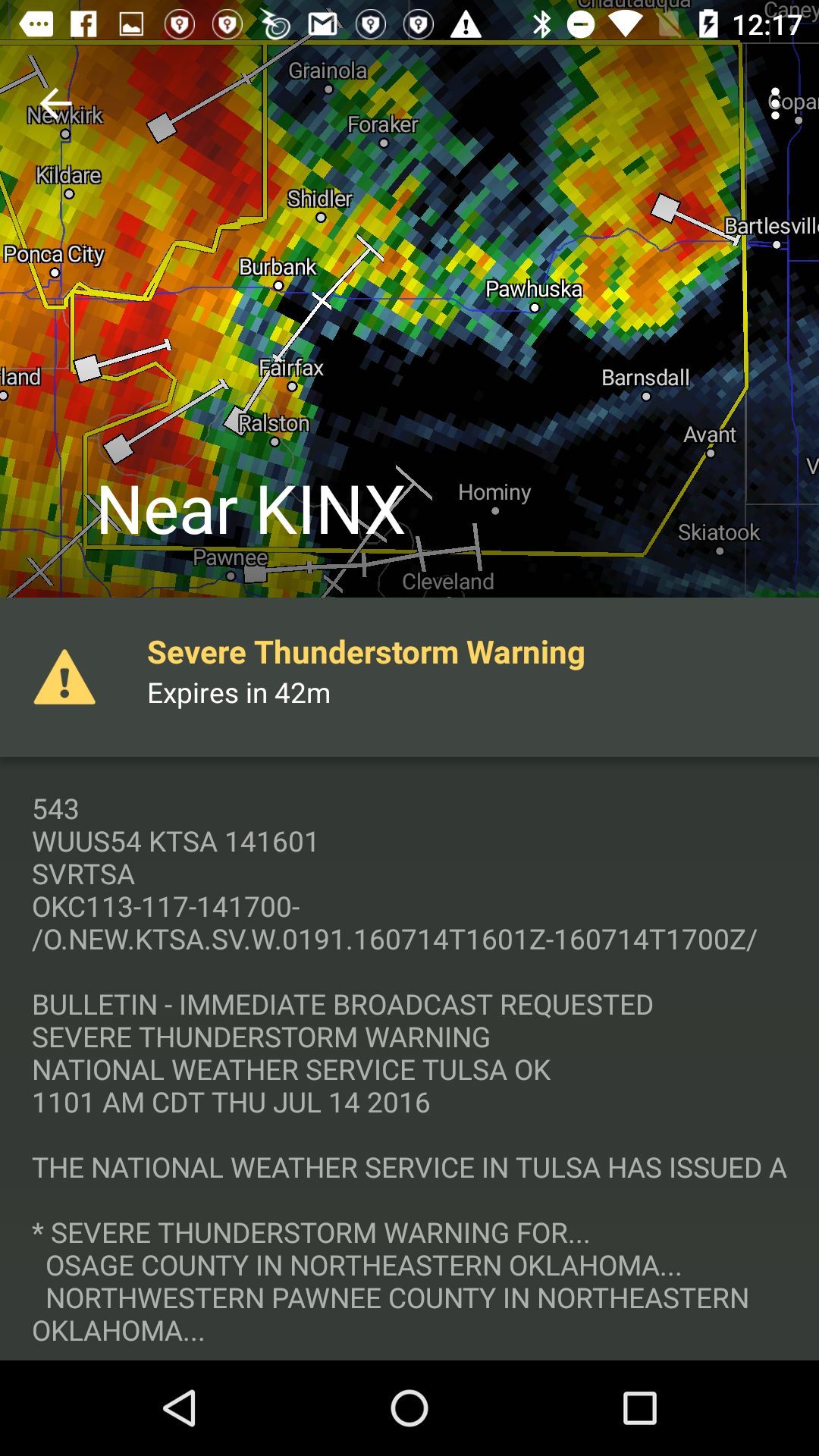
RadarScope is a specialized display utility for weather enthusiasts and meteorologists that allows you view NEXRAD Level 3 and Super-Resolution radar data along with Tornado, Severe Thunderstorm, Flash Flood Warnings, and predicted storm tracks issued by the US National Weather Service. It can display the latest reflectivity, velocity, dual-polarization, and other products from any NEXRAD or TDWR radar site in the United States, Guam and Puerto Rico, as well as reflectivity and velocity data from Environment Canada radars. These aren’t smoothed PNG or GIF images, this is native radar data rendered in its original radial format for a high level of detail.
Whether you are scanning reflectivity for a mesocyclone’s tell-tale hook echo, trying to pinpoint the landfall of a hurricane’s eye wall, or looking for small features like velocity couplets in the storm relative radial velocity product, RadarScope gives you the power to view true radial NEXRAD weather radar on your Android device.
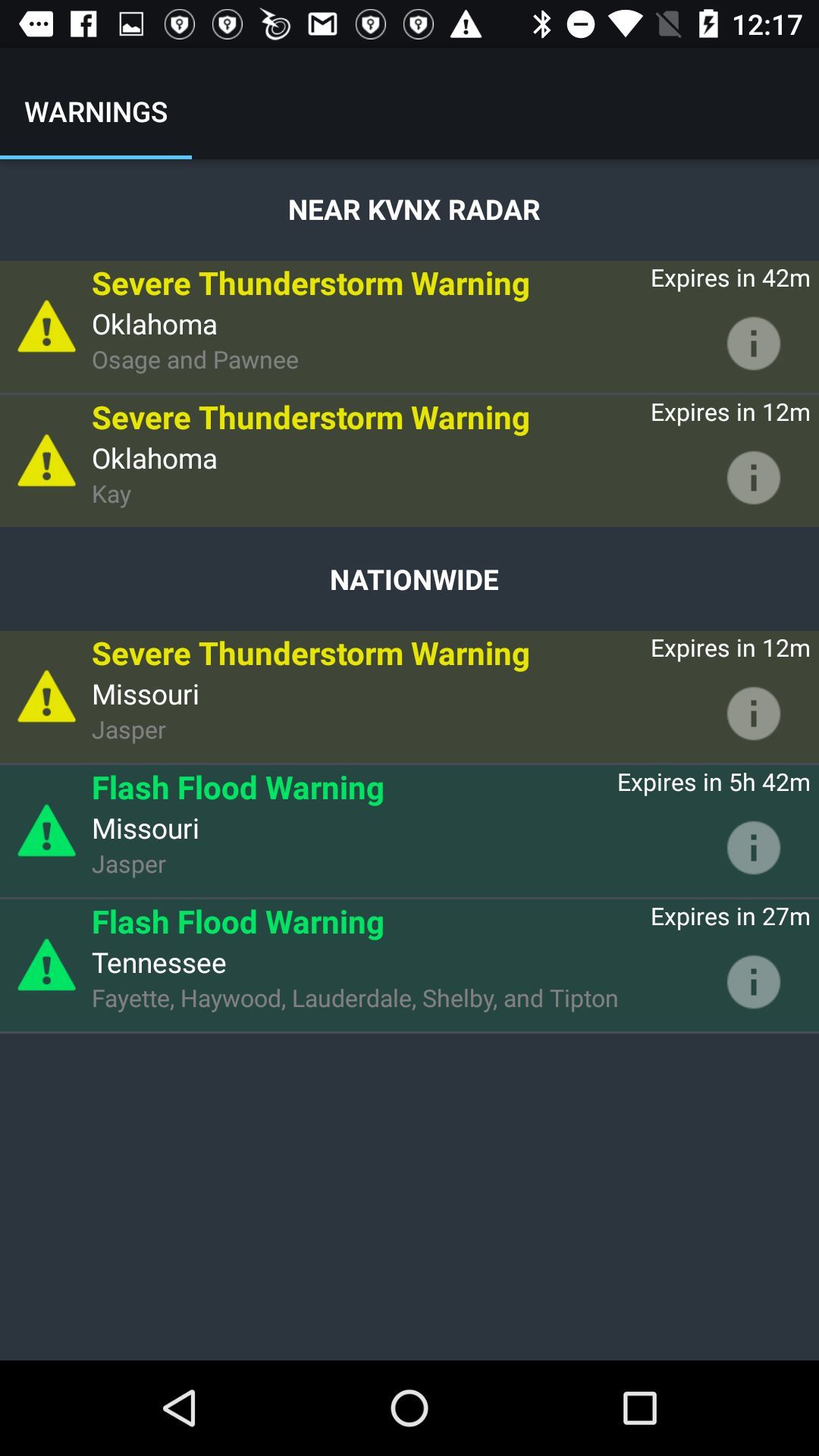
When there are any Tornado Warnings (outlined in RED), Severe Thunderstorm Warnings (YELLOW polygons), or Flash Flood Warnings (GREEN polygons) in effect throughout the US, tap the warning button in the top right corner to browse the list of current warnings, view the details, and even zoom to the selected warning on the map.
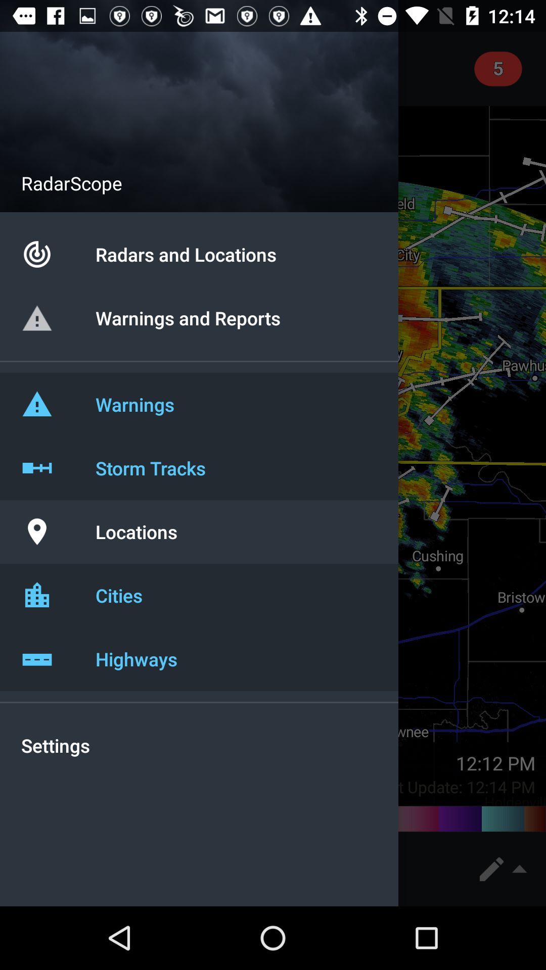
Pinch or stretch to zoom in and out. Drag your finger around the map to scroll. Tap the radar sweep button in the toolbar to switch radars. Select one of the 156 different NEXRAD radar sites and 45 Terminal Doppler radars in the US, 30 other radar sites in Canada, and 2 in the Republic of Korea. Plot your current location by tapping the location button and optionally report it to the Spotter Network. Tap the play button to download and animate over recent images. Display the names of over 25,000 cities and towns on the map as you zoom and scroll. Tap and hold the color legend to see the data values.
Meanwhile, RadarScope will retrieve and display updated data automatically and intelligently (approximately every 2 to 10 minutes, depending on the radar scan strategy).
You can display data from NOAA’s public access web site, our optional WDT feed (the default), or your AllisonHouse subscriber account. Spotter Network members can report their location and view the locations of other spotters.
The RadarScope Pro subscription is an optional auto-renewing subscription with two different tiers to choose from. Super-res products are still available to all RadarScope users without purchasing a subscription.
RadarScope Pro Tier 1 provides access to real-time lightning data that animates along with the radar loop and up to 20 frames of radar data, including extended loops of Super-Res Level 2 data. Tier 1 subscribers can also access a data interrogation tool to quickly determine data values for specific radar pixels and an optional dual-pane mode for viewing two radar products side-by-side.
RadarScope Pro Tier 2 combines all the features in Tier 1 with more advanced features, including a 30-day archive of all radar products, estimated hail size contours, rotation (azimuthal shear) contours, and the ability to use subscription features across multiple platforms. RadarScope purchased through the Amazon App Store may utilize a Tier 2 subscription purchased elsewhere once that subscription has been linked to a RadarScope account.
Please visit our web site for more information.
Key features
-
View raw Level 2 and Level 3 radar data rendered in its original radial format for a high level of detail
-
View the latest reflectivity, velocity, and other radar products from any NEXRAD radar site in the United States, Guam, and Puerto Rico
-
View tornado, severe thunderstorm, and flash flood warnings issued by the National Weather Service
-
View storm tracks, or use your optional AllisonHouse subscription to add SPC day 1 outlooks, storm reports, summarized lightning, and watches.
-
View the locations and details of storm chasers using the Spotter Network