StarStruck Navigation: Celestial Navigation Application to Complement the Sextants
App details
About StarStruck Navigation: Celestial Navigation Application to Complement the Sextants
“And all I ask is a tall ship and a star to steer her by”
–John Masefield–
I have to agree with Al Placette when he said this is “one of the most beautiful and oft-quoted lines ever penned about sailing and the sea…”
If you have this extreme nostalgic feeling for this ancient art of navigation using the stars and the planets rather than a GPS, then this app is for you. This app is created with the hope that it could help to do a little part in preserving this beautiful art of navigation, and may be, bringing us all a little bit closer to those courageous sea goers centuries before us.
You can also use it for practical purposes of locating your position while treking or navigating on the open sea. It is more fun to use than using a GPS and it doesn’t drain your phone battery power as a GPS would.
Features:
Highlighted functions:
-
This app allows you to enter sextant information of a star sighting and it calculates the most likely position for you.
-
The most likely position is shown on a map that you can zoom in and out to any location around the world.
-
It outputs the relevant information about any star that you are sighting (GHA, Declination, Intercept distance, Azimuth angle, calculated altitude, etc) for you to review. This is a handy feature so that you don’t need to brother bringing those big and heavy Nautical Almanac volumes around with you.
-
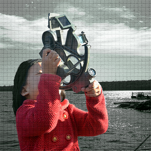
It can make use of the sensor available on most smart phones to help you measure the altitude of a star by pointing your device in the direction of the star. This feature is handy when you don’t have a sextant available.
-
It supports all the 57 navigation stars, plus the SUN, MOON, POLARIS and all the planets.
This software is a complement to your sextants. It is also a good tool to show your kids about astronomy and its practical benefit, that is how people have been using it to navigate their ways around the world.
Usage:
If you are already familiar with sextant navigation then continue with the reading, otherwise you can read the background section on celestial navigation to familiar yourself with the concept.
To determine your position you must perform a series of star sighting (at least two but the more the better) and record the following information with the help of a sextant:
-
GMT time of the observations
-
Star name: SUN, MOON, Polaris, Sirius, Altair, etc.
-
Altitudes of the stars in degrees and minutes
-
Others info: eyes height above sea level, sextant correction index, lower or upper limb (required for the SUN and MOON only)
The app allows you to enter all these information and it calculates the most likely position for you.
Since most of us may not have a sextant, this app makes use of the available sensors on most smart phones to help you measure the altitude of the star by simply point the device to it. The sensor accuracy is within 1 degree so it is not as accurate as a good sextant but if you do several star sightings then the error will average out and you will get a good fix of your position.
Celestial Navigation Background:
Rather than writing a complex mathematical tutorial on celestial navigation and perhaps turn away 90% of the users permanently, let me start by saying that celestial navigation is another way of determining your position on earth by using the stars as your light houses .
Please note that I am using the term star loosely here to mean the Sun, the Moon and the planets as well.
Most of us are familiar with the concept of the light house as it is a mean to help people at sea to determine their position and find their way to a safe port. By keeping track of light houses along your route on a map and follow them, one should be able to get to his destination without much trouble.
Similarly, this app is able to compute the locations of all the light houses in the sky and help you to navigate to your safe harbor - even if your GPS is broken :)
Key features
-
Locate your position while trekking or navigating on the open sea – without a GPS
-
View relevant information about any star that you're sighting
-
Reference all 57 navigation stars, plus the Sun, Moon, Polaris, and all the planets
-
Calculate meridian passage, rise and set time for Sun and Moon
-
Calculate magnetic variation to help correct your compass to true north