Track of the day - Pro Edition
App details
About Track of the day - Pro Edition
This is the latest version: 5.14
Microsoft Visual C++ Redistributables are included.
This application is the ultimate tool for planning complex trips and routes of all kinds.
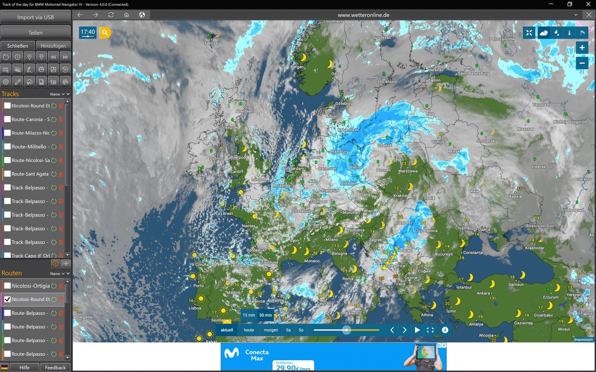
The route planner masters hikes, bicycle routes, supercurvy motorcycle routes as well as fuel-saving fast routing for cars, trailers, motorhomes and large vehicles of all. The integrated truck routing takes into account all vehicle dimensions and automatically avoids bottlenecks, too low a bridge and much more. Warnings about construction sites, traffic jams, border crossings, gravel roads, private roads and toll roads are generated automatically. For each warning, the current traffic situation is displayed.
This application supports all popular GPX-enabled navigation devices and smartphone apps.
Information about stages and destinations of the next trips can simply never be collected in one place and combined into ever new exciting routes. Thanks to the integrated SQL database (Microsoft SQL Server 2019), all information can be found quickly.
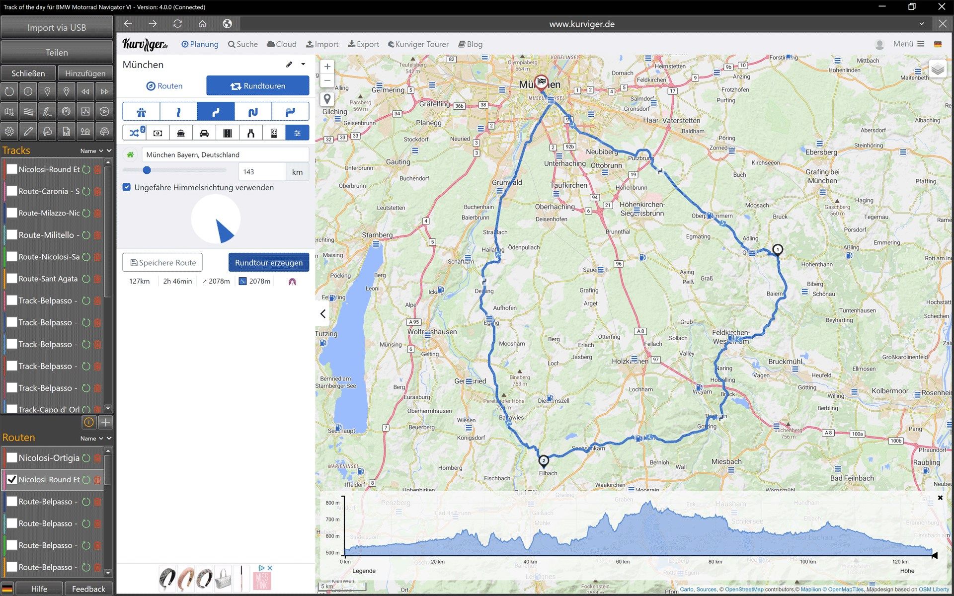
KAKIMOTO is the industrious super curve assistant that automatically creates new variants for breathtaking motorcycle routes for motorcycle enthusiasts. Round trips can be easily created on the basis of the current map section. Entry and return can be freely specified for all round trips at any time.
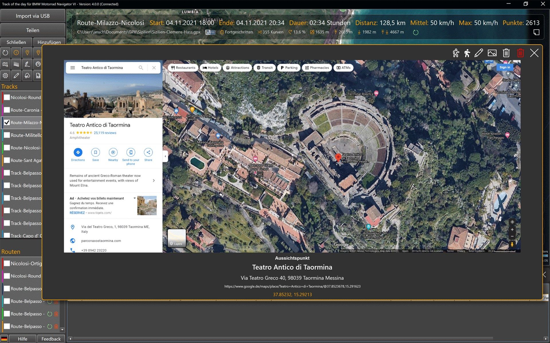
Thanks to the integration of Google Earth, a 3D visualization of all destinations is possible at any time. POIs with screenshots of the current Google Earth view are possible at any time. Alternatively, the Cesium 3D terrain is available, which can also display tracks and routes in interactive 3D views. The simulation of light and time of day and thus also shadows is also possible. Even rendered houses can be displayed in the 3D views with one click.
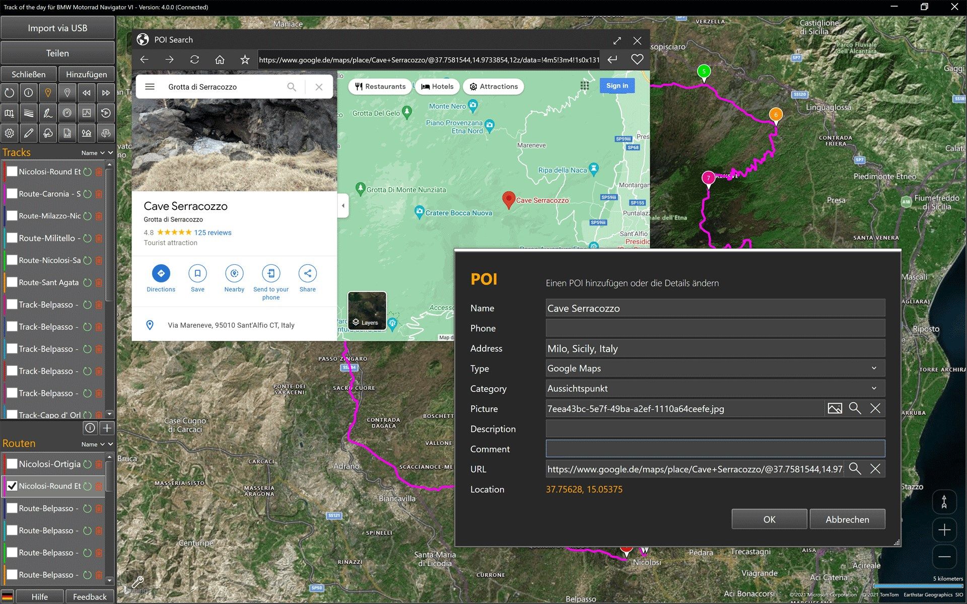
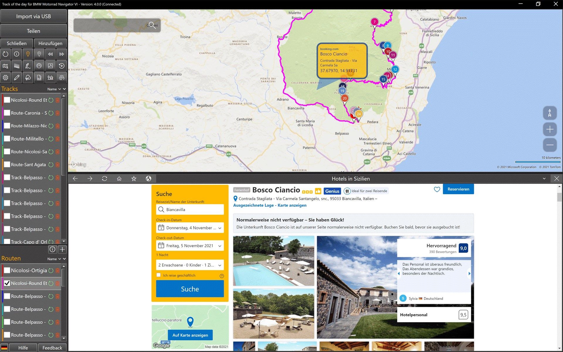
With the integrated POI and hotel search you will find the best POIs and the most beautiful hotels. With ‘POIs along the route’, the integration of overnight stays becomes child’s play.
The ‘ConnectedRoutes’ technology holds the routes of several days together during long journeys. Long routes can be easily divided into travel days with the ‘TraveldaySplitting’.
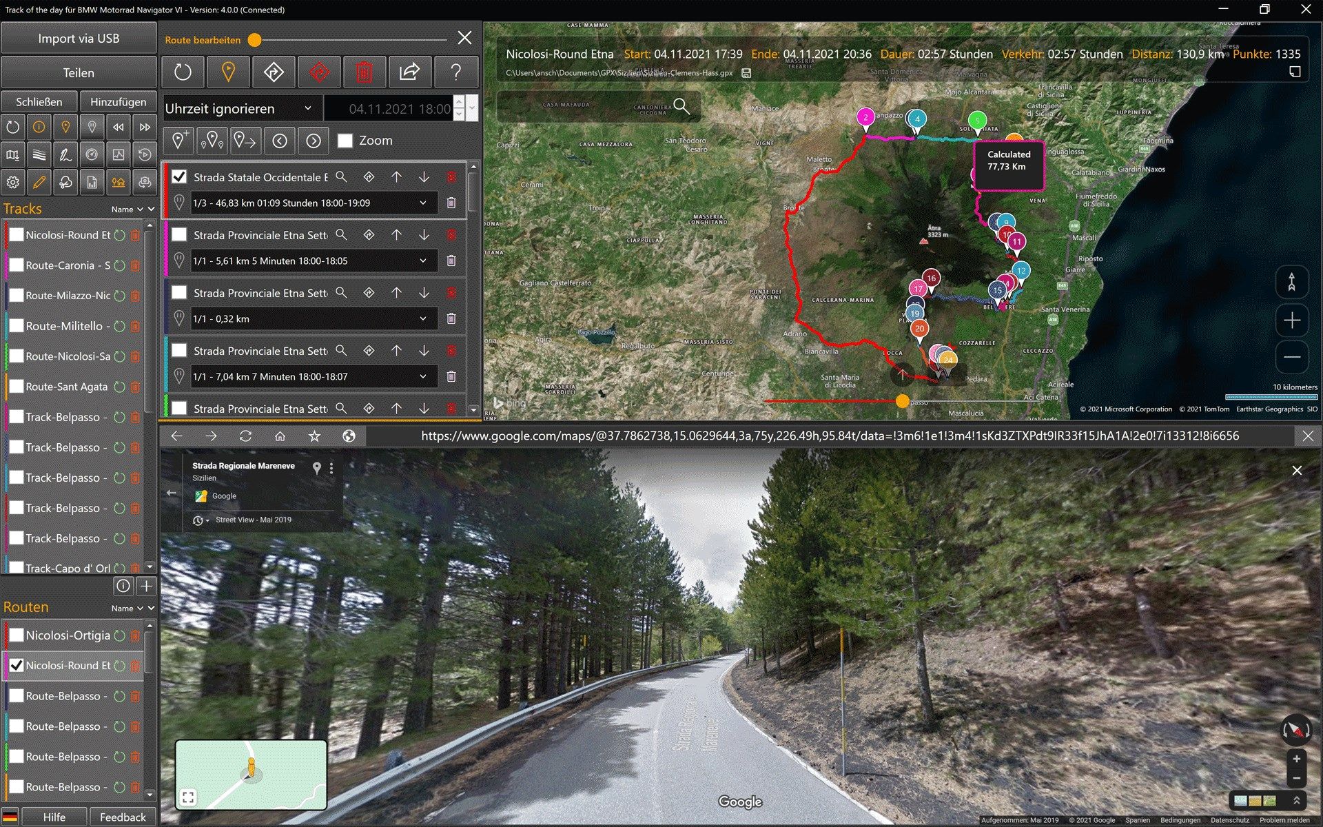
In addition to advanced features such as ‘AutoShaping’ and ‘AutoRouting’, the integrated route planner also enables ‘Connecting routes’ and ‘Previous routes’. Individual routing parameters are possible for all sections of a route. A comfortable approach and return journey via the motorway, pleasurable cornering with friends and in between a hike to a viewpoint, no problem. Even adventurous off-route trips can be planned without any restrictions. Where the known paths stop, a route navigation can also be possible.
The special software architecture also makes it possible to plan routes of any length. Once the Panamericana there and back, no problem.
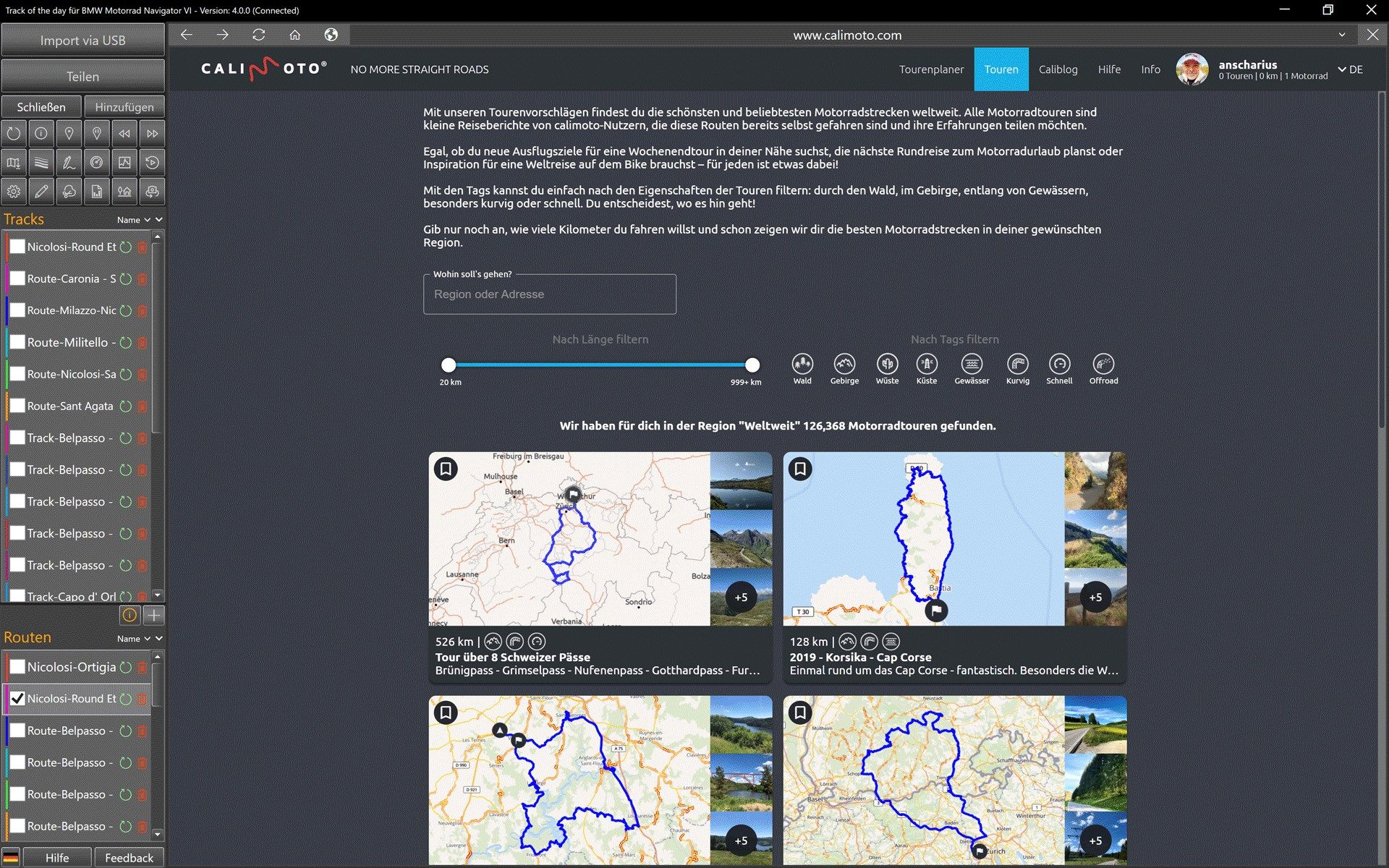
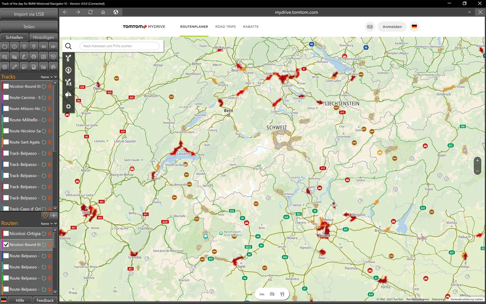
By integrating Komoot, MRA, Calimoto, Kurviger, TomTom MyDrive and many other route planners, ready-made tours can be imported and processed with one click. Plan with Kurviger or Calimoto, navigate with TomTom, Garmin or BMW Navigator, everything is possible. Using Komoot without a subscription with free navigation is also no problem.
Tracks from all built-in route planners can be freely split, reassembled, reversed, converted to routes and much more.
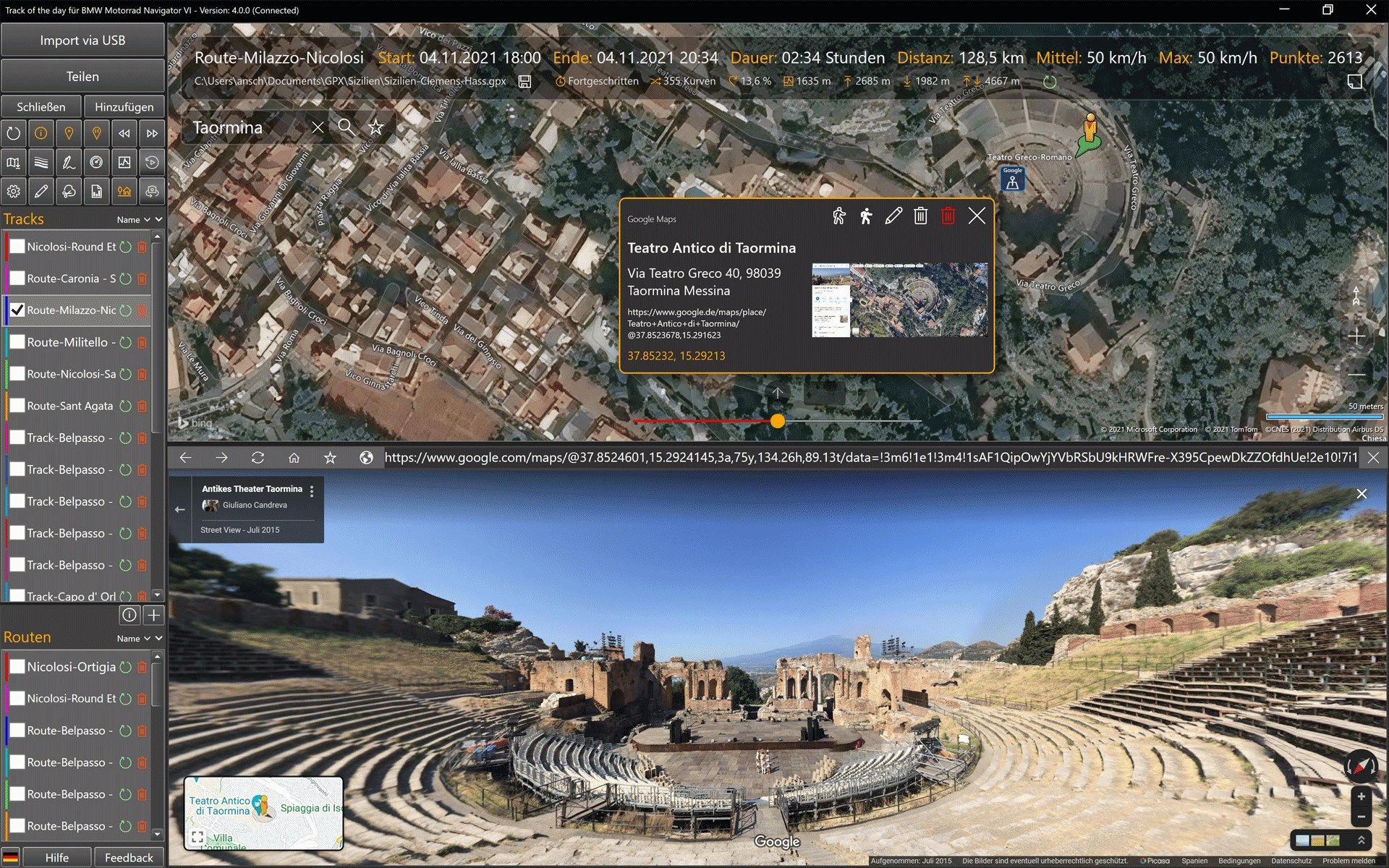
Route planning has never been so efficient and easy. Already during the planning you can experience with Google Streetview what will wait on a route. Already during planning, the ‘RouteMetrics’ calculate important parameters such as fun factor, curviness, altitude profile and other information fully automatically in the background.
This application does not require the purchase of expensive maps. There are 24 different cards available. All maps are continuously updated automatically by the providers and are available in many different languages. 21 map views are fully customizable. An automatic local cache for map data can be activated at any time.
All route calculations are done at the speed of light on server farms with thousands of computers, giving them the very best performance.
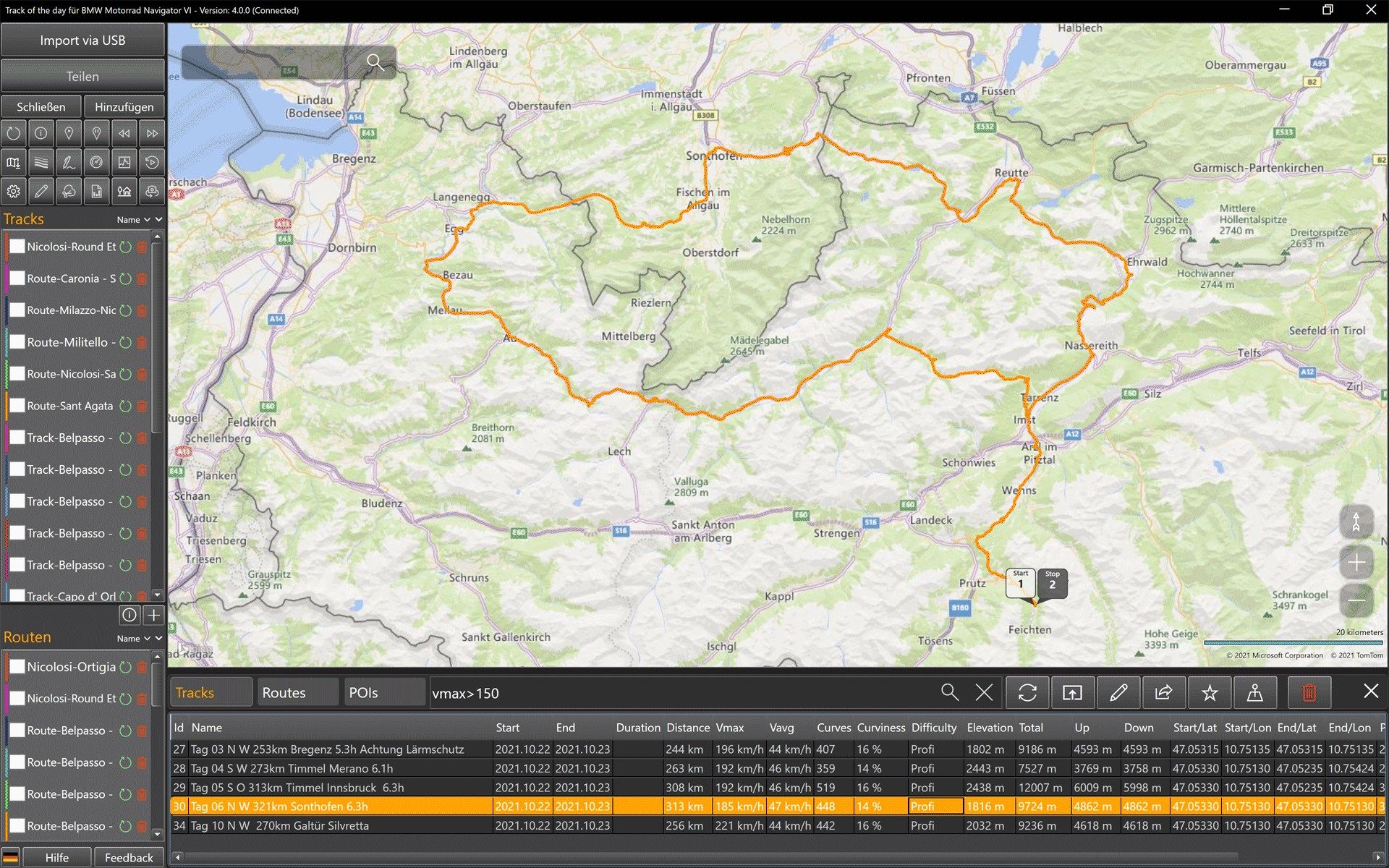
The sorting of tracks and routes by name, date, distance, driving time, speed, altitude, etc. is possible at any time. With one click, tracks are automatically colored by height or tempo. The analysis shows altitude profile, speed profile and other exciting evaluations. All evaluations can be saved separately as 300 dpi graphics.
Importing geocoded photos and automatically converting them to POIs is extremely easy. Photos can be easily imported as POIs via drag & drop from Windows Explorer.
With the Streetview integration you can experience all tracks and routes in the direction of travel virtually. With just one click, both tracks and routes become animated MP4 videos. The virtual cockpit visualizes parameters such as distance, time, speed, altitude and direction of travel. At the same time, you can play photos and images from Google Streetview as a slideshow.
Road types such as ‘Senic’ or ‘Off-Road’ can be marked for individual sections of a track and automatically coloured. This automatically creates a legend of the selected sections.
With the ‘TrackClipping’ you can reduce the amount of data of very large tracks with one click to half of the waypoints.
Refueling stops and small detours can be easily corrected with the integrated track editor. An anonymization of tracks is also easily possible.
Images of tracks and routes can be shared completely or in excerpts as JPG graphics with a resolution of 300 dpi.
When exporting routes, limitations of the connected devices are automatically taken into account. On request, the POIs of the current map section can be automatically embedded in routes during export and displayed on navigation devices.
The import and export of unencrypted POIs is supported for many devices of the manufacturers TomTom, Garmin and the BMW Navigator series. The exchange of POIs between devices from different manufacturers is possible at any time.
TomTom users can transfer all routes to their devices in GPX or ITN format. The integration of TomTom MyDrive makes it possible to send multi-stop routes directly to TomTom devices.
It is possible for anyone to open routes in Google Maps and send them directly to their personal smartphone or tablet. The import of all routes from Google Maps is also supported. Places stored in Google Maps can be imported as POIs at any time.
The DOCX generator creates a practical roadbook in DOCX format from complex routes with just one click, which can be further processed and printed with Microsoft Word and compatible programs. Photos from all POIs are automatically transferred. The export of tables in XSLX format and further processing with programs such as Microsoft Excel is also possible at any time.
Authors of e-books will be pleased that all graphics are generated in a resolution of 300dpi and can be integrated directly from the clipboard into new e-books without annoying rework.
Key features
-
Routeplanning with integrated Google Streetview functionality
-
Virtual tour in driving direction with Google Streetview
-
Animated track preview with MP4 video rendering
-
Integrated editor for trackpoints
-
Reduction of the amount of data with the clipping function
-
Display of elevation or speed with different colors
-
Import of tracks from BMW Navigator VI via USB connection with a single click
-
Elevation- and speed profiles
-
Automatic sorting of all routes and tracks by date, name, distance and much more
-
Mark sections of tracks with the type of the road like Off-Road etc.
-
Delete unwanted stopps and eliminate errors with the track editor
-
Plan, edit and export routes in GPX format
-
Convert GPX tracks to GPX routes and vice versa
-
Reverse routes and tracks
-
Use routing overlays to find the best routes
-
SQL Database for Tracks, Routes and POIs
-
Import of geocoded Photos
-
Support of iPhone HEIC photos
-
Photo import from Apple iCloud
-
Support for POIs in Garmin, TomTom and Google Maps format