
VFR Navigator X
Rating
4.2
Reviews
5
App details
About VFR Navigator X
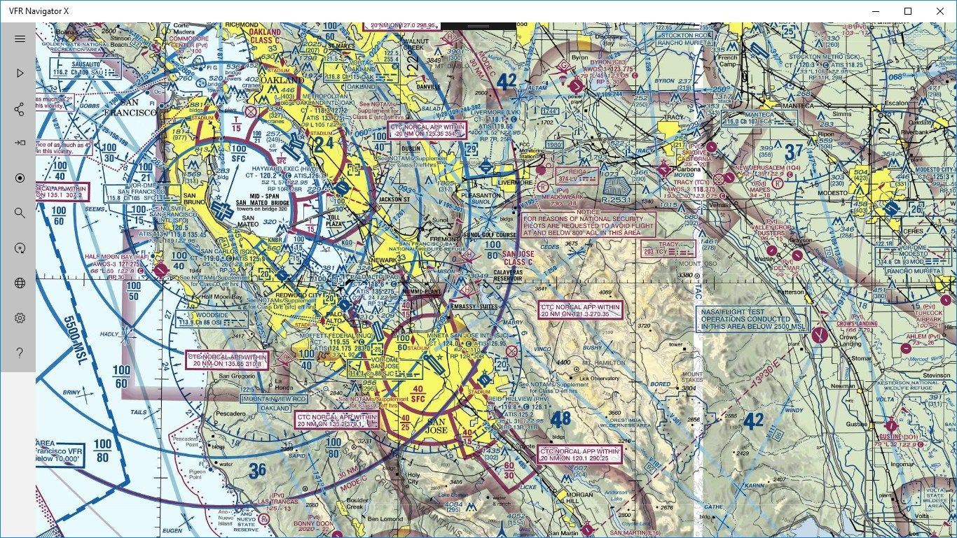
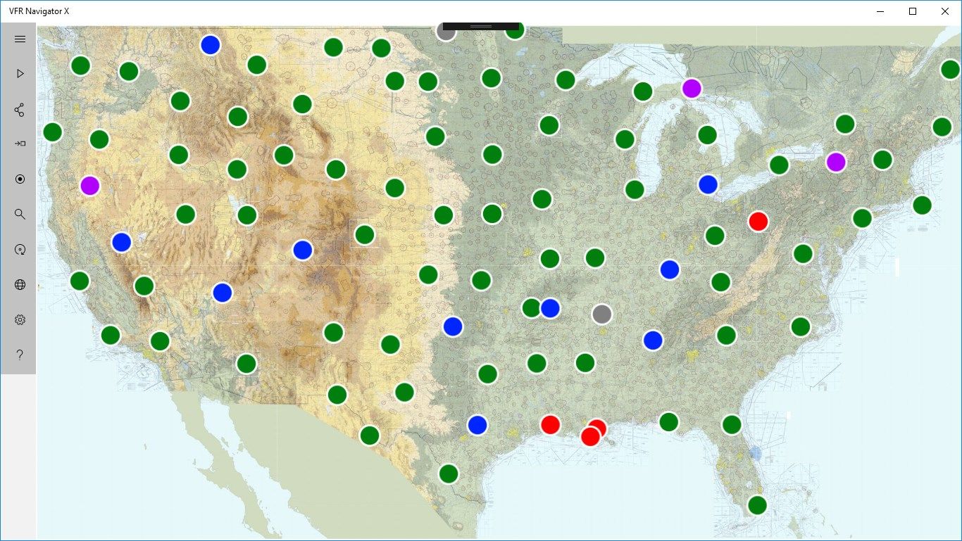
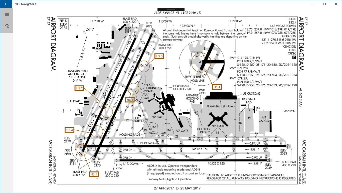
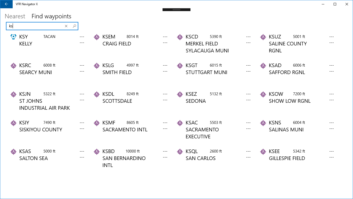
Basic moving map app with VFR sectional charts and terminal procedure publications for lower US states. Contains data on waypoints, navaids and over 5000 public airports.
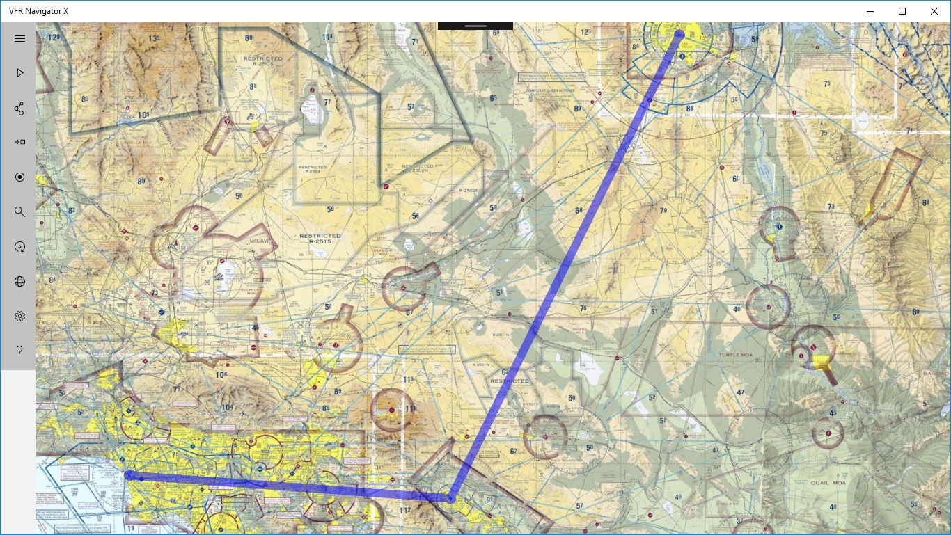
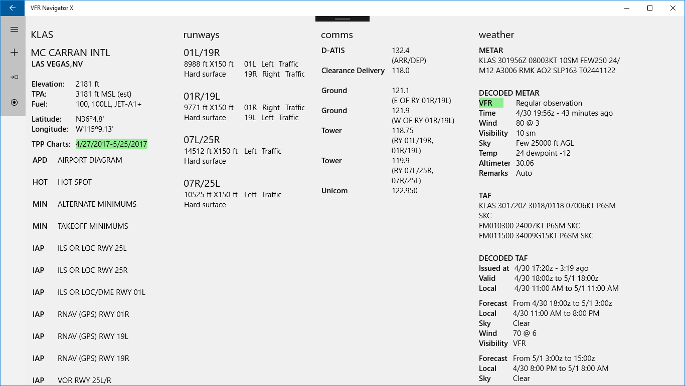
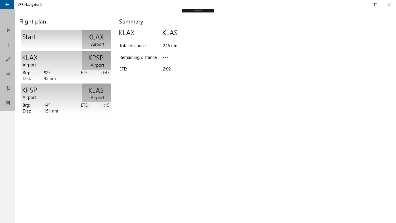
App supports flight planning, tracking, direct-to mode and can show METARs and TAFs for the airports.
App can run on desktop, tablet or phone.
One chart is available for free after installation. In-app data subscription purchase is required to access sectional VFR charts and terminal procedure publications (TPP) of lower 48 states. Charts for Alaska, Hawaii and territories are not available at this time.
v2.2.4