Weather Radar Pro
App details
About Weather Radar Pro
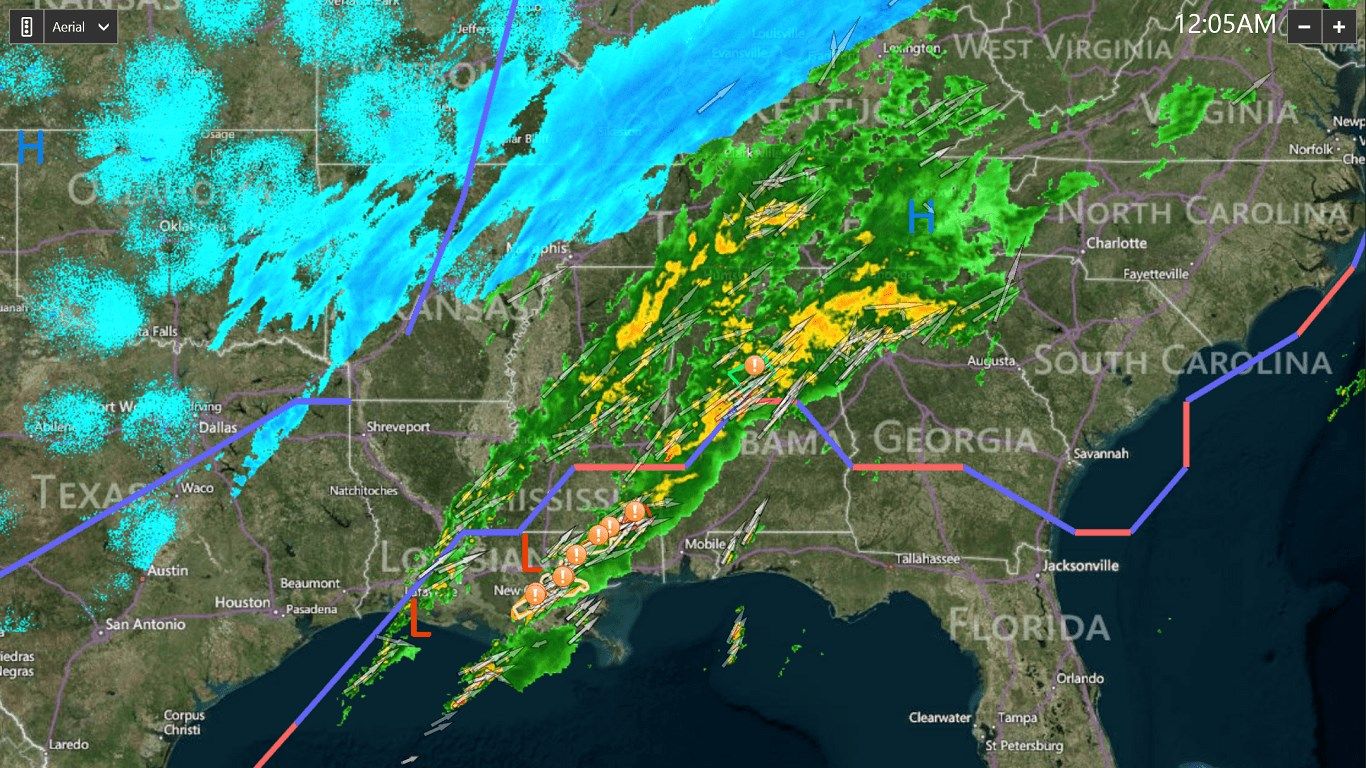
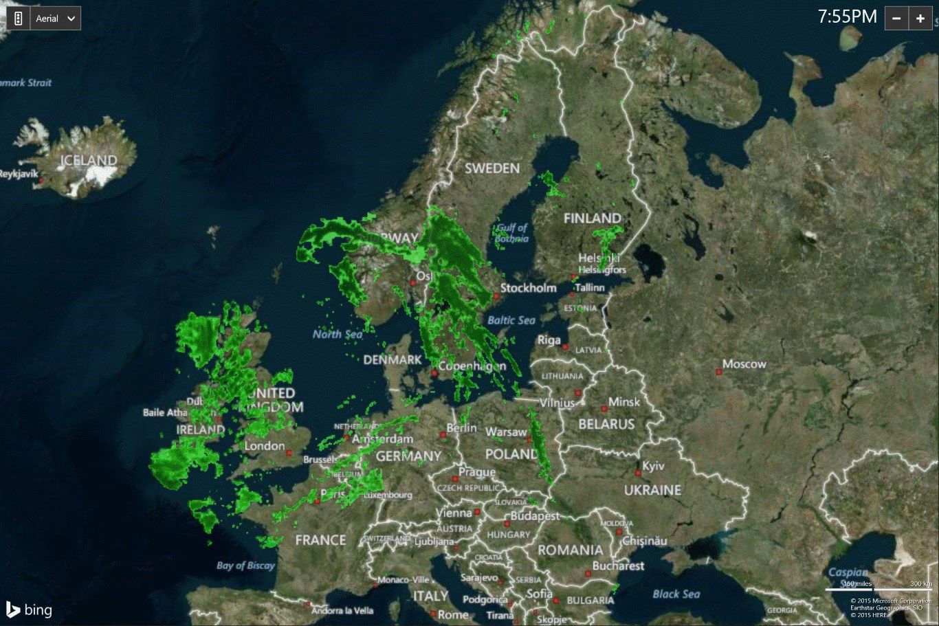
Radar data covers the United States, Europe, and Eastern Caribbean!
This is the only radar app in the Windows Store that provides you with more radar products than just base reflectivity. It’s professional data that you don’t want to be without.
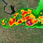
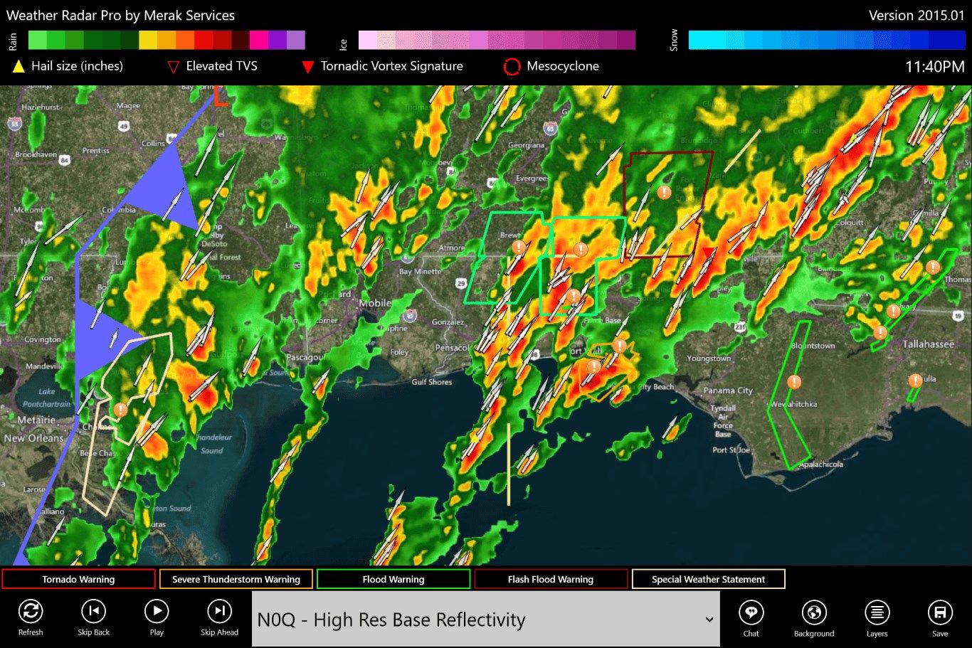
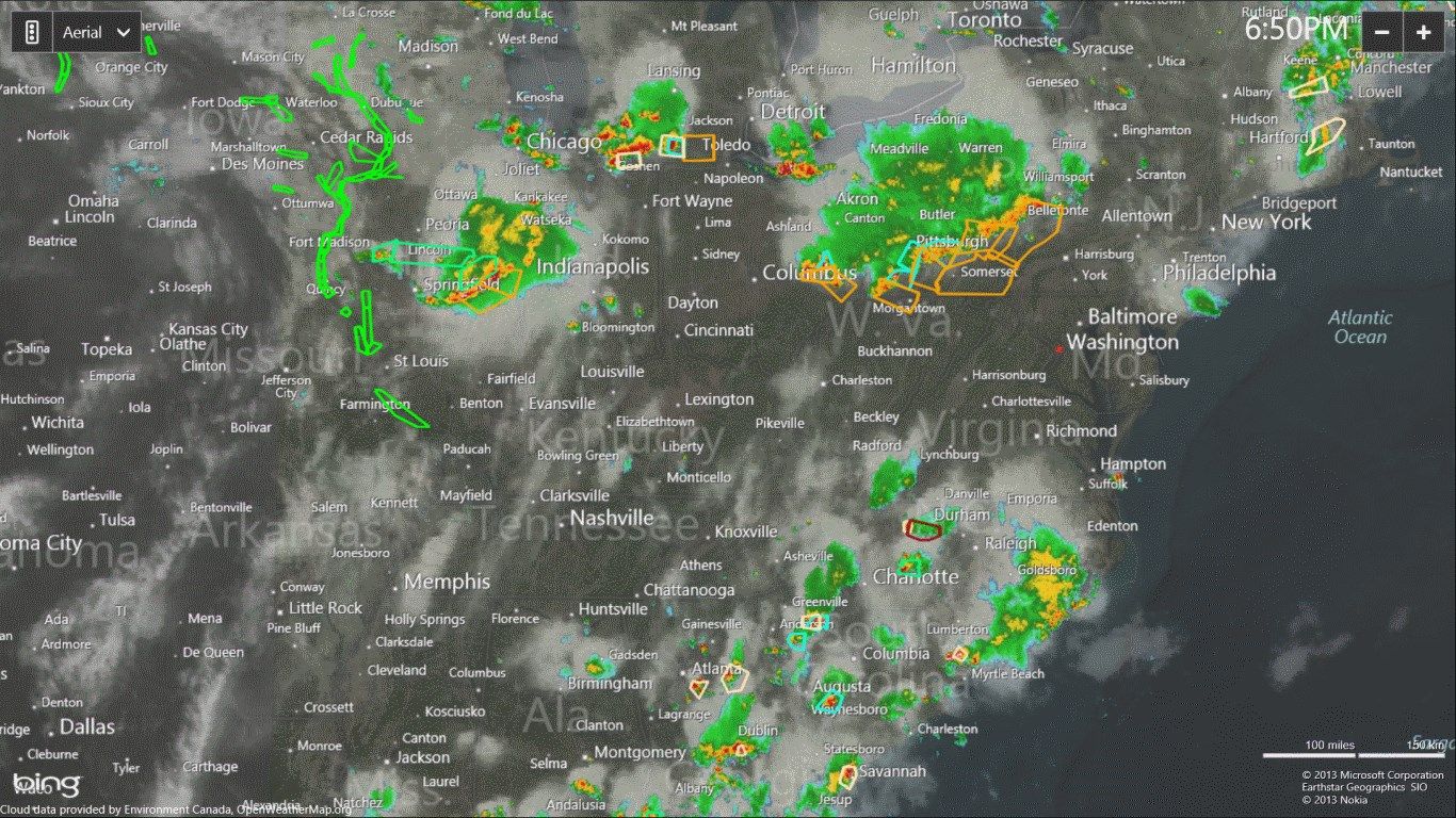
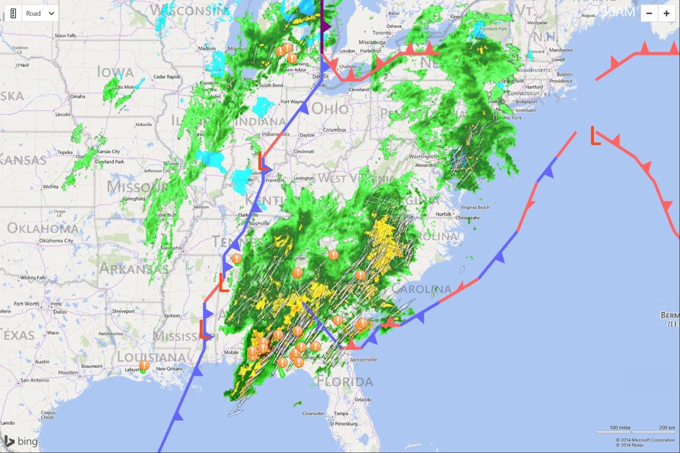
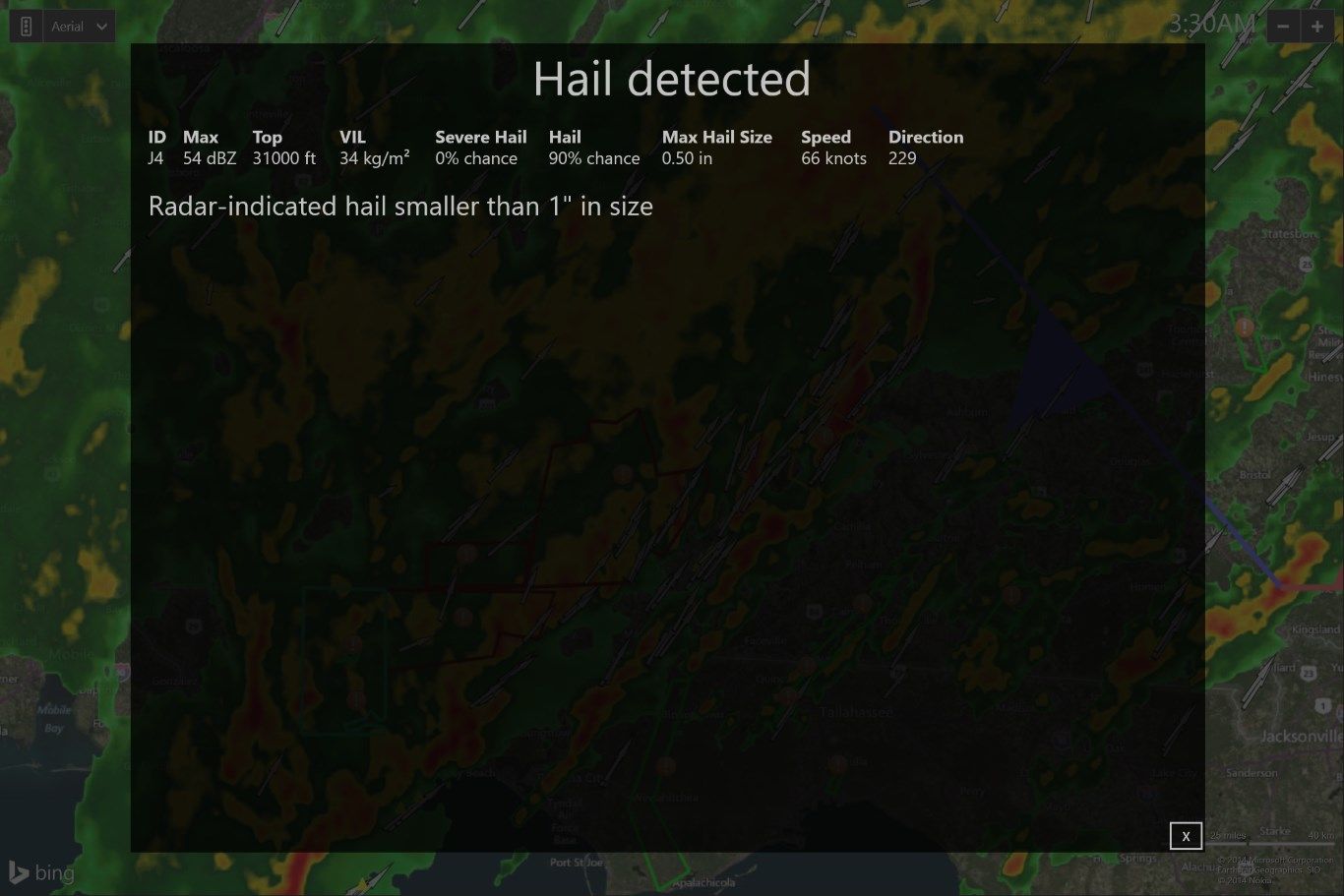
Animated weather radar with watch/warning boxes, global hurricane tracking, and cloud overlays. Radar includes storm attributes - arrows indicating the direction of travel, and icons indicating the location and size of hail, mesocyclones, and tornadic vortex signatures that indicate the presence of rotation in supercells and possible tornados. Radar images include high resolution base reflectivity at multiple scan angles, enhanced echo tops, vertically integrated liquid, correlation coefficient, differential reflectivity, 1 hour precipitation totals, and storm total precipitation.
Click on hail, mesocyclone, or tvs icons to view the storm attribute table for that particular storm cell. Storm attribute table includes information about hail size, probability of hail, cloud top height, vertically integrated liquid, and more.
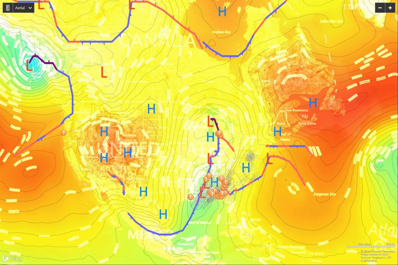
Overlay animated radar over GOES satellite imagery, view global temperature data, or view global sea-level pressure with isobars. Radar imagery covers the United States, Europe, Guam, and the Eastern Caribbean. Hurricane data is global and includes all the oceans of the world.
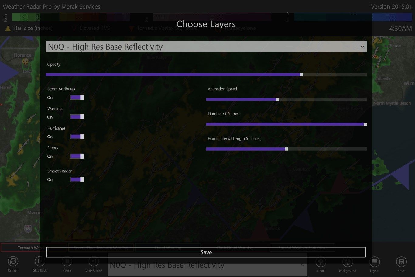
Choose the number of frames in your radar animation, the animation speed, and the interval between frames.
Optimized for Windows 10 with new Live Tile.
Key features
-
Animated radar data with cloud overlays
-
Watch/warning boxes for all warning types
-
Hail size estimates
-
Mesocyclones and tornadic vortex signatures
-
Storm direction indicated by arrows
-
Hurricane tracking with forecast for storms around the world
-
GOES satellite data with optional radar overlay
-
Global sea-level pressure map with isobars
-
Global temperature data
-
Timestamped radar
-
Live Tile
-
High Resolution Base Reflectivity
-
Enhanced Echo Top
-
Vertically Integrated Liquid
-
Weather Fronts
-
Radar data includes the United States and Europe