
WeatherPlex

App details
About WeatherPlex
WeatherPlex (WPLX) provides access to important weather information for your location, city, state and the entire U.S.
Use WPLX to stay informed of conditions and forecasts using data from the National Weather Service (NWS).
Features include:
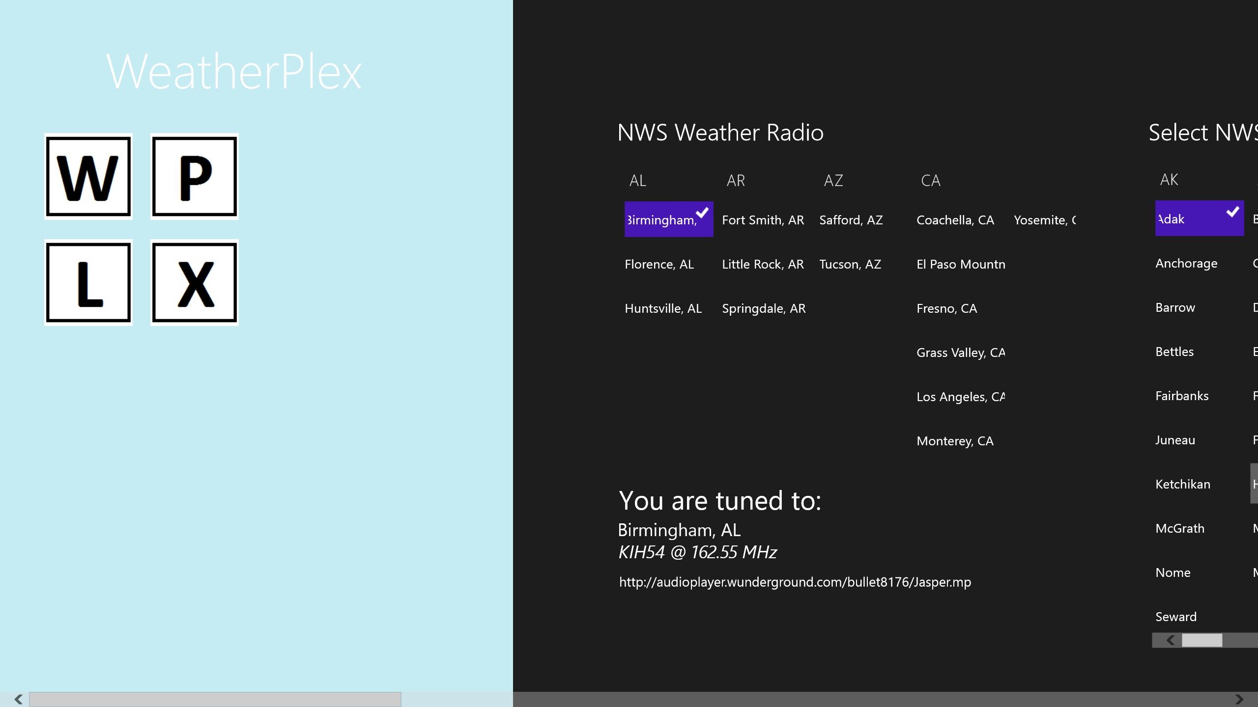
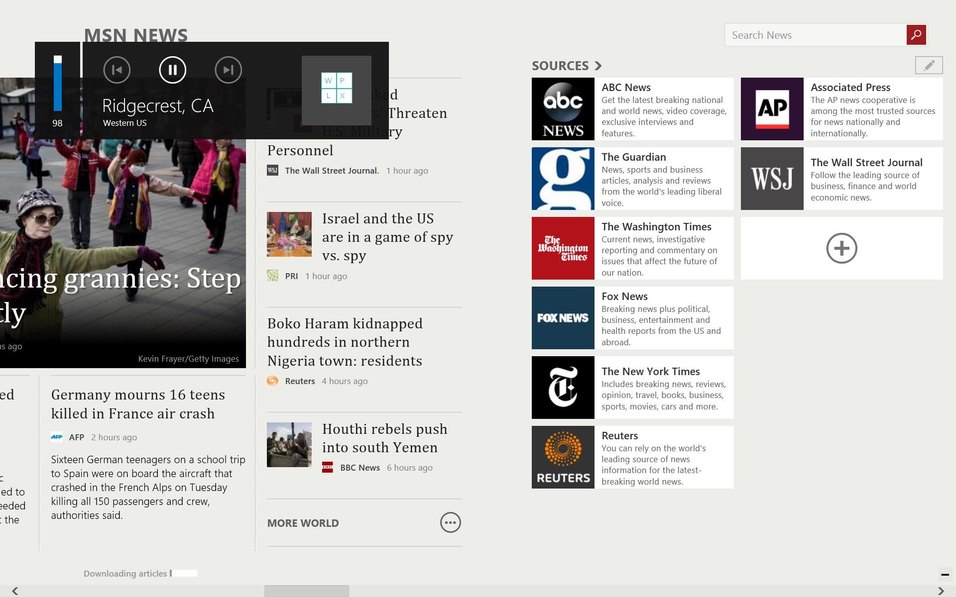
- Listen to NWS “All Hazards” Radio (for available stations as streamed by WeatherUnderground).
- “All Hazards” Radio is fully supported while WPLX is in the background. Conveniently play & pause the “All Hazards” broadcast and adjust volume from your device’s media controls while running other apps.
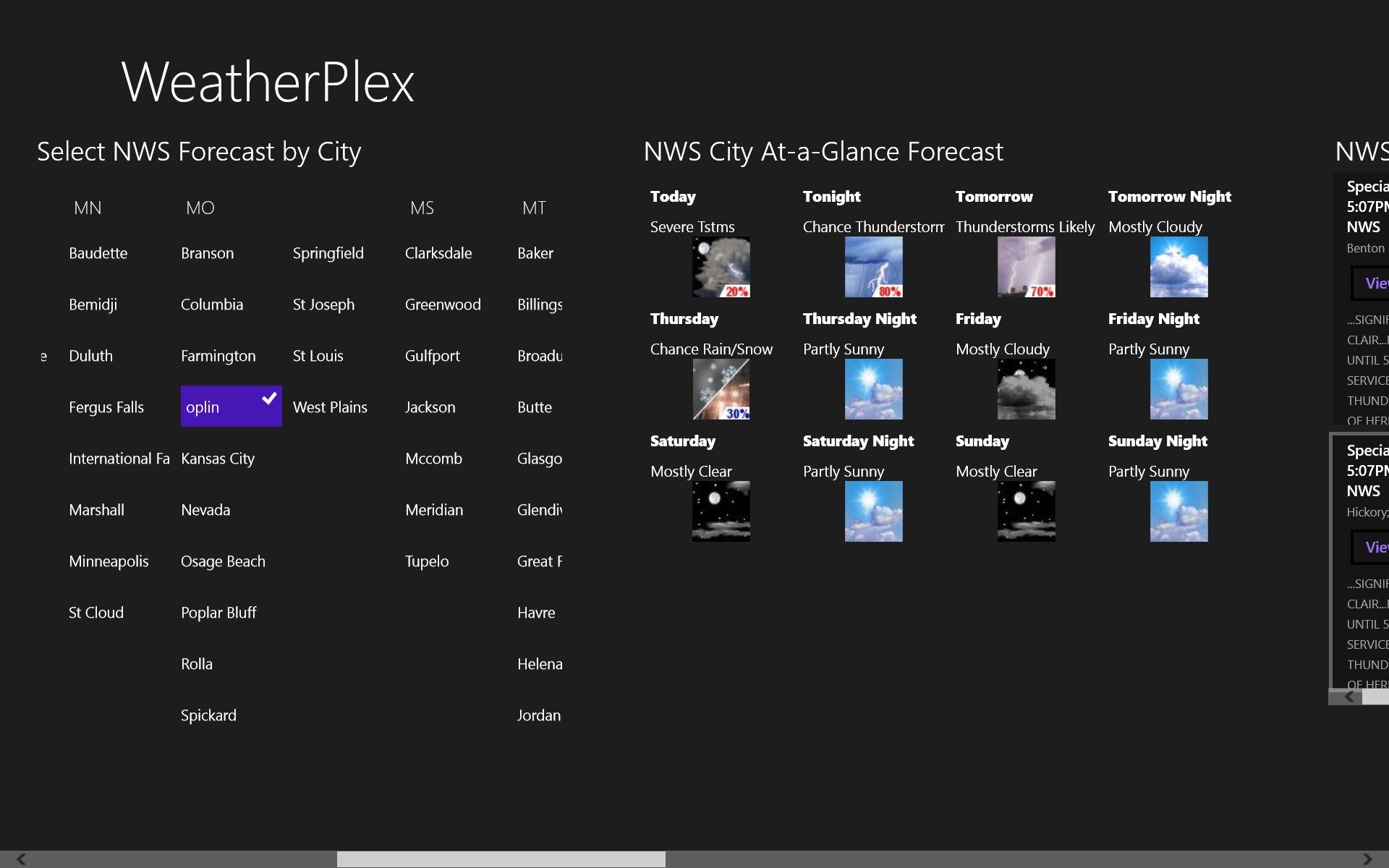
- Selectable “At-a-Glance” forecasts from 495 locations acrosss the U.S., Guam, Puerto Rico and the U.S. Virgin Islands.
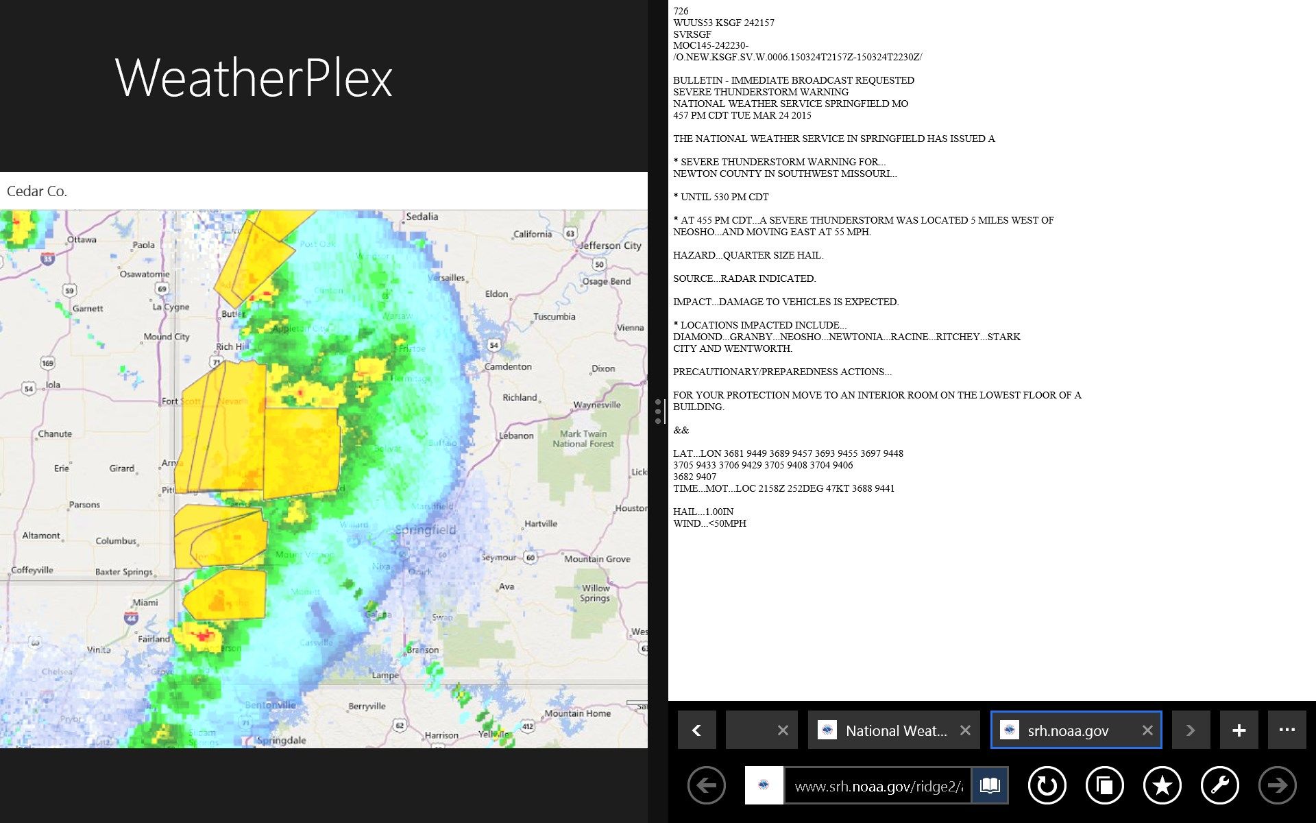
- Review NWS-issued Warnings, Alerts, Watches and Advisories for any state and link directly to the NWS web-page for additional details.
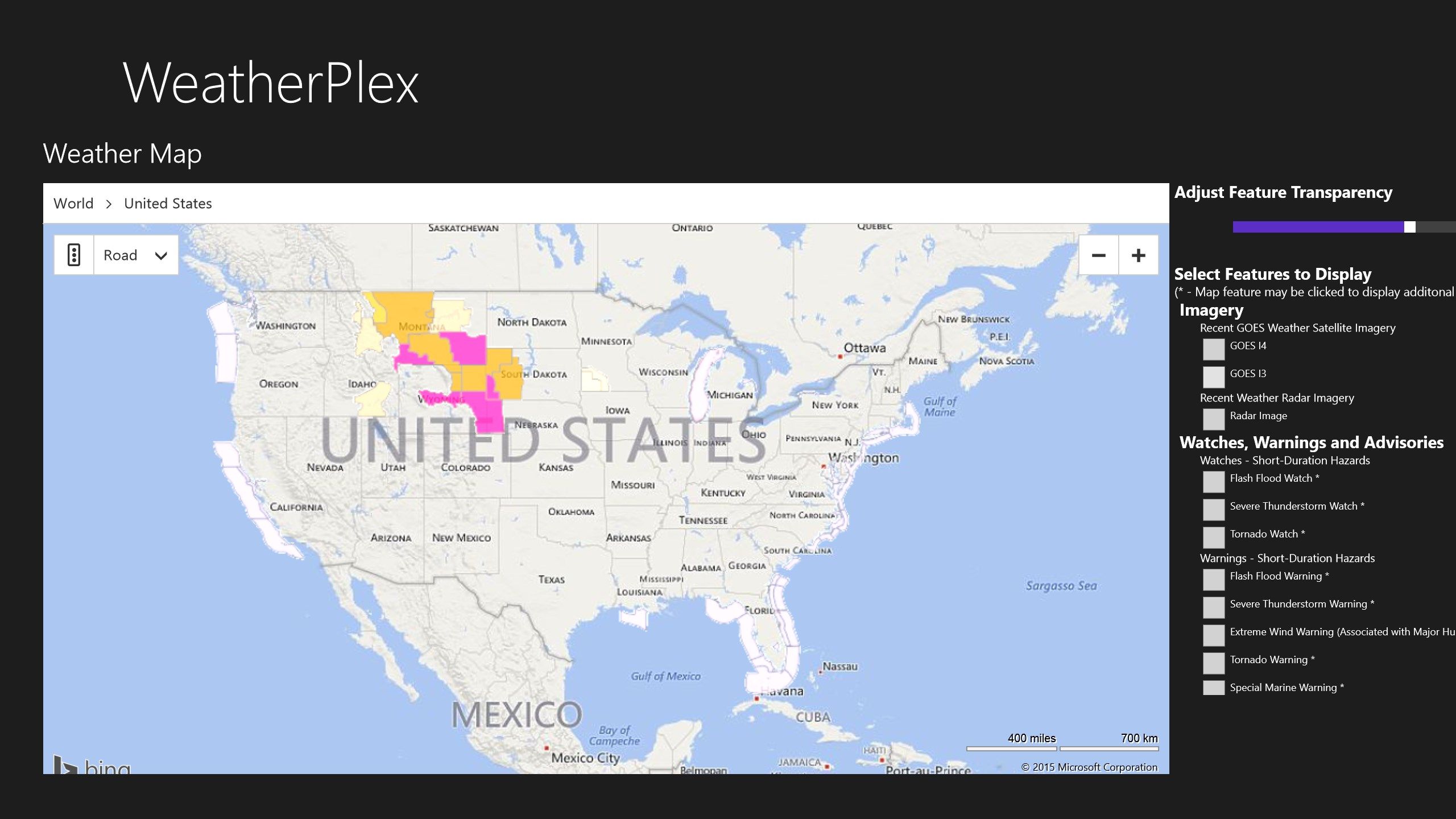
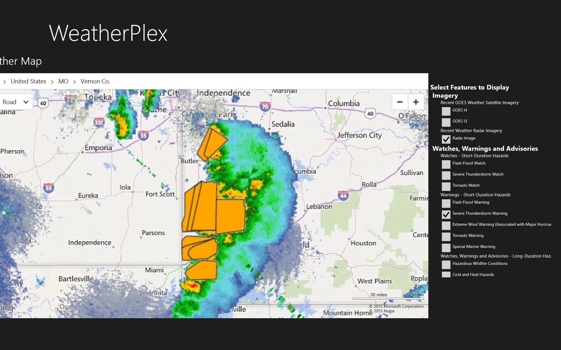
- An embedded Weather Map with a user-configurable view of weather conditions (radar image and NWS ‘events’) from NOAA’s nowCOAST GIS Map services. The map data displayed is conveniently shown/hidden based upon the map resolution selected. The user may also select between Road, Aerial and Bird’s Eye map perspectives. Configurable view include:
5.1. Satellite Imagery (GOES 2 bands)
5.2. Radar Imagery
5.3. Weather - Watches, Warnings and Advisories
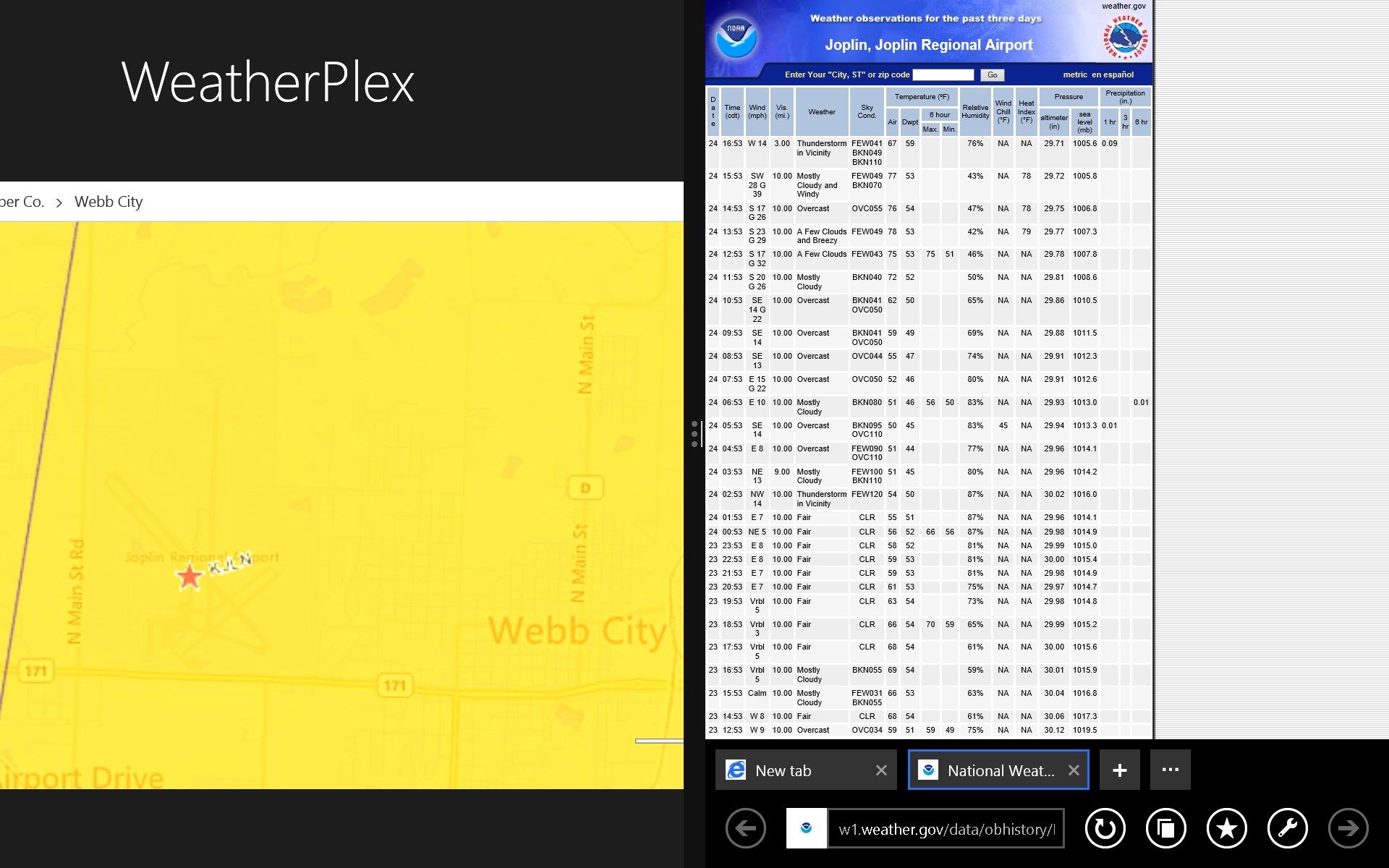
5.4. Weather Observations
5.5. Geolinks - Hyperlinked data for features identified on the Weather Map, including:
5.5.1 Weather Observation stations
5.5.2 River Observation stations
5.6. State & County Boundaries
-
Several of the items displayed in the embedded Weather Map may be clicked in order to display additional information on the selected weather event or observation.
-
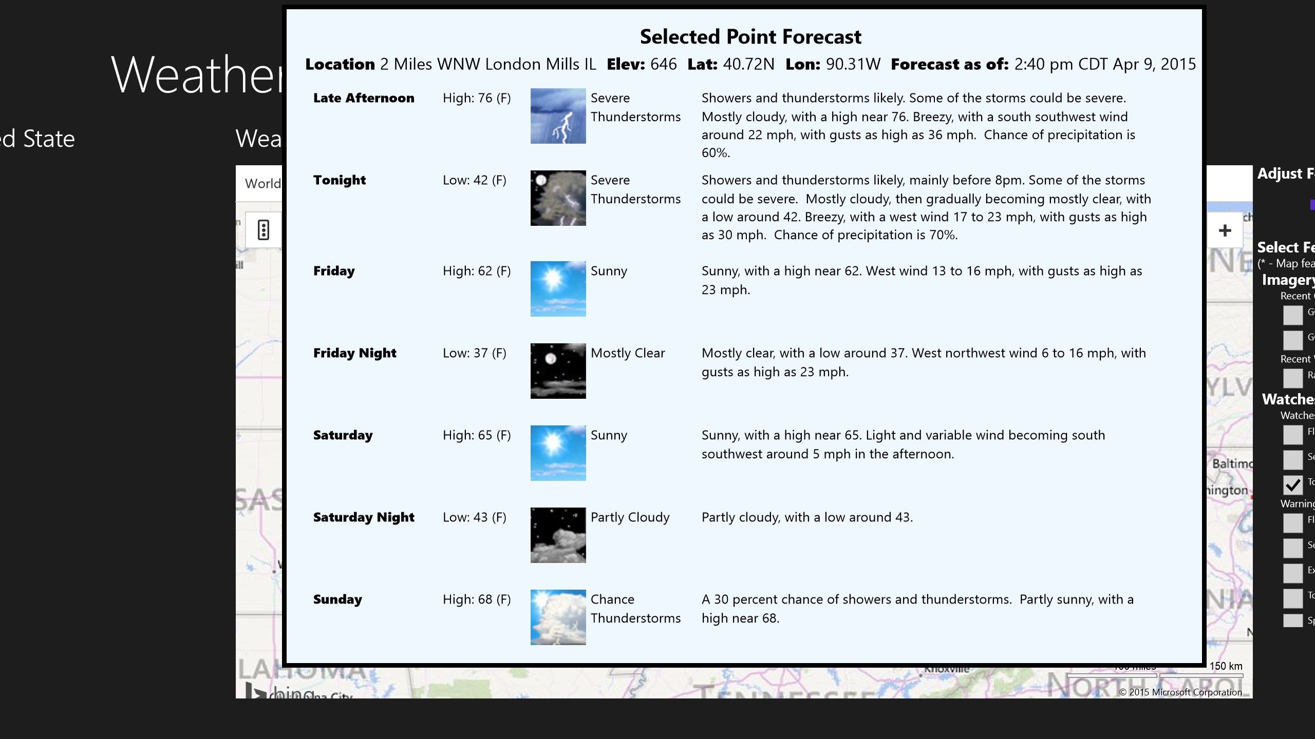
‘Point Forecasts’ - right-click any location on the weather map for a detailed forecast.
Enhancements Under Consideration:
- Support of additional nowCOAST Map Layers.
- Support of additional ‘At-a-Glance’ forecast data.
Known Issues:
- NWS “All Hazards” stations may be unavailable in the event that they are no longer streamed by WeatherUnderground or the station is off-the-air. Station off-the-air status may be obtained from: www.nws.noaa.gov/nwr/
- Map layers of the Weather Map do not display at all levels of Weather Map resolution. Note: This is a feature of the nowCOAST map server which does not render elements if the resolution is not suited to the layer being displayed.
Key features
-
Listen to NWS "All Hazards" Radio (for available stations as streamed by WeatherUnderground).
-
Radio is fully suppored in the 'background' - work on other things while listening to a broadcast.
-
Select 'At-a-Glance' forecasts from 495 locations acrosss the U.S., Guam, Puerto Rico and the U.S. Virgin Islands.
-
View NWS-issued weather alerts for a selected state.
-
Customizable weather map with point-forecasts and queryable map features.