YachtWinds
App details
About YachtWinds
Has the wind out on the bay kicked up yet? What time does it usually get going each day? How hard did it blow when that front moved through last night? What parts of the bay have the most wind? Should I have taken today off to go sailing? If you sail, you want answers to these questions and YachtWinds puts you in the know.
What is going on in the Caribbean today? What about that hurricane that is threating to come up the coast? If you think you had your nose glued to your computer screen last hurricane season, just wait till you get YachtWinds.
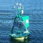
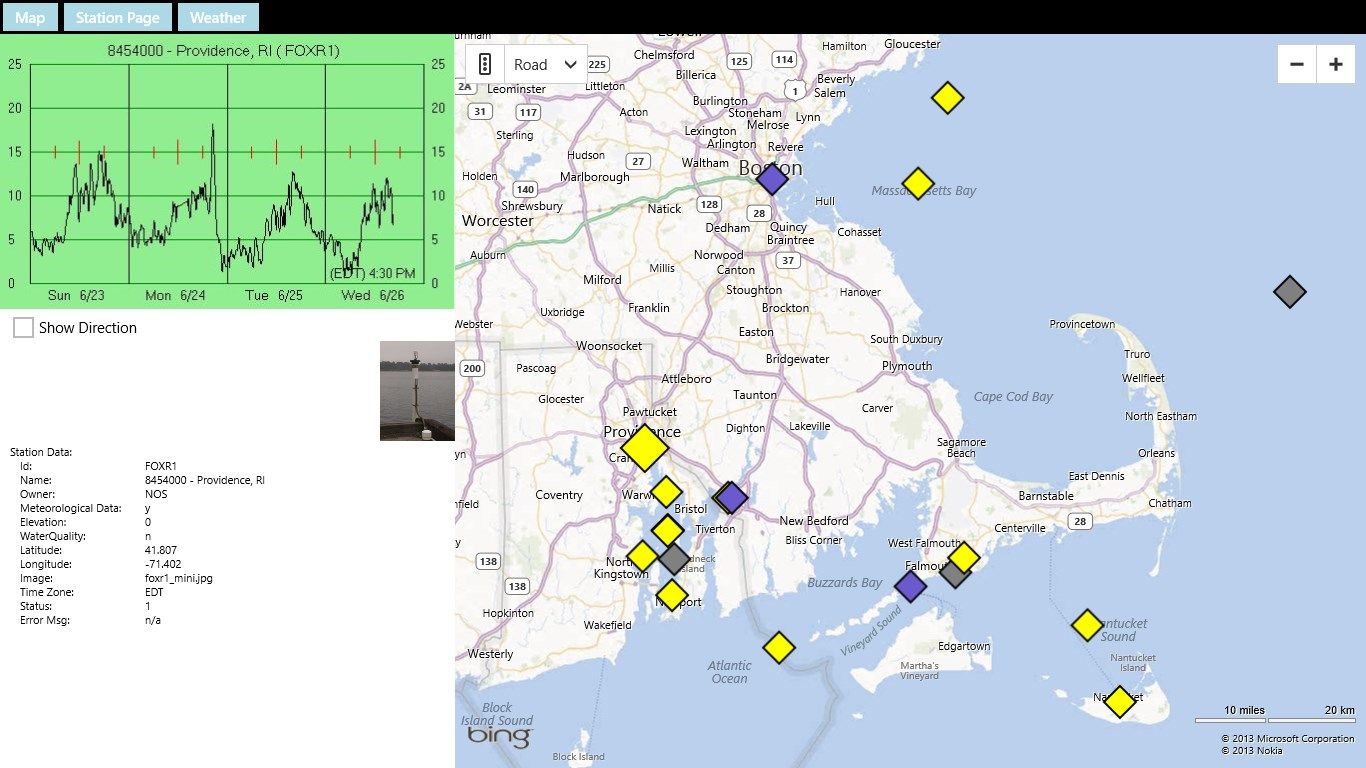
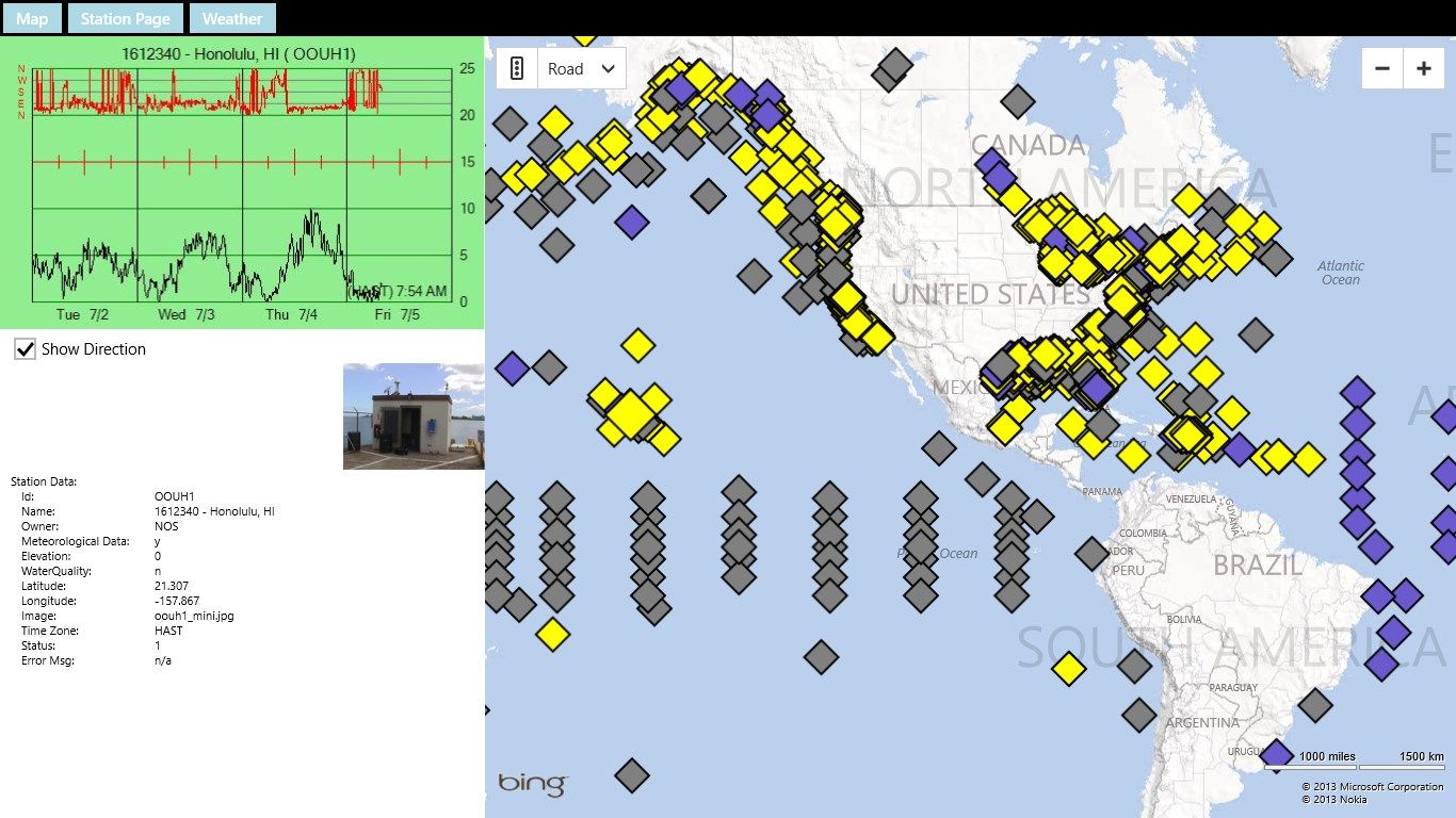
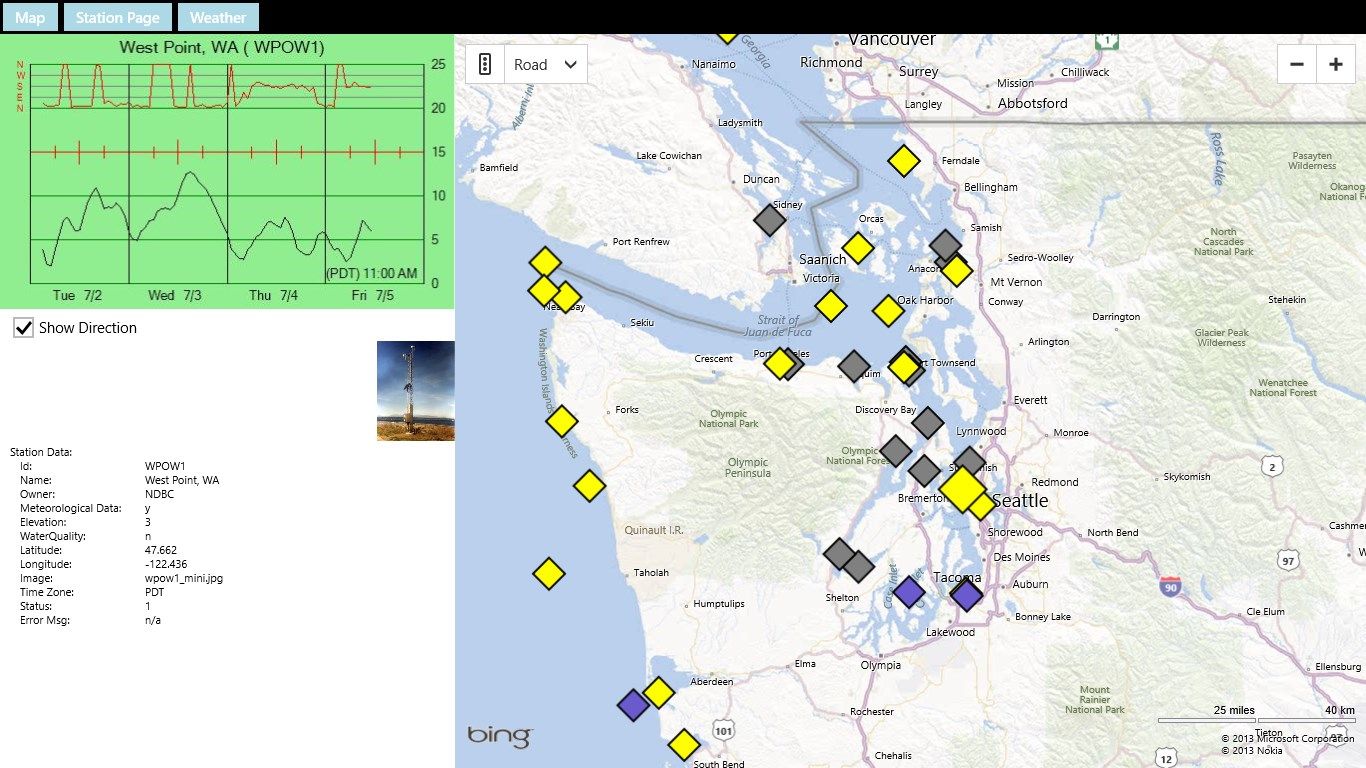
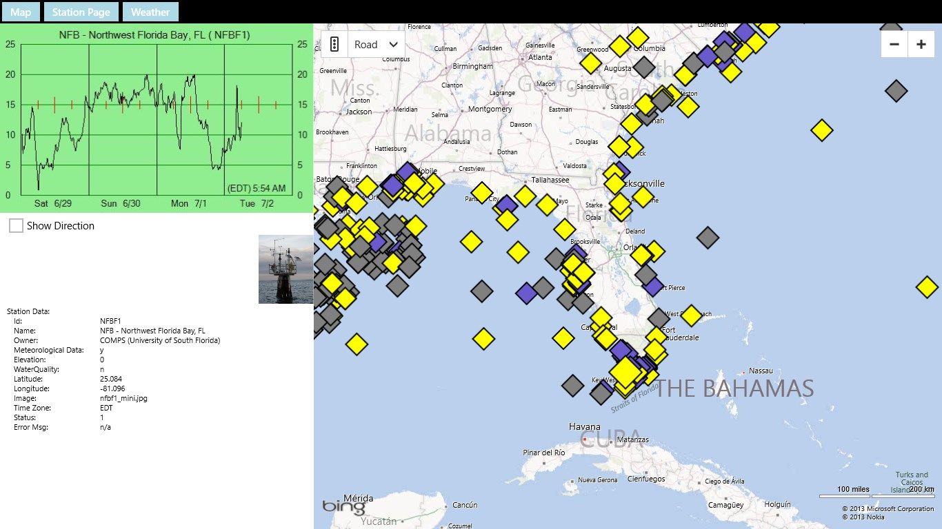
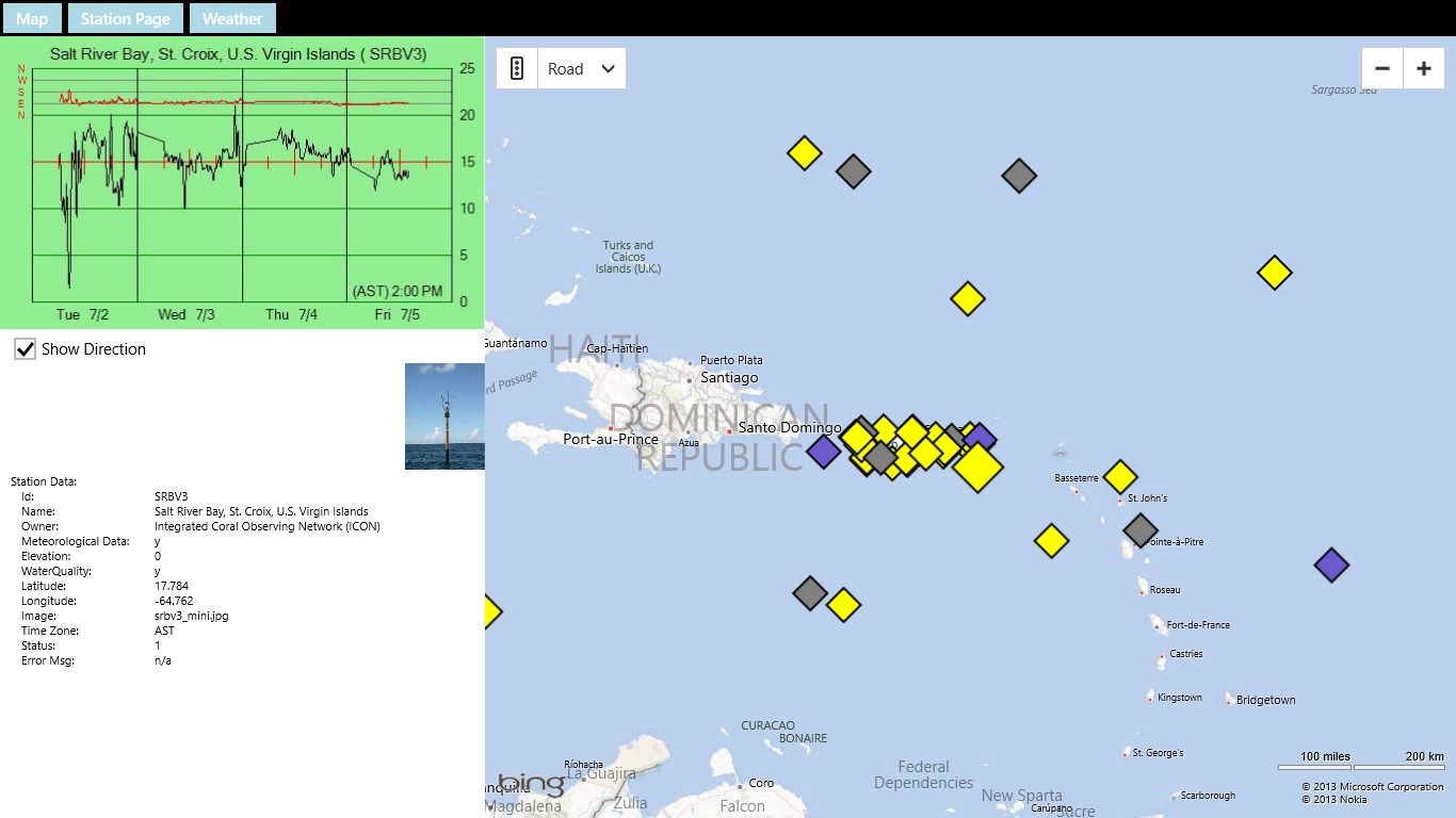
YachtWinds displays the location of NOAH weather stations on a Bing Map. Mostly these are buoys out on the water. But some stations are on land near the water, on lighthouses, towers, platforms, etc. In some cases we provide a picture of the station.
The stations are indicated by diamonds on the map. Yellow diamonds indicate stations that we have tested and at that time were producing the data YachtWinds uses and in a format YachtWinds understands. Gray diamonds indicate stations that NOAA said were not producing data when we checked. They may be producing data now (sometimes stations break down and then get fixed). Blue diamonds represent stations that NOAA indicated were good but we could not use for some reason. For example BHBM3 in Boston harbor is producing data but not wind data. When a station is not marked as good (yellow) the reason is shown in the lower left of the screen. Even when a station is not yellow you can usually get the station page and weather forecast.
When you tap or click a station it becomes selected and is shown larger on the screen. The graph updates with the data from that station and the station properties are shown in the lower left.
Most stations have a web page with additional data. You can access that using the Station Page button at the upper left of the screen. There is also a button to obtain a weather forecast for the area around the station.
The last station you visit will become the Live Tile for the application on the Windows Start Screen. That allows you to get the graph for that station without even opening the app.
Check YachtWinds.com for more information and refer questions and comments to [email protected].
Key features
-
Displays graphs of wind speed and direction from NOAS weather stations out over the water.
-
Displays station web pages which have additional information.
-
Displays weather forecasts for the area.
-
Shows Bing Map Aerial and Bird’s eye view and Road Map view for the shoreline. You may be able to see your boat at it’s mooring.
-
Displays information from all around the world. Look for favorite island sailing destination.